Skip to content
Trout Derby
About
Cart
Checkout
Collections
Contact
Home
My Account
Payment Methods
Privacy Policy
Return Policy
Shipping Policy
Shop
Terms of Use
Track your order
Trout Derby
Main Menu
About
Cart
Checkout
Collections
Contact
Home
My Account
Payment Methods
Privacy Policy
Return Policy
Shipping Policy
Shop
Terms of Use
Track your order
Home
/
Shop
/ Products tagged “Chesapeake Bay chart”
Chesapeake Bay chart
Showing all 6 results
Default sorting
Sort by popularity
Sort by average rating
Sort by latest
Sort by price: low to high
Sort by price: high to low
Buy product
Charts & Maps
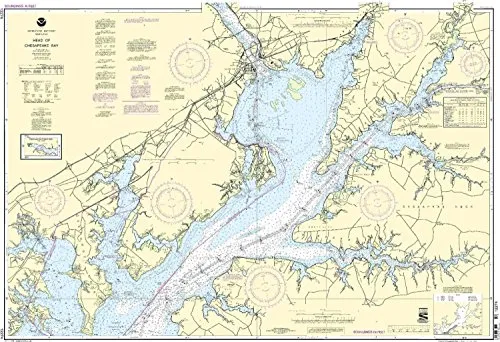
NOAA Approved Nautical Chart 12274: Head of Chesapeake Bay – Printed on Demand, Latest Updates
Rated
0
out of 5
$
32.95
Buy product
Buy product
Subjects
NOAA Chart 12235 – Chesapeake Bay Rappahannock River Entrance, 50.8×33.9 inches by East View
Rated
0
out of 5
$
18.99
Buy product
Buy product
Charts & Maps
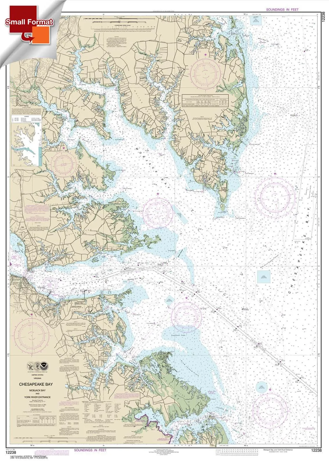
NOAA Chart 12238: Chesapeake Bay Mobjack Bay & York River Entrance, Small Waterproof Format
Rated
0
out of 5
$
18.95
Buy product
Buy product
Charts & Maps
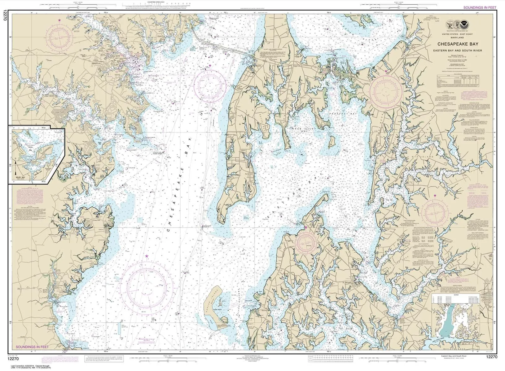
NOAA Chart 12270: Chesapeake Bay Eastern Bay & South River, 35.5’x48.4′, Water-Resistant Paper
Rated
0
out of 5
$
28.95
Buy product
Buy product
Charts & Maps
NOAA Training Chart 3-Pack by Paradise Cay – Chesapeake Bay, Block Island & Long Island Sounds
Rated
0
out of 5
$
29.95
Buy product
Buy product
Charts & Maps
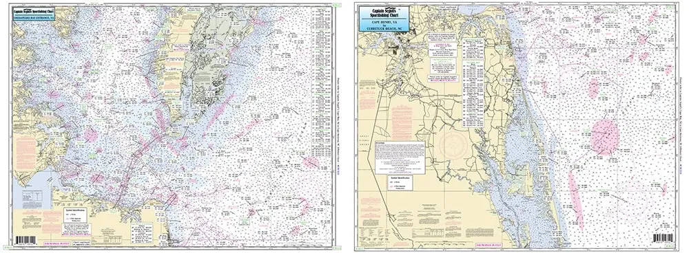
Off Coastal Lower Chesapeake Bay Laminated Fishing Chart CBL22 by Captain Segull 19.5×26.5
Rated
0
out of 5
$
27.95
Buy product
Scroll to Top