Skip to content
Trout Derby
About
Cart
Checkout
Collections
Contact
Home
My Account
Payment Methods
Privacy Policy
Return Policy
Shipping Policy
Shop
Terms of Use
Track your order
Trout Derby
Main Menu
About
Cart
Checkout
Collections
Contact
Home
My Account
Payment Methods
Privacy Policy
Return Policy
Shipping Policy
Shop
Terms of Use
Track your order
Home
/
Shop
/ Products tagged “maritime navigation”
maritime navigation
Showing all 4 results
Default sorting
Sort by popularity
Sort by average rating
Sort by latest
Sort by price: low to high
Sort by price: high to low
Buy product
Charts & Maps
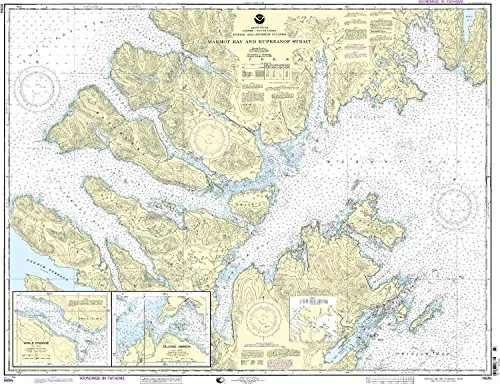
16594-Kodiak Island Nautical Chart – NOAA Approved, 1:78900 Scale, 35.37” H x 45.89” W
Rated
0
out of 5
$
34.95
Buy product
Buy product
Charts & Maps
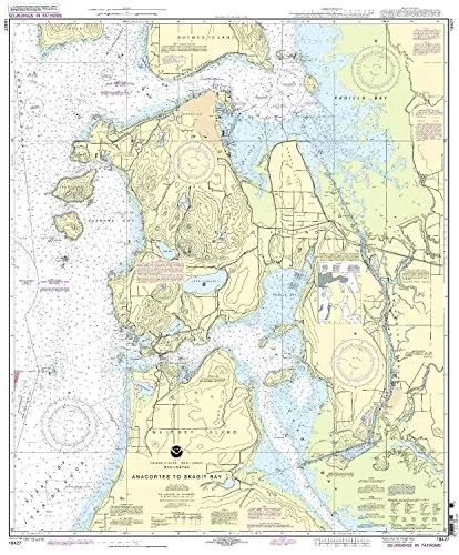
18427 Anacortes to Skagit Bay Nautical Chart, NOAA Approved, On-Demand Printing with Latest Updates
Rated
0
out of 5
$
27.95
Buy product
Buy product
Charts & Maps
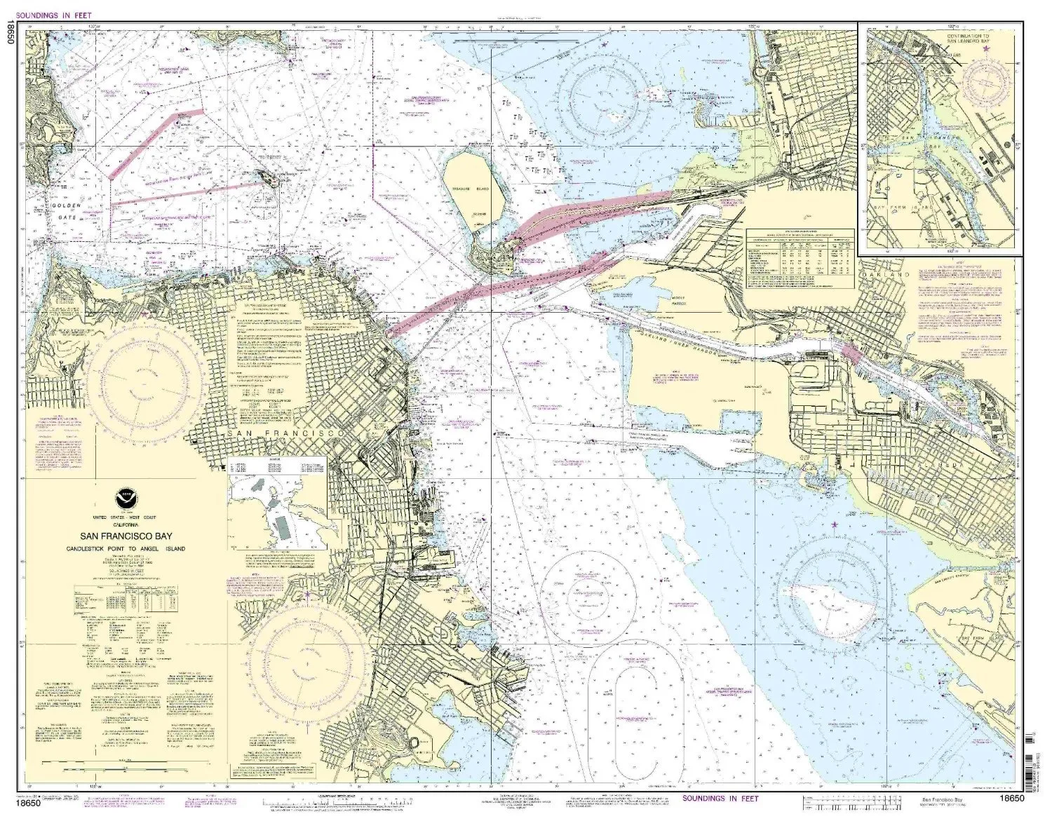
18650-San Francisco Bay Nautical Chart – Candlestick Point to Angel Island by NOAA
Rated
0
out of 5
$
27.95
Buy product
Buy product
Charts & Maps
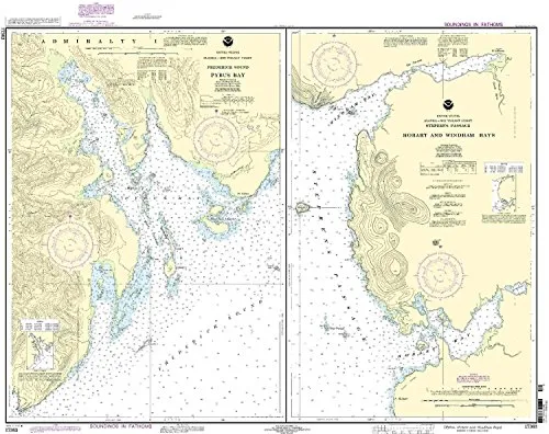
NOAA Pybus Bay Nautical Chart 17363 – Updated, Approved for Commercial Vessels, Printed on Demand
Rated
0
out of 5
$
32.95
Buy product
Scroll to Top