Skip to content
Trout Derby
About
Cart
Checkout
Collections
Contact
Home
My Account
Payment Methods
Privacy Policy
Return Policy
Shipping Policy
Shop
Terms of Use
Track your order
Trout Derby
Main Menu
About
Cart
Checkout
Collections
Contact
Home
My Account
Payment Methods
Privacy Policy
Return Policy
Shipping Policy
Shop
Terms of Use
Track your order
Home
/
Shop
/
Products tagged “nautical chart”
/ Page 3
nautical chart
Showing 25–36 of 56 results
Default sorting
Sort by popularity
Sort by average rating
Sort by latest
Sort by price: low to high
Sort by price: high to low
Buy product
Charts & Maps
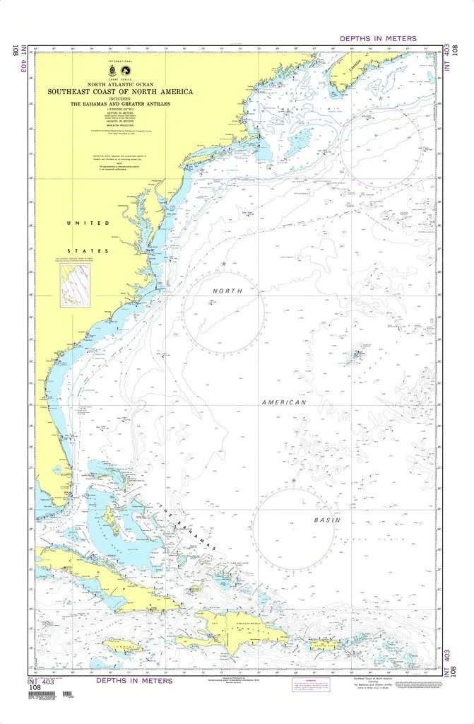
NGA Chart 108: Southeast Coast of North America, Bahamas & Greater Antilles – Water Resistant
Rated
0
out of 5
$
28.95
Buy product
Buy product
Charts & Maps
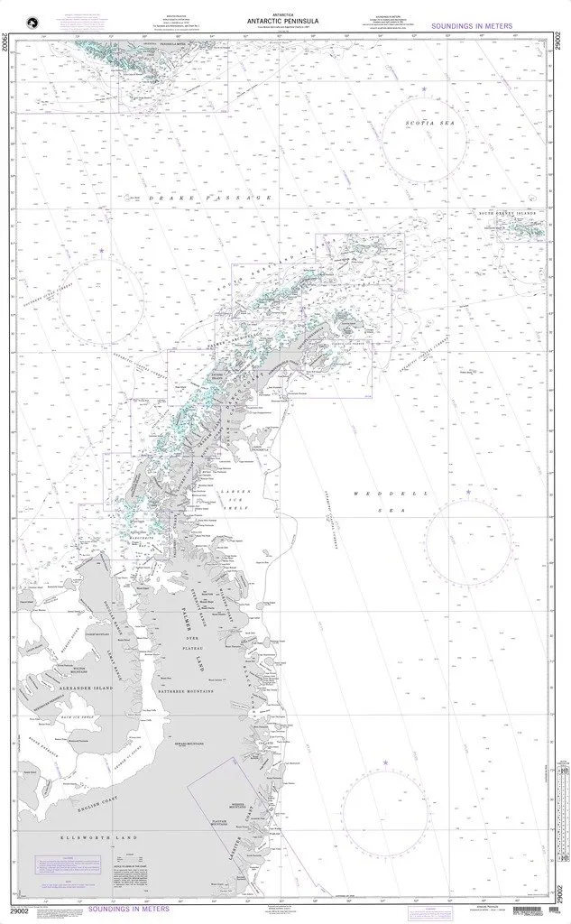
NGA Chart 29002: Antarctic Peninsula – Water Resistant Nautical Chart for Mariners
Rated
0
out of 5
$
36.95
Buy product
Buy product
Charts & Maps
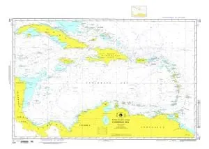
NGA Chart 402: Caribbean Sea – Printed on Demand, Water Resistant, Meets SOLAS Requirements
Rated
0
out of 5
$
28.95
Buy product
Buy product
Charts & Maps
NGA Chart 550: Gulf of Thailand to Taiwan – Water Resistant Nautical Chart for Mariners
Rated
0
out of 5
$
36.95
Buy product
Buy product
Charts & Maps
NOAA Approved Nautical Chart – 12373 Guilford Harbor/Farm River – 30.84′ H x 39.17′ W
Rated
0
out of 5
$
20.94
Buy product
Buy product
Charts & Maps
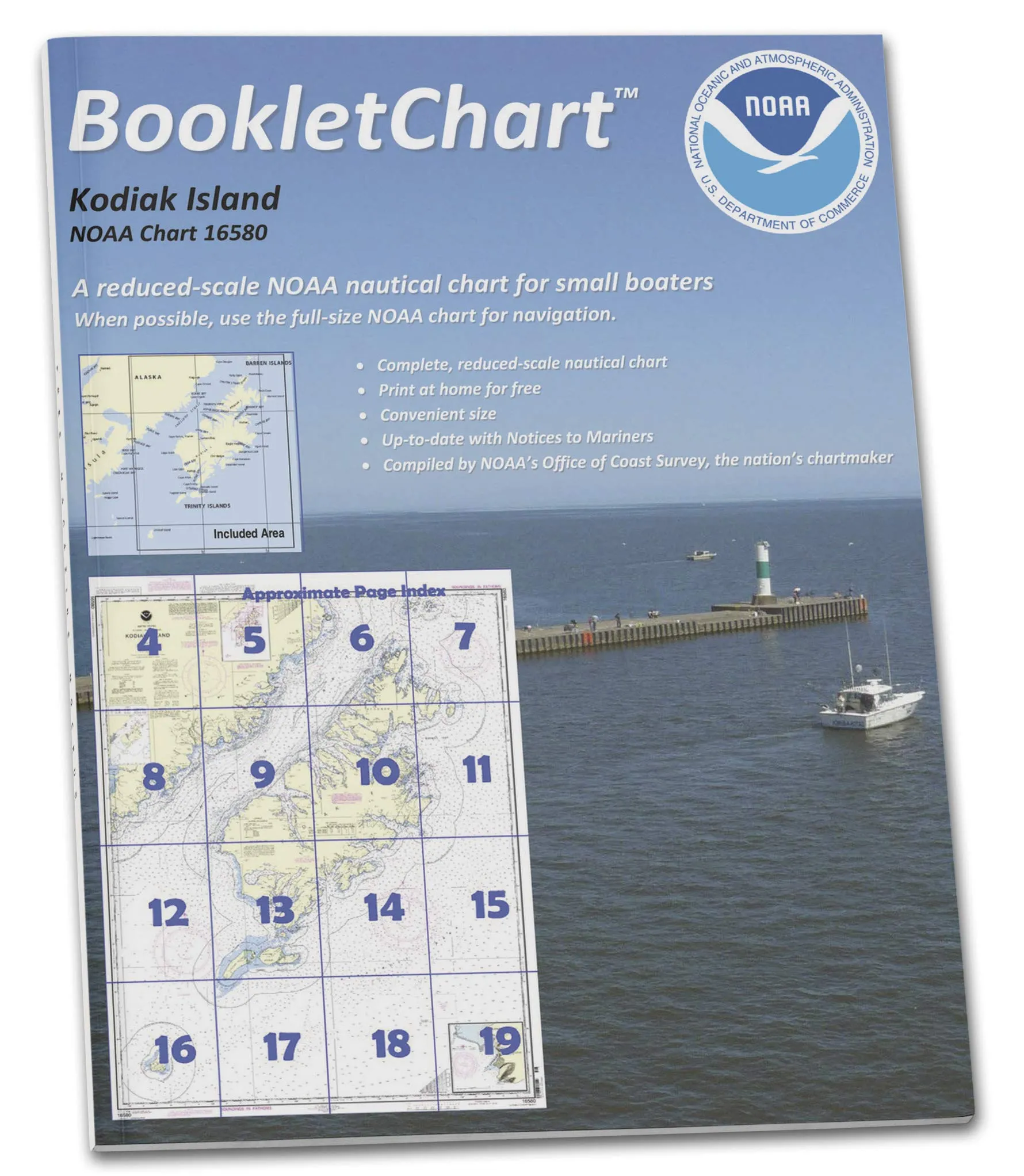
NOAA BookletChart 16580 Kodiak Island; Southwest Anchorage, Handy 8.5′ x 11′ Nautical Chart
Rated
0
out of 5
$
12.95
Buy product
Buy product
Charts & Maps
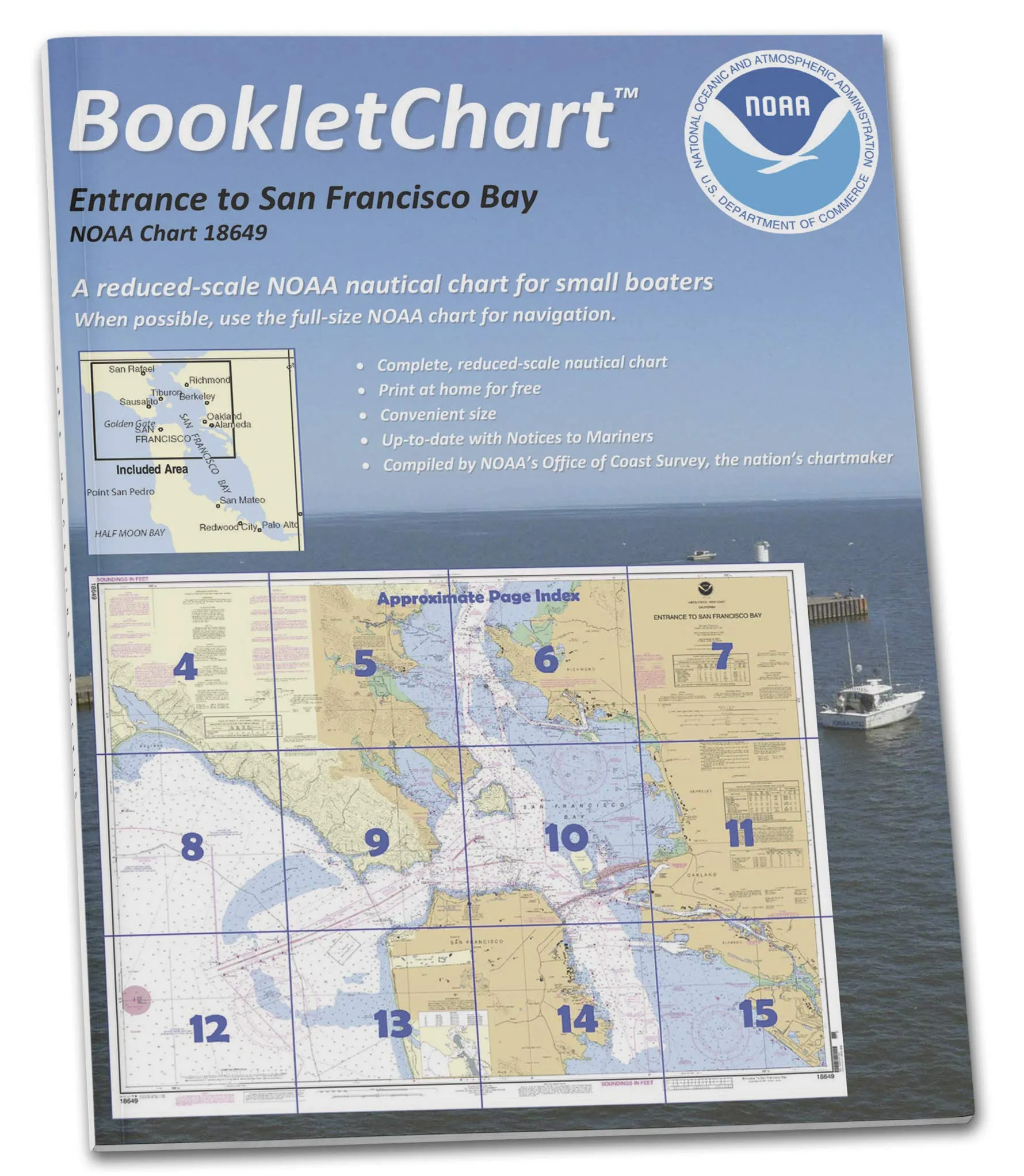
NOAA BookletChart 18649: San Francisco Bay Navigation Guide, Handy 8.5′ x 11′ Size
Rated
0
out of 5
$
12.95
Buy product
Buy product
Charts & Maps
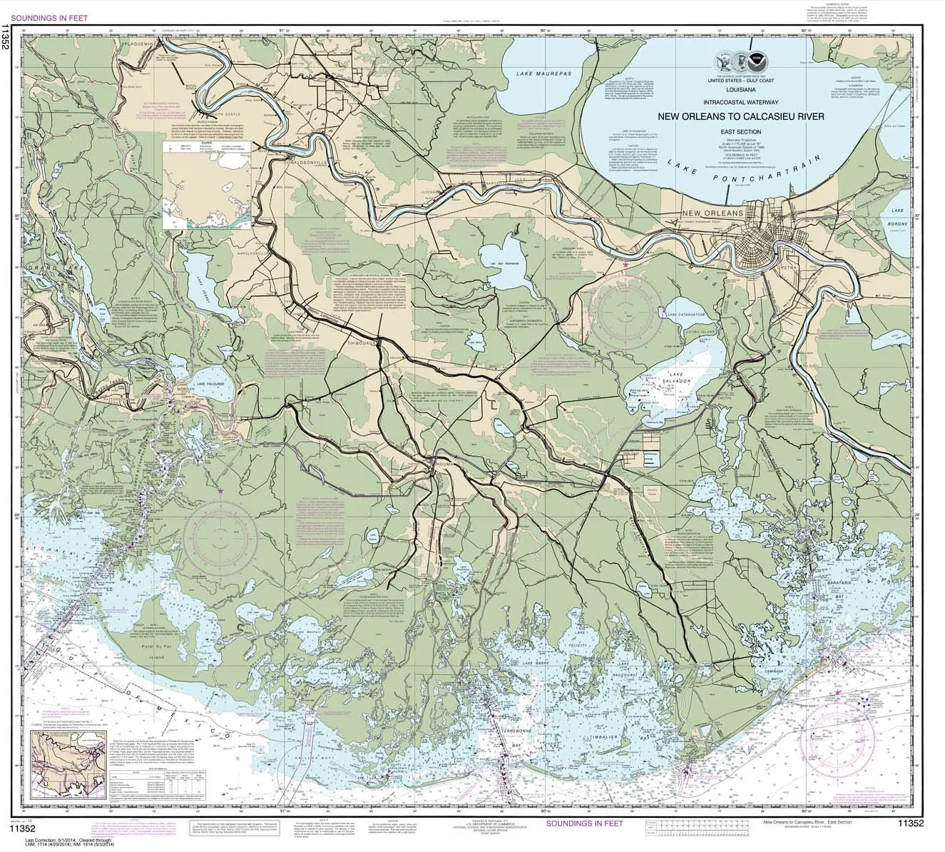
NOAA Chart 11352: Intracoastal Waterway New Orleans to Calcasieu River – 35.4′ x 39.3′ Paper
Rated
0
out of 5
$
28.95
Buy product
Buy product
Charts & Maps
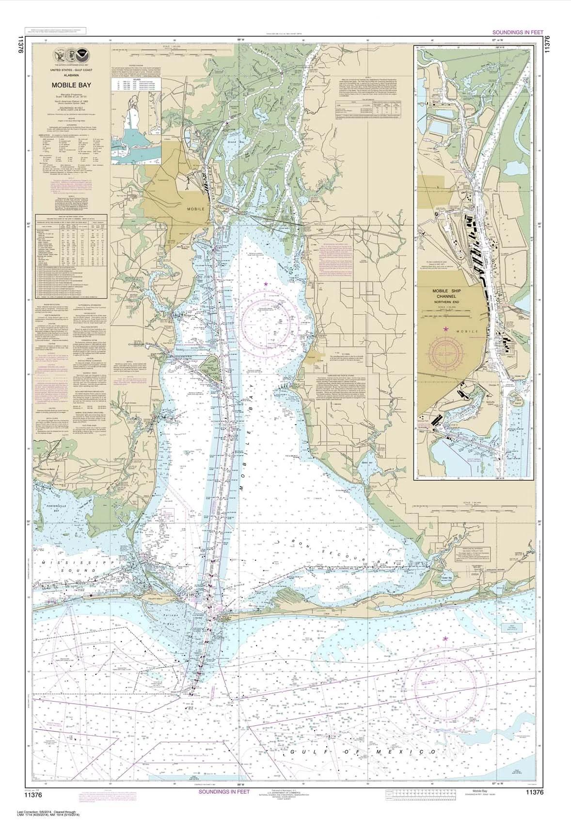
NOAA Chart 11376 Mobile Bay Ship Channel 34.9’x50.1′ Water-Resistant Paper by Paradise Cay
Rated
0
out of 5
$
28.95
Buy product
Buy product
Subjects
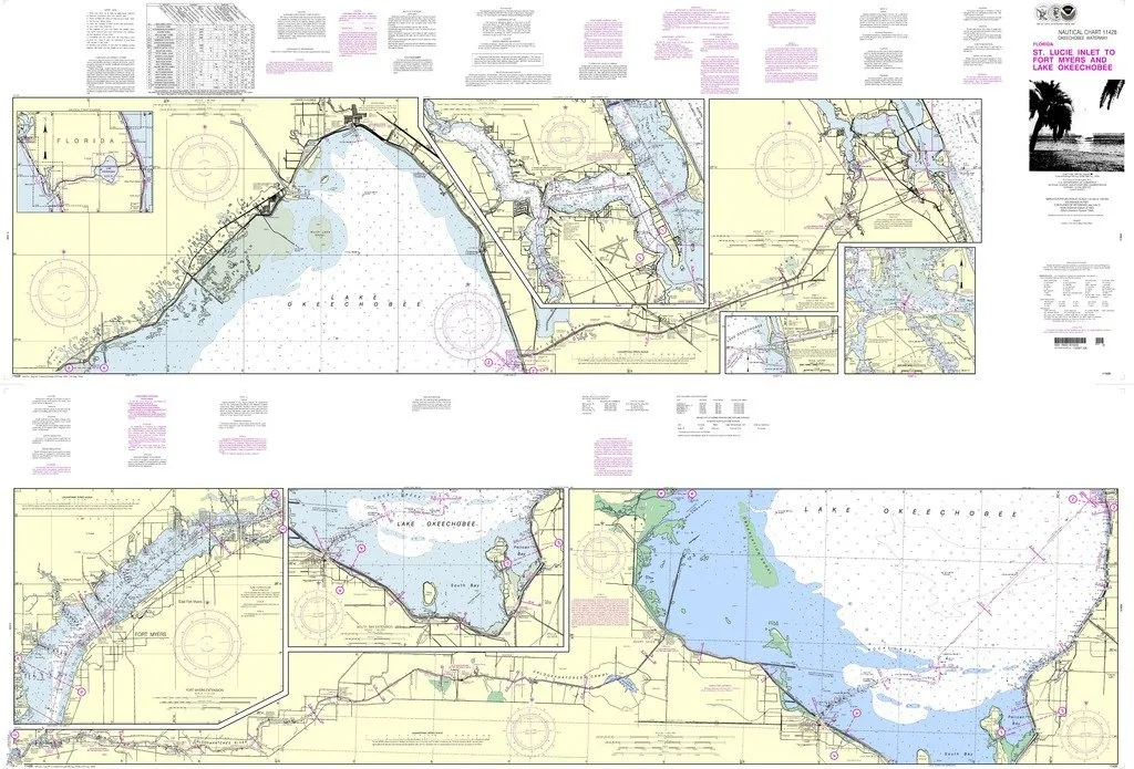
NOAA Chart 11428: Okeechobee Waterway to Fort Myers; Up-to-Date Nautical Chart
Rated
0
out of 5
$
40.95
Buy product
Buy product
Charts & Maps
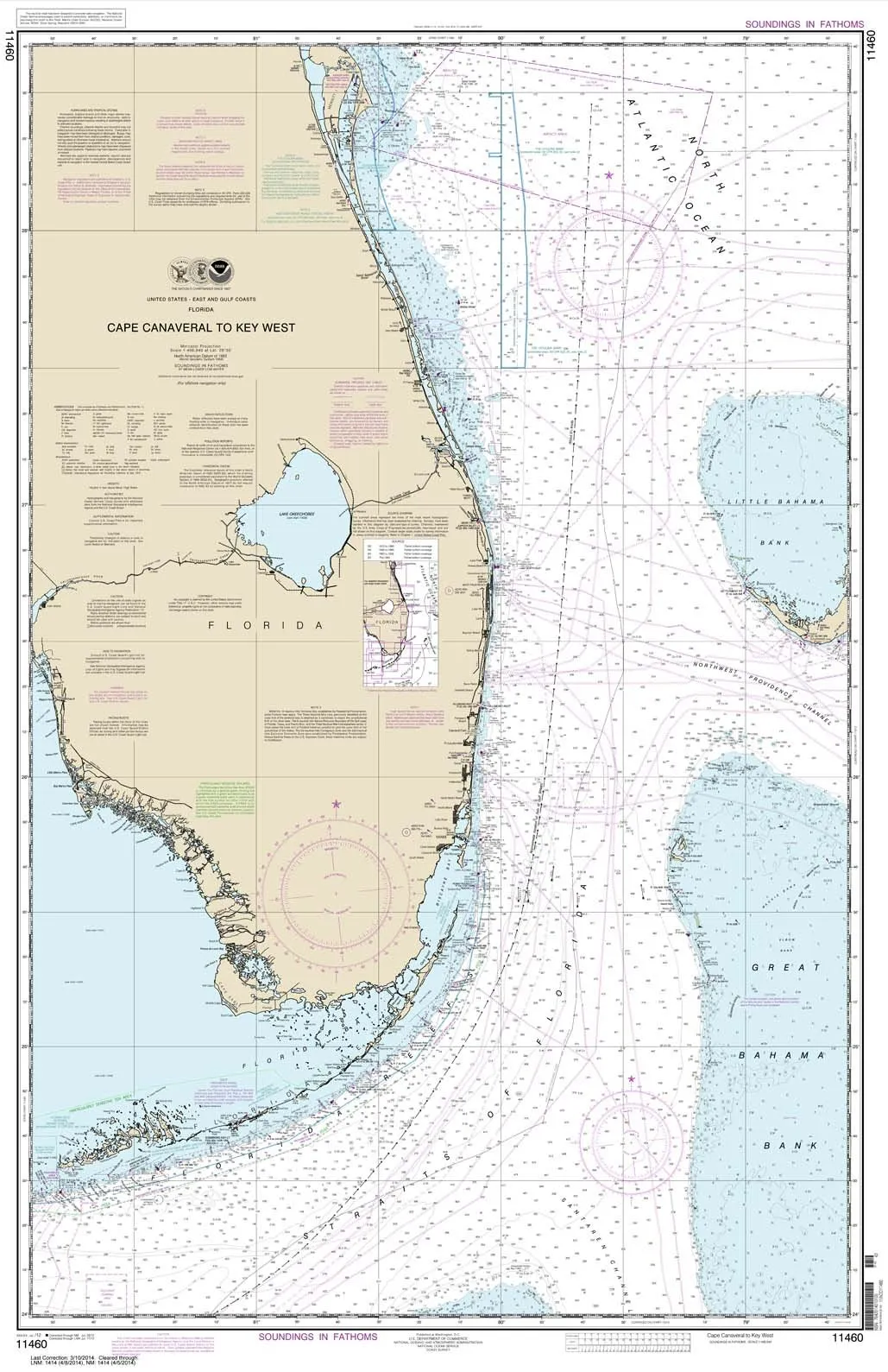
NOAA Chart 11460: Cape Canaveral to Key West – Water-Resistant Nautical Chart by Paradise Cay
Rated
0
out of 5
$
28.95
Buy product
Buy product
Subjects
NOAA Chart 12235 – Chesapeake Bay Rappahannock River Entrance, 50.8×33.9 inches by East View
Rated
0
out of 5
$
18.99
Buy product
←
1
2
3
4
5
→
Scroll to Top