Skip to content
Trout Derby
About
Cart
Checkout
Collections
Contact
Home
My Account
Payment Methods
Privacy Policy
Return Policy
Shipping Policy
Shop
Terms of Use
Track your order
Trout Derby
Main Menu
About
Cart
Checkout
Collections
Contact
Home
My Account
Payment Methods
Privacy Policy
Return Policy
Shipping Policy
Shop
Terms of Use
Track your order
Home
/
Shop
/ Products tagged “nautical navigation”
nautical navigation
Showing 1–12 of 14 results
Default sorting
Sort by popularity
Sort by average rating
Sort by latest
Sort by price: low to high
Sort by price: high to low
Buy product
Charts & Maps
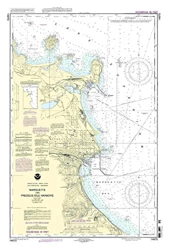
14970-Marquette and Presque Isle Harbors NOAA Nautical Chart 1:15000 Scale, 35.83” H x 23.89” W
Rated
0
out of 5
$
28.00
Buy product
Buy product
Charts & Maps
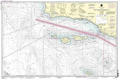
18720 Point Dume to Purisima Point NOAA Nautical Chart 32.64′ H x 48.31′ W, U.S. Coast Guard Approved
Rated
0
out of 5
$
32.95
Buy product
Buy product
Charts & Maps
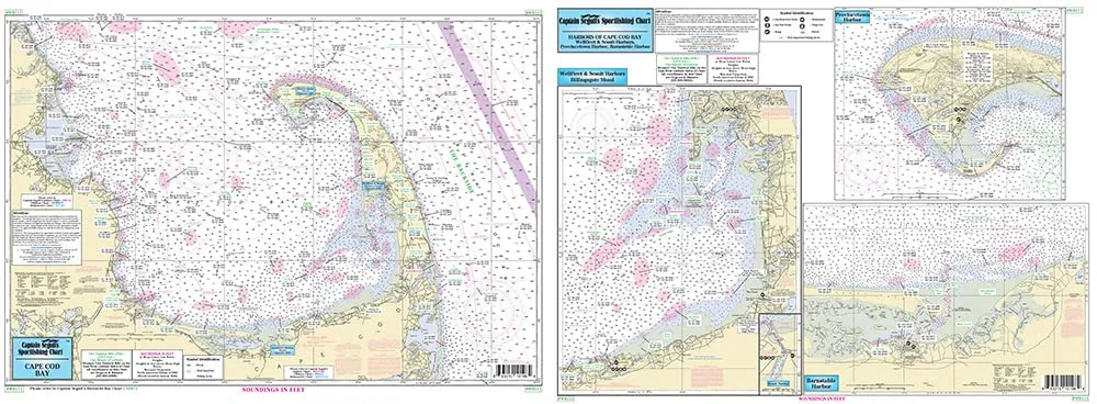
Harbors of Cape Cod Bay Fishing Chart – Laminated Nautical Map 19.5’x26.5′ by Captain Segull
Rated
0
out of 5
$
16.90
Buy product
Buy product
Charts & Maps
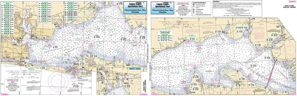
Laminated Nautical Fishing Chart for Choctawhatchee Bay, 12’x18′ by Captain Segull’s
Rated
0
out of 5
$
18.95
Buy product
Buy product
Charts & Maps
Laminated Nautical Fishing Chart for Pamlico Sound, NC – Double-Sided, 19.5’x26.5′ by Captain Segull
Rated
0
out of 5
$
16.95
Buy product
Buy product
Charts & Maps
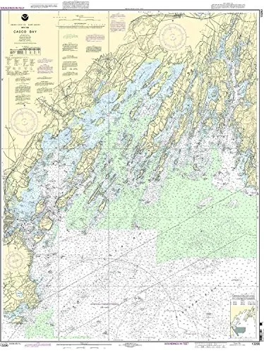
NOAA Casco Bay Nautical Chart 1:40000 Scale, 46.4” H x 35.97” W, U.S. Coast Guard Approved
Rated
0
out of 5
$
20.94
Buy product
Buy product
Charts & Maps
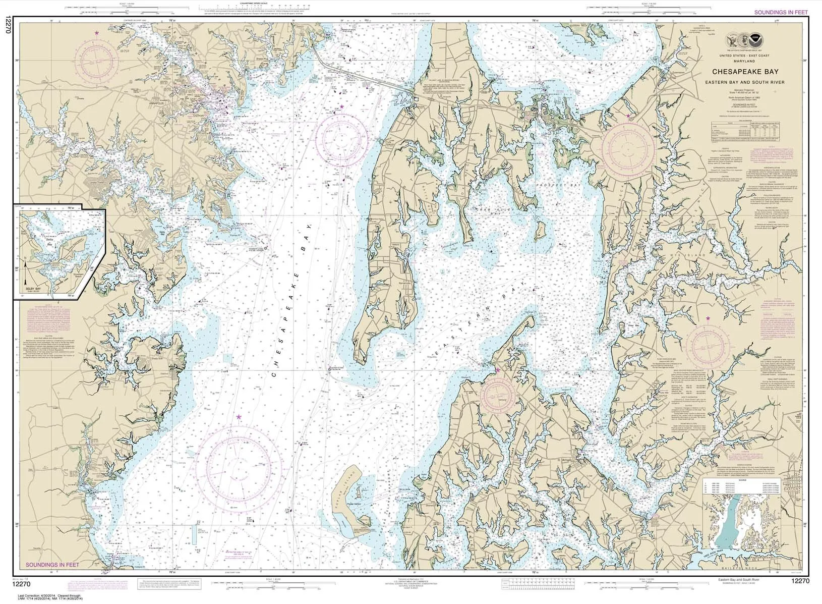
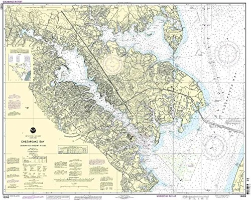
NOAA Chart 12270: Chesapeake Bay Eastern Bay & South River, 35.5’x48.4′, Water-Resistant Paper
Rated
0
out of 5
$
28.95
Buy product
Buy product
Charts & Maps
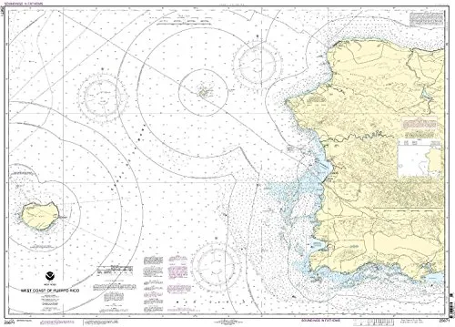
NOAA Chart 25671 – West Coast of Puerto Rico – Up-to-Date Nautical Chart for Mariners
Rated
0
out of 5
$
28.00
Buy product
Buy product
Charts & Maps
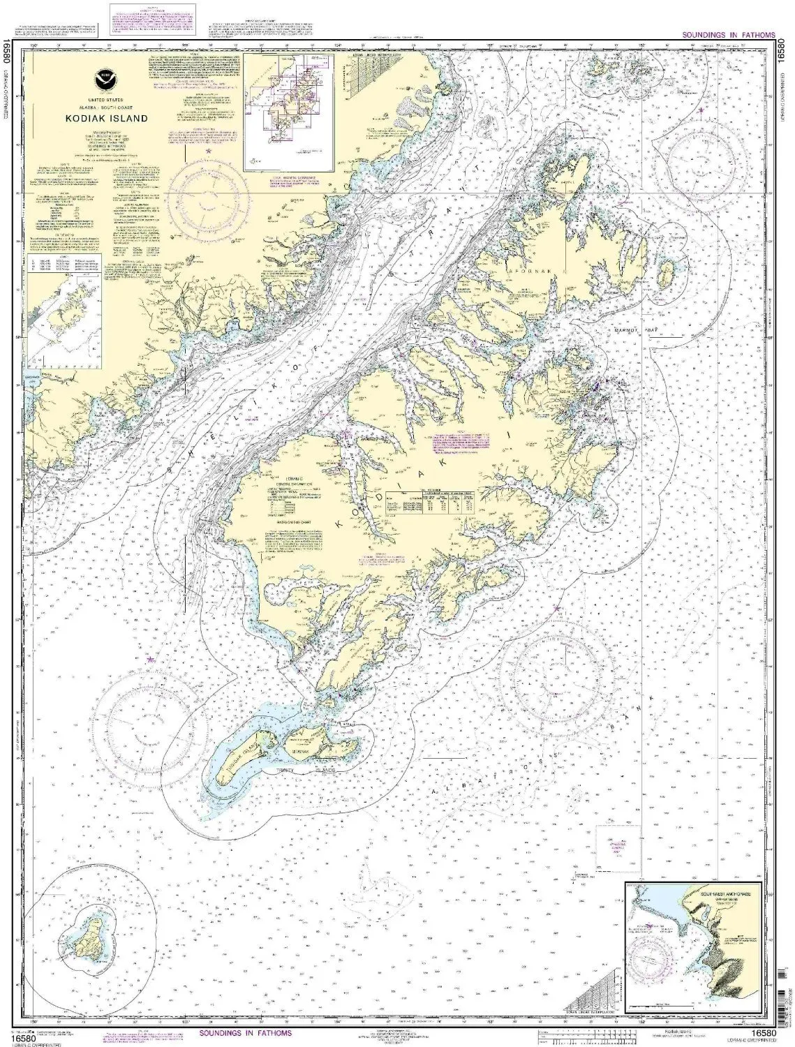
NOAA Kodiak Island Nautical Chart – 16580, 1:350000 Scale, 46.73” H x 35.21” W, U.S. Coast Guard Approved
Rated
0
out of 5
$
34.95
Buy product
Buy product
Charts & Maps
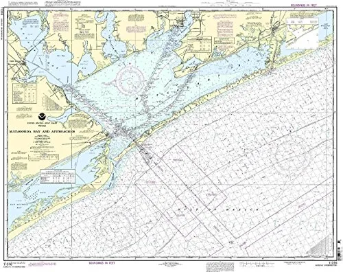
NOAA Matagorda Bay Nautical Chart 11316, 1:80000 Scale, 33.8” H x 34.29” W, U.S. Coast Guard Approved
Rated
0
out of 5
$
20.94
Buy product
Buy product
Charts & Maps
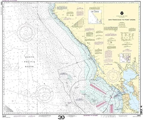
NOAA Nautical Chart 18640 San Francisco to Point Arena, 33.51′ H x 40.72′ W, U.S. Coast Guard Approved
Rated
0
out of 5
$
29.95
Buy product
Buy product
Charts & Maps
NOAA Nautical Chart for Severn & Magothy Rivers – 1:25000 Scale – 32.95′ H x 40.61′ W
Rated
0
out of 5
$
20.94
Buy product
1
2
→
Scroll to Top