Skip to content
Trout Derby
About
Cart
Checkout
Collections
Contact
Home
My Account
Payment Methods
Privacy Policy
Return Policy
Shipping Policy
Shop
Terms of Use
Track your order
Trout Derby
Main Menu
About
Cart
Checkout
Collections
Contact
Home
My Account
Payment Methods
Privacy Policy
Return Policy
Shipping Policy
Shop
Terms of Use
Track your order
Home
/
Shop
/ Products tagged “nautical navigation chart”
nautical navigation chart
Showing 1–12 of 24 results
Default sorting
Sort by popularity
Sort by average rating
Sort by latest
Sort by price: low to high
Sort by price: high to low
Buy product
Charts & Maps
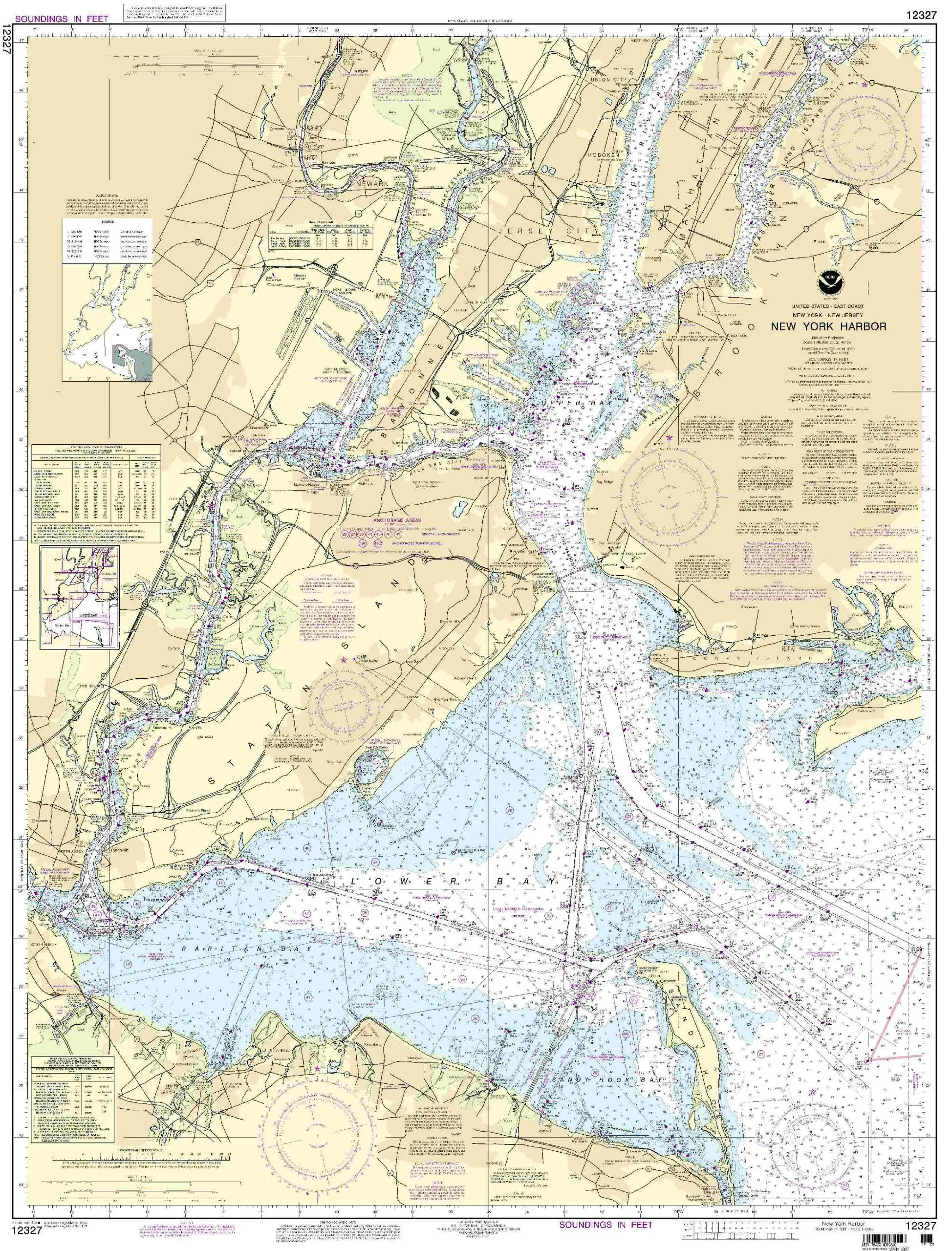
12327 New York Harbor NOAA Nautical Chart – 46.2” H x 35.24” W – U.S. Coast Guard Approved
Rated
0
out of 5
$
20.94
Buy product
Buy product
Charts & Maps
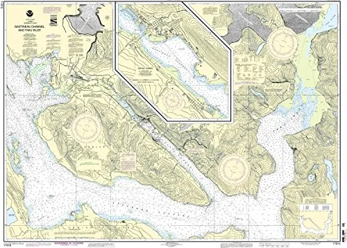
17315-Gastineau Channel Nautical Chart – NOAA Approved, 35.88” H x 48.45” W, Scale 1:40000
Rated
0
out of 5
$
27.95
Buy product
Buy product
Charts & Maps
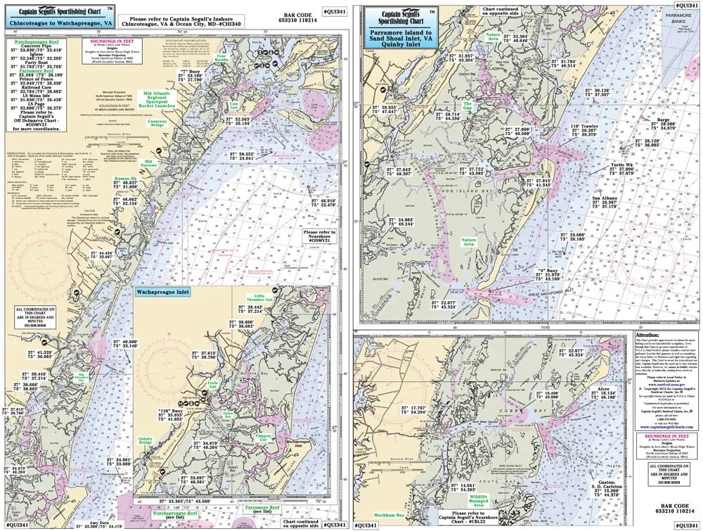
Chincoteague VA Laminated Nautical Fishing Chart 12’x18′ – Local Areas & GPS by Captain Segull’s
Rated
0
out of 5
$
18.95
Buy product
Buy product
Charts & Maps
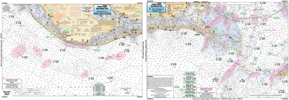
Clearwater to St. Petersburg Laminated Nautical Fishing Chart 12’x18′ by Captain Segull’s
Rated
0
out of 5
$
18.95
Buy product
Buy product
Charts & Maps
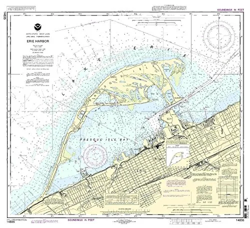
Erie Harbor Nautical Chart by NOAA – 1:15000 Scale, 29.42” H x 32.64” W, Approved for Commercial Use
Rated
0
out of 5
$
28.00
Buy product
Buy product
Charts & Maps
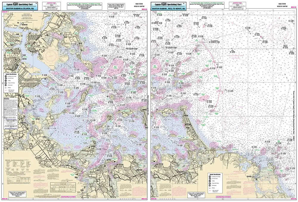
Inshore Boston Harbor Fishing Chart – Laminated Nautical Navigation Chart by Captain Segull’s
Rated
0
out of 5
$
27.95
Buy product
Buy product
Charts & Maps
Inshore Fishing Chart for Miami to Marathon FL – Laminated Nautical Navigation by Captain Segull’s
Rated
0
out of 5
$
27.95
Buy product
Buy product
Charts & Maps
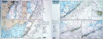
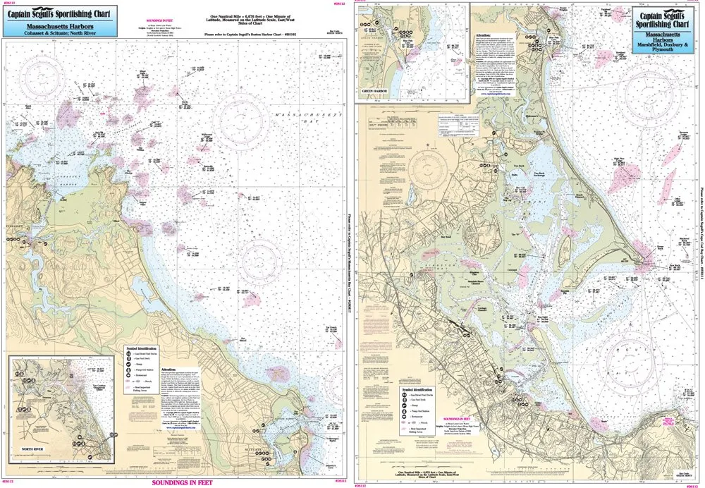
Inshore Fishing Chart: Laminated Navigation Map from Cohasset to Manomet, MA – 19.5’x26.5′
Rated
0
out of 5
$
27.95
Buy product
Buy product
Charts & Maps
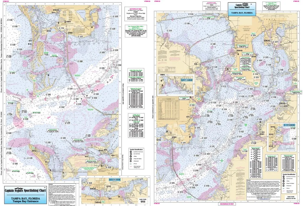
Inshore Tampa Bay Fishing Chart – Laminated Nautical Navigation by Captain Segull 19.5’x26.5′
Rated
0
out of 5
$
16.95
Buy product
Buy product
Charts & Maps
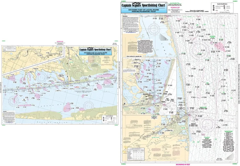
Laminated Nautical Fishing Chart – Laguna Madre South, TX – 19.5’x26.5′ – Captain Segull’s
Rated
0
out of 5
$
27.95
Buy product
Buy product
Charts & Maps
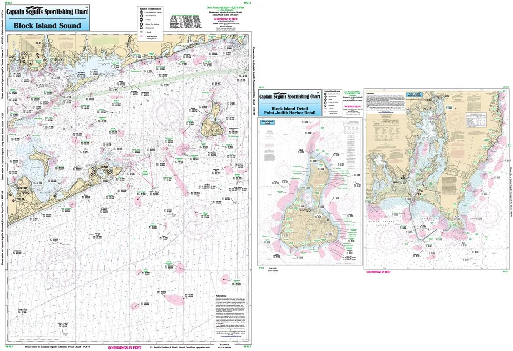
Laminated Nautical Fishing Chart for Block Island Sound & Point Judith – 19.5′ x 26.5′
Rated
0
out of 5
$
16.95
Buy product
Buy product
Charts & Maps
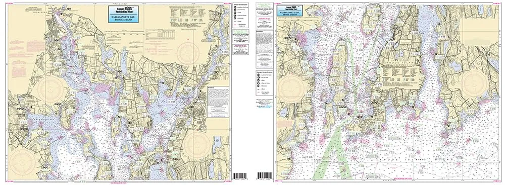
Laminated Nautical Fishing Chart for Narragansett Bay, RI – 19.5′ x 26.5′ by Captain Segull’s
Rated
0
out of 5
$
16.95
Buy product
1
2
→
Scroll to Top