Skip to content
Trout Derby
About
Cart
Checkout
Collections
Contact
Home
My Account
Payment Methods
Privacy Policy
Return Policy
Shipping Policy
Shop
Terms of Use
Track your order
Trout Derby
Main Menu
About
Cart
Checkout
Collections
Contact
Home
My Account
Payment Methods
Privacy Policy
Return Policy
Shipping Policy
Shop
Terms of Use
Track your order
Home
/
Shop
/
Products tagged “NOAA chart”
/ Page 2
NOAA chart
Showing 13–24 of 42 results
Default sorting
Sort by popularity
Sort by average rating
Sort by latest
Sort by price: low to high
Sort by price: high to low
Buy product
Subjects
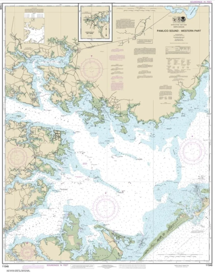
NOAA Chart 11548 Pamlico Sound West – Water-Resistant Nautical Map 112×89 inches
Rated
0
out of 5
$
24.99
Buy product
Buy product
Subjects
NOAA Chart 12235 – Chesapeake Bay Rappahannock River Entrance, 50.8×33.9 inches by East View
Rated
0
out of 5
$
18.99
Buy product
Buy product
Charts & Maps
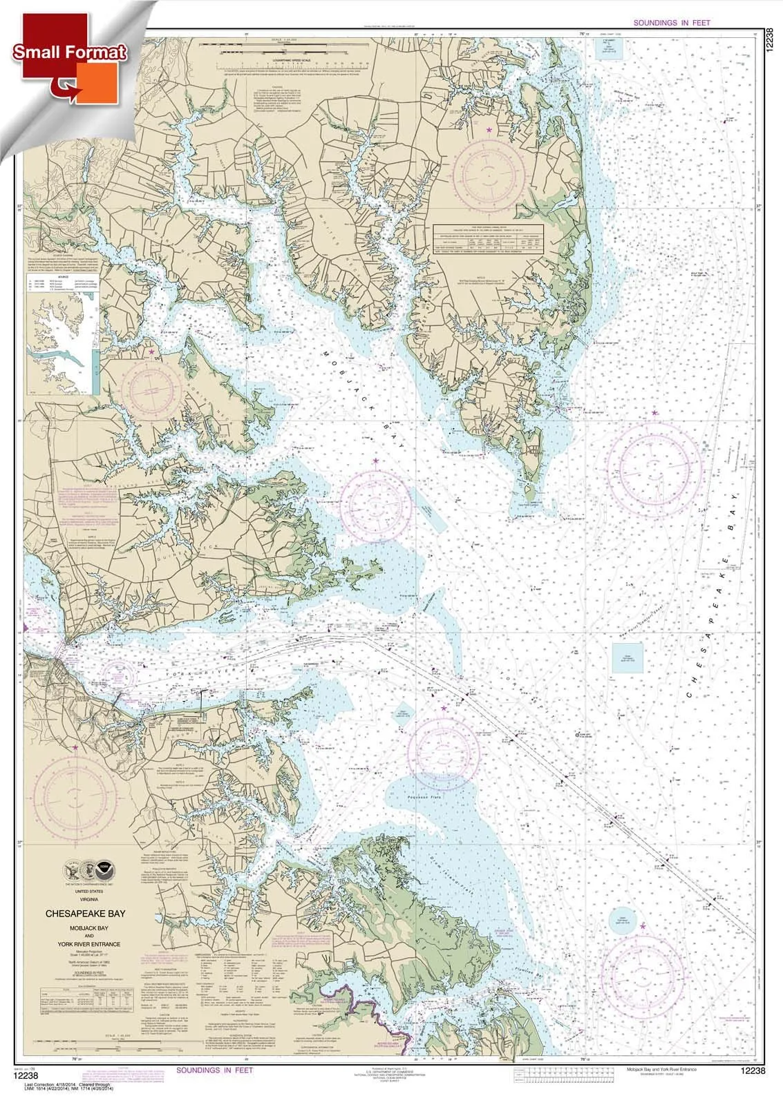
NOAA Chart 12238: Chesapeake Bay Mobjack Bay & York River Entrance, Small Waterproof Format
Rated
0
out of 5
$
18.95
Buy product
Buy product
Subjects
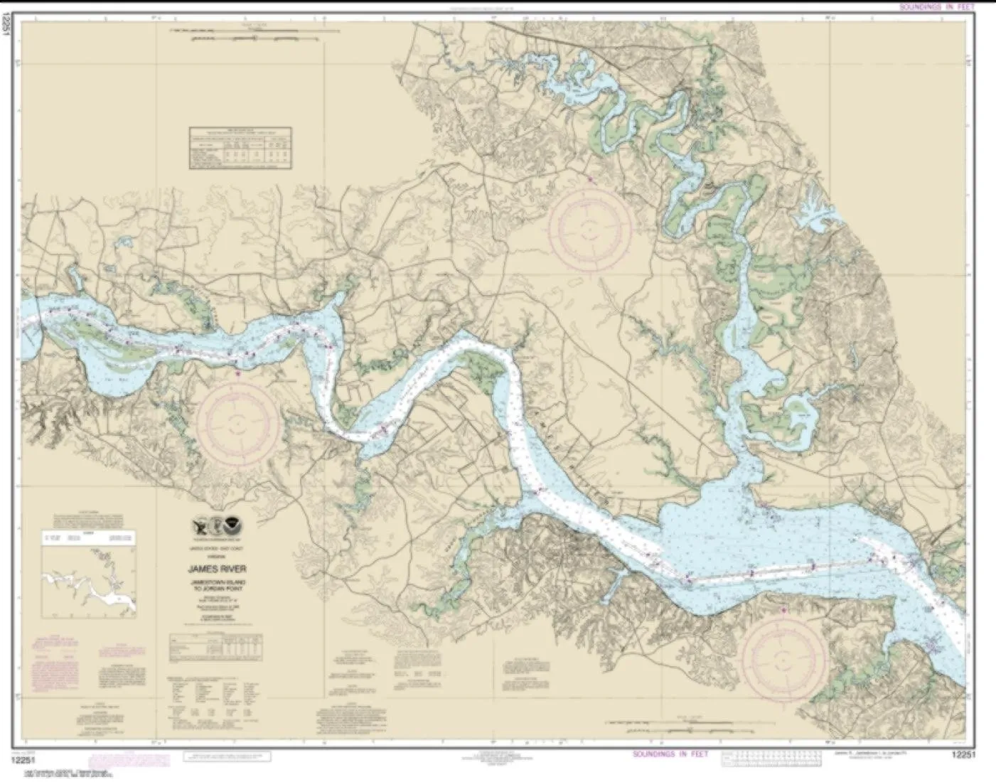
NOAA Chart 12251 – James River Jamestown Island to Jordan Point – Water-Resistant – East View
Rated
0
out of 5
$
24.99
Buy product
Buy product
Subjects
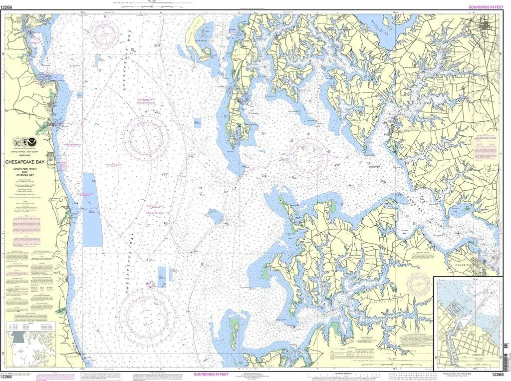
NOAA Chart 12266: Chesapeake Bay Choptank River and Herring Bay – Cambridge, OceanGrafix Approved
Rated
0
out of 5
$
28.95
Buy product
Buy product
Charts & Maps
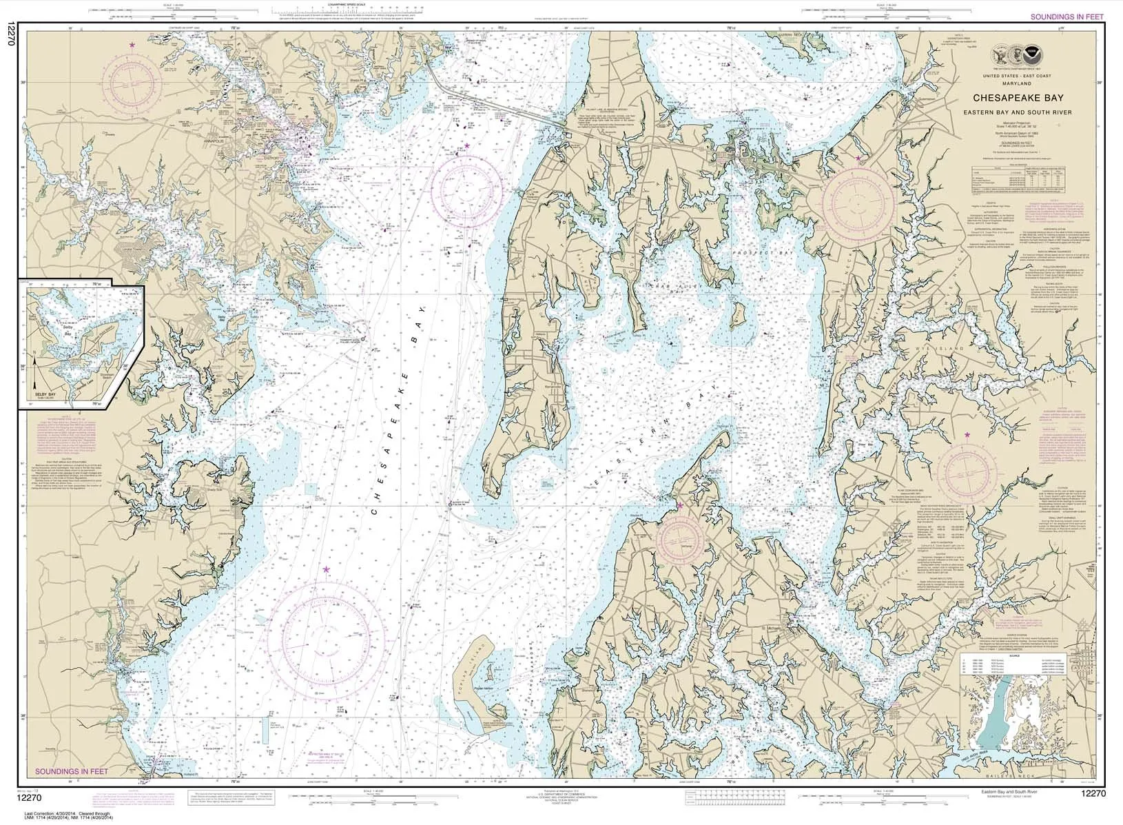
NOAA Chart 12270: Chesapeake Bay Eastern Bay & South River, 35.5’x48.4′, Water-Resistant Paper
Rated
0
out of 5
$
28.95
Buy product
Buy product
Subjects
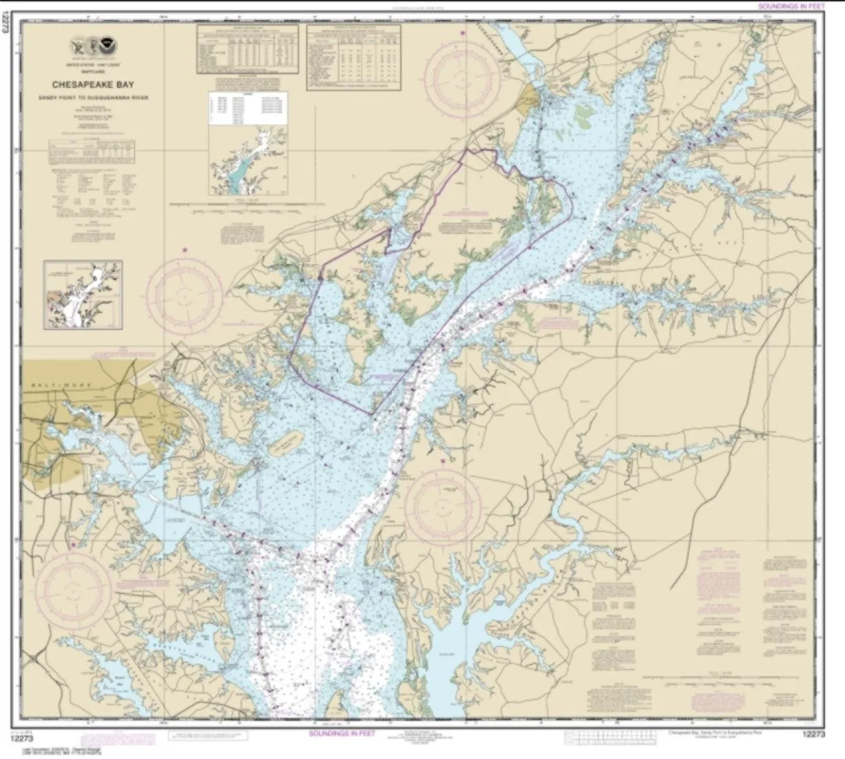
NOAA Chart 12273 Chesapeake Bay Sandy Point to Susquehanna River – Water-Resistant Paper Map
Rated
0
out of 5
$
24.99
Buy product
Buy product
Charts & Maps
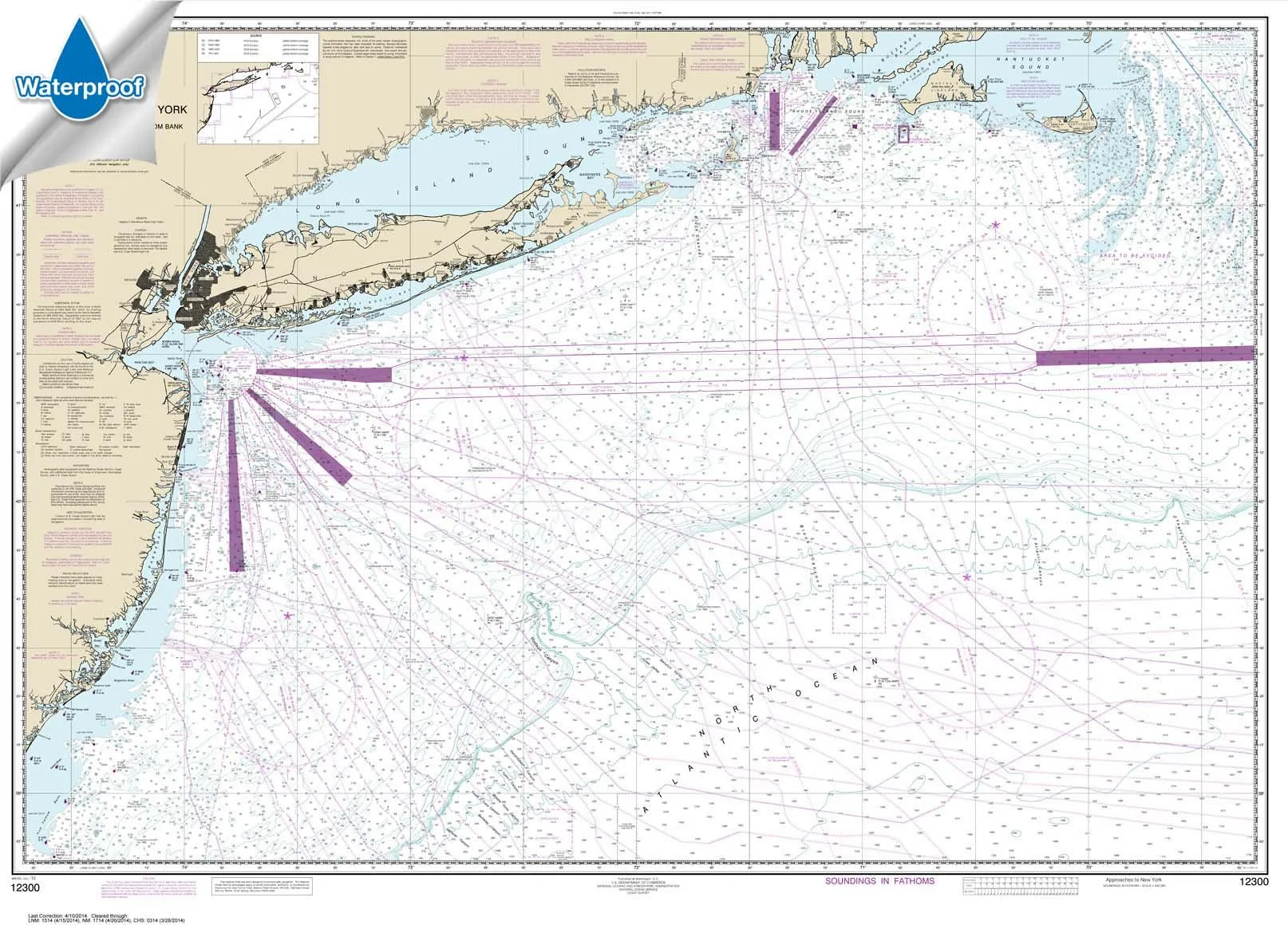
NOAA Chart 12300: Approaches to New York, Waterproof Nautical Chart 34.6’x47.9′ by Paradise Cay
Rated
0
out of 5
$
31.95
Buy product
Buy product
Subjects
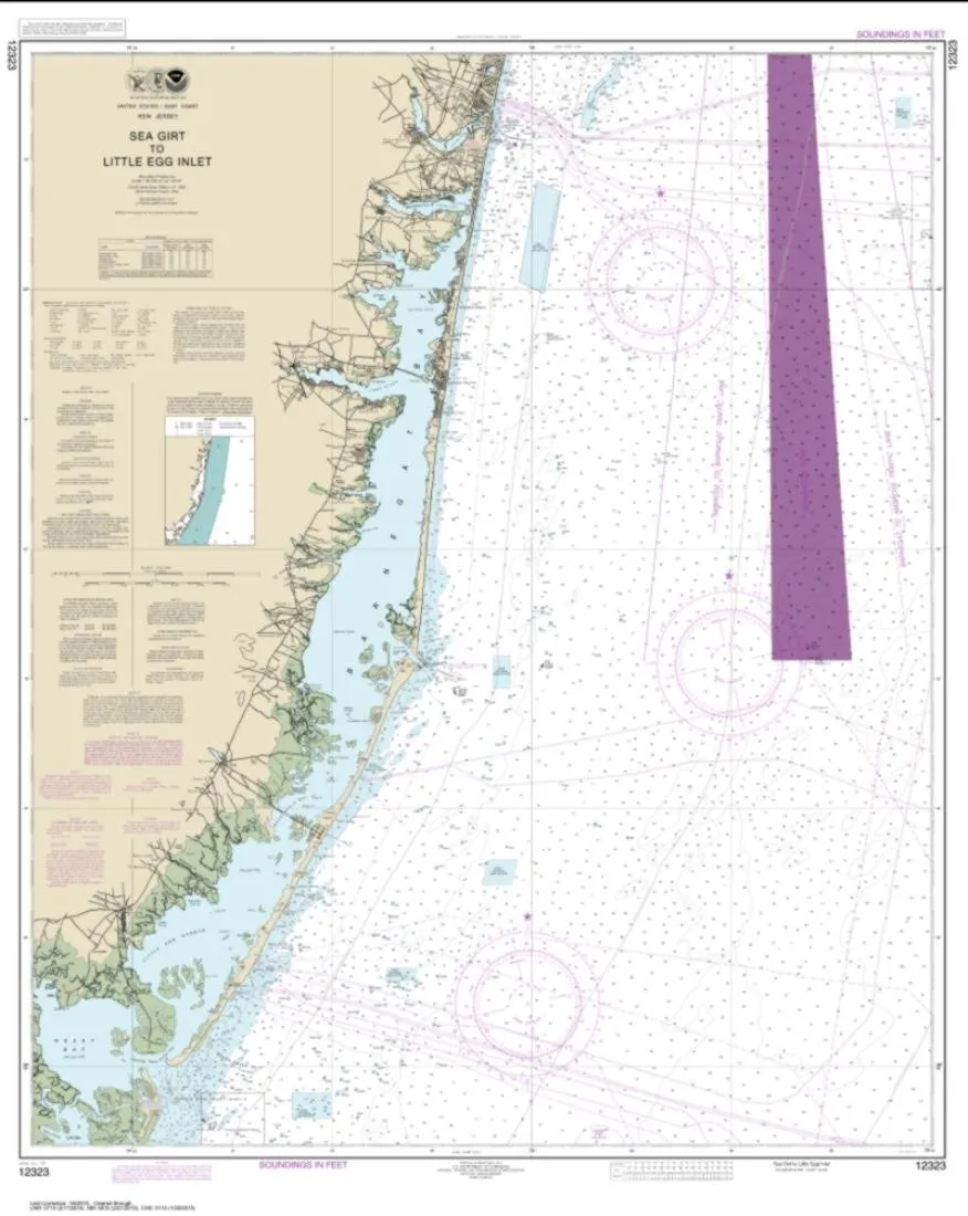
NOAA Chart 12323 – Sea Girt to Little Egg Inlet – Water-Resistant PaperTyger – 109 x 87 Inches
Rated
0
out of 5
$
24.99
Buy product
Buy product
Charts & Maps
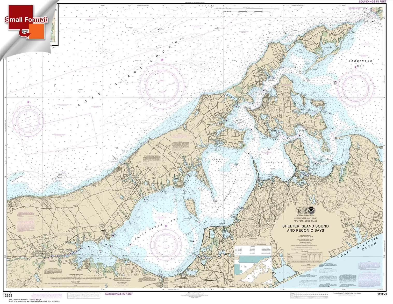
NOAA Chart 12358: Shelter Island Sound & Peconic Bays, 21’x27′ Waterproof Small Format
Rated
0
out of 5
$
18.95
Buy product
Buy product
Charts & Maps
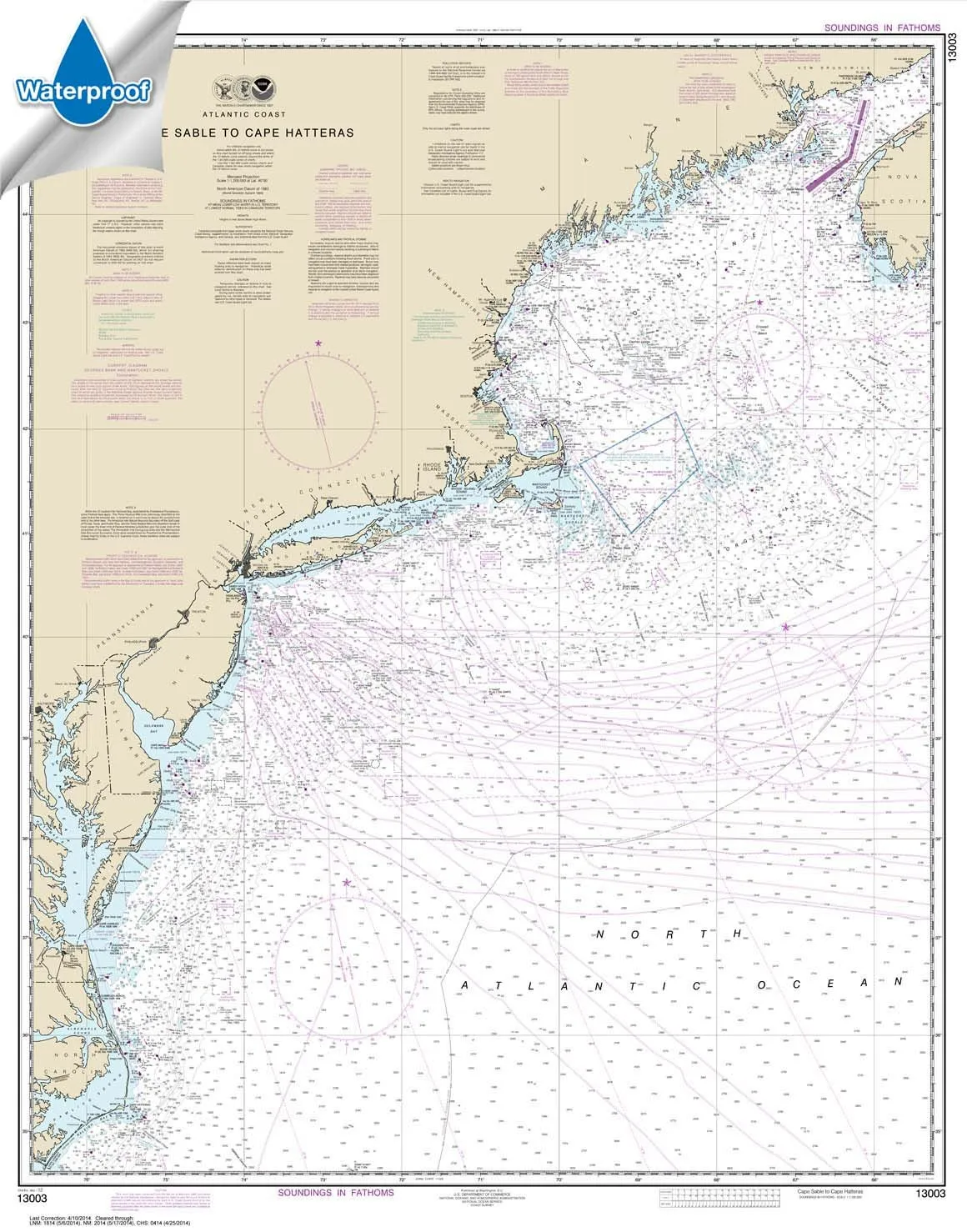
NOAA Chart 13003: Cape Sable to Cape Hatteras – Waterproof, USCG Certified, High-Quality Print
Rated
0
out of 5
$
31.95
Buy product
Buy product
Subjects
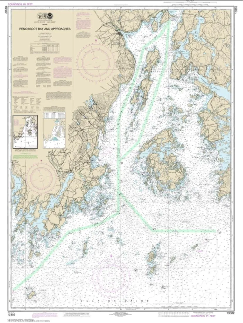
NOAA Chart 13302 – Penobscot Bay 44.5’x33.5′ on Acid-Free Paper by East View Geospatial
Rated
0
out of 5
$
18.99
Buy product
←
1
2
3
4
→
Scroll to Top