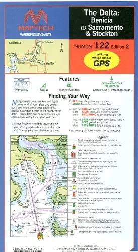
Introducing the Maptech Waterproof Chart for the Delta-Benicia to Sacramento, now available in its 2nd Edition. This chart provides a comprehensive and detailed overview of the waterways, ensuring that you have the most accurate navigation aid available. Measuring 24 inches by 36 inches and printed to a scale of 1:53,333, this chart perfectly balances size and detail, making it an essential tool for both recreational and professional mariners.
The Delta-Benicia region is rich in scenic beauty and navigational complexity. This chart covers crucial areas including the Sacramento and San Joaquin Rivers, extending to Suisun Bay. Key locations depicted on the chart include Antioch, Sacramento, Stockton, as well as Bethel and Andrus Islands, and Mossdale. With these detailed illustrations, you can navigate with confidence, whether you are enjoying a leisurely day on the water or engaging in serious boating activities.
One of the standout features of this waterproof chart is its inclusion of GPS waypoints. These waypoints are essential for modern navigation, allowing you to pinpoint your location accurately while on the water. In addition to the waypoints, the chart also highlights nearly 100 marine facilities and boat ramps, making it easier for you to plan your outings effectively.
| Dimensions | 24 in. x 36 in. |
| Scale | 1:53,333 |
| Coverage Area | Delta-Benicia to Sacramento & Stockton |
| Features | GPS Waypoints, Marine Facilities, Boat Ramps |
This chart is not only a practical tool but also built to withstand the rigors of the marine environment. Its waterproof material ensures durability and longevity, so you can rely on it for years to come. Whether you are a seasoned sailor or a beginner, the Maptech Waterproof Chart has something to offer for everyone.
In summary, the Maptech Waterproof Chart of the Delta-Benicia to Sacramento 2nd Edition is an indispensable resource for anyone navigating these waterways. With its detailed coverage, useful features, and robust design, it makes for a perfect companion on your maritime adventures.

Reviews
There are no reviews yet.