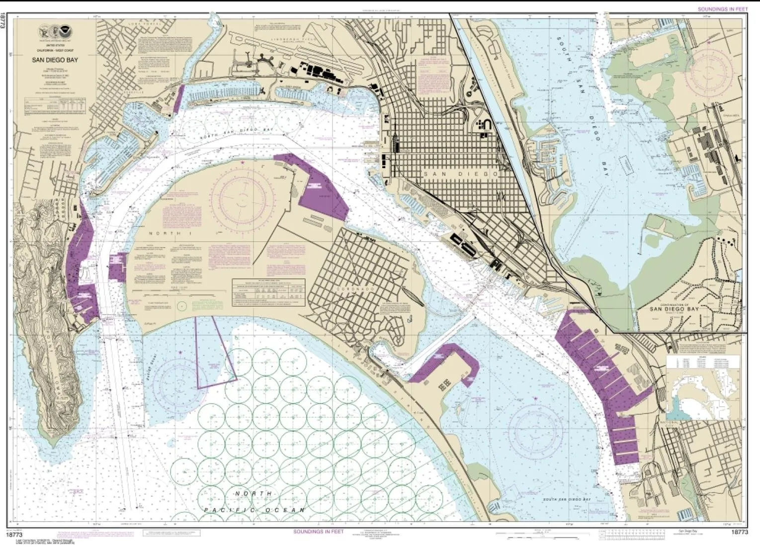
Explore the stunning and detailed NOAA Chart 18773, specifically designed for San Diego Bay. This nautical chart is an essential tool for mariners and boating enthusiasts, offering a comprehensive view of the bay’s waters. The chart is printed on PaperTyger, a revolutionary lightweight, tear-resistant, and water-resistant material that provides a smooth matte finish. This means you can rely on its durability even in wet conditions, making it perfect for your maritime adventures.
With a map scale of 1:12,000 and a generous size of 126 x 91 inches, this chart provides detailed navigation guidance. Each chart is printed on demand, ensuring that you receive the most up-to-date NOAA data along with the latest Notice to Mariners (NTMs) applied at the time of printing. This commitment to quality and accuracy ensures that your navigational information is reliable and current.
East View Geospatial (EVG) is a certified NOAA and NGA print-on-demand printer, specializing in high-resolution nautical charts. All charts are meticulously printed to meet the United States Coast Guard carriage requirements, ensuring that you have the necessary information for safe navigation.
It’s important to note that NOAA-OCS has canceled this Raster and PDF chart. Therefore, this product does not meet the U.S. and international carriage requirements for commercial vessels, as defined in SOLAS Chapter V Regulation 19.2.1. However, it remains an invaluable resource for recreational use and personal navigation.
Whether you are planning a boating trip, conducting research, or simply want to explore the beautiful San Diego Bay, this chart is a must-have. Its large size allows for easy reading and provides a wealth of information about the bay’s depths, hazards, and navigation aids.
| Feature | Details |
| Material | PaperTyger – lightweight, tear-resistant, water-resistant |
| Scale | 1:12,000 |
| Size | 126 x 91 inches |
| Certification | NOAA and NGA approved |
| Print Quality | High-resolution with pre-production finishing |
In conclusion, the NOAA Chart 18773 for San Diego Bay is not just a map; it is an essential companion for anyone who enjoys the water. With its high-quality printing, durable materials, and accurate information, you can navigate confidently and safely.


Reviews
There are no reviews yet.