Skip to content
Trout Derby
About
Cart
Checkout
Collections
Contact
Home
My Account
Payment Methods
Privacy Policy
Return Policy
Shipping Policy
Shop
Terms of Use
Track your order
Trout Derby
Main Menu
About
Cart
Checkout
Collections
Contact
Home
My Account
Payment Methods
Privacy Policy
Return Policy
Shipping Policy
Shop
Terms of Use
Track your order
Home
/
Shop
/ Page 349
Shop
Showing 4177–4188 of 4944 results
Default sorting
Sort by popularity
Sort by average rating
Sort by latest
Sort by price: low to high
Sort by price: high to low
Buy product
Charts & Maps
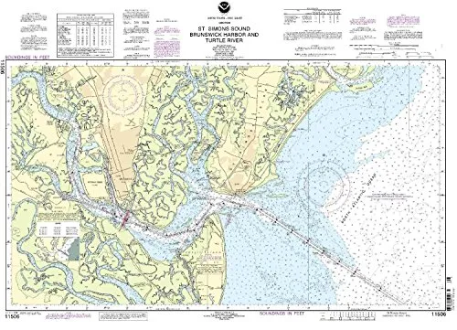
NOAA Nautical Chart for St. Simons Sound, Brunswick Harbor & Turtle River – On-Demand Updates
Rated
0
out of 5
$
20.94
Buy product
Buy product
Charts & Maps
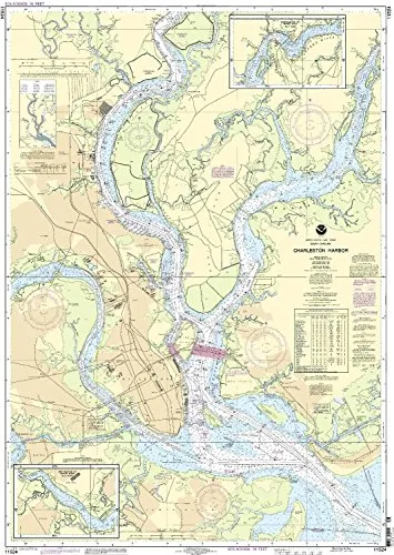
11524 Charlseston Harbor NOAA Nautical Chart – 1:20000 Scale, 36.93” H x 26.6” W, U.S. Coast Guard Approved
Rated
0
out of 5
$
20.94
Buy product
Buy product
Charts & Maps
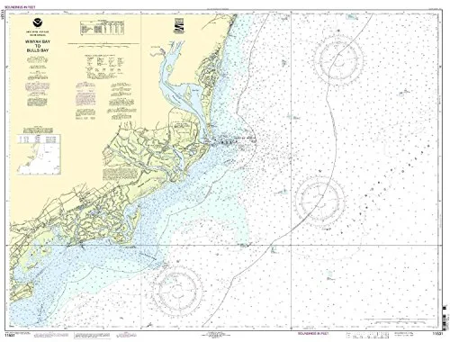
Winyah Bay Entrance to Isle of Palms Nautical Chart 34.13” H x 43.12” W – NOAA Approved
Rated
0
out of 5
$
20.94
Buy product
Buy product
Charts & Maps
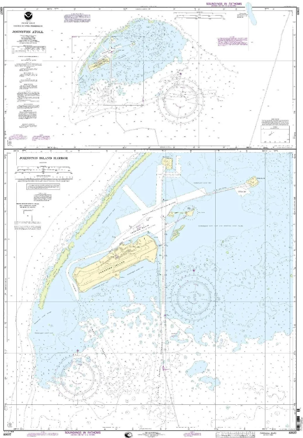
Johnston Atoll Nautical Chart, NOAA Approved 1:50000 Scale, 49.03” H x 34” W, OceanGrafix
Rated
0
out of 5
$
34.95
Buy product
Buy product
Charts & Maps
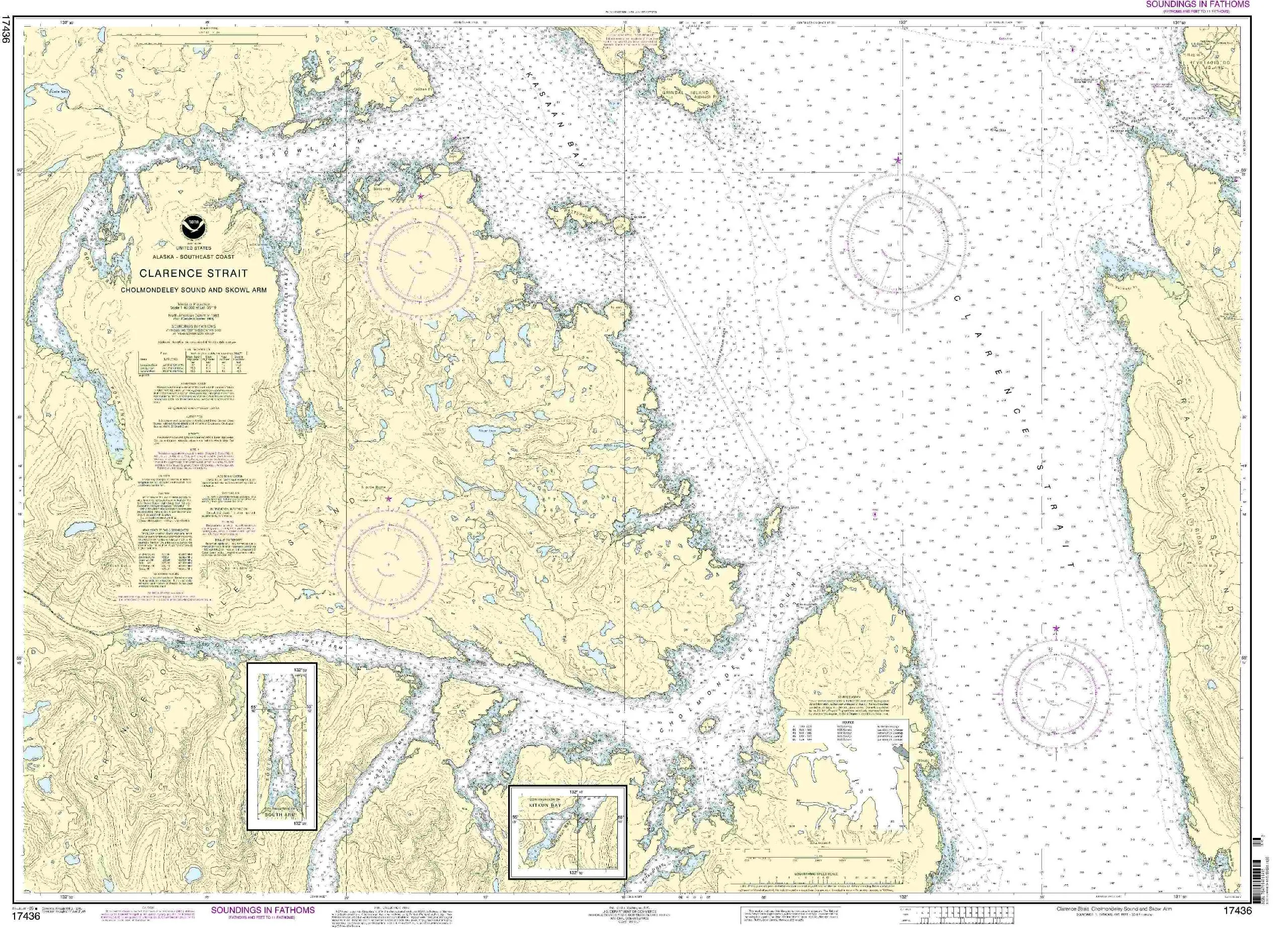
NOAA Chart 17436: Clarence Strait, Cholmondeley Sound, Skowl Arm – Updated Nautical Chart
Rated
0
out of 5
$
32.95
Buy product
Buy product
Charts & Maps
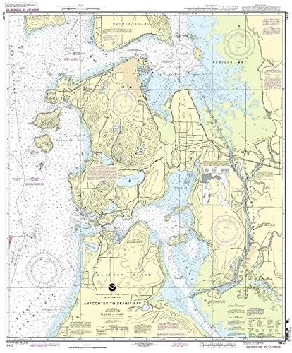
18427 Anacortes to Skagit Bay Nautical Chart, NOAA Approved, On-Demand Printing with Latest Updates
Rated
0
out of 5
$
27.95
Buy product
Buy product
Charts & Maps
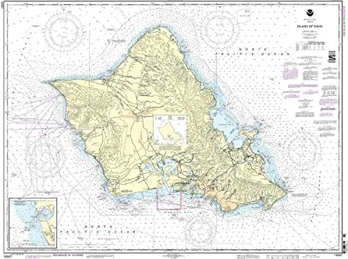
Oahu Nautical Chart – Barbers Point Harbor, NOAA Approved, 1:80000 Scale, 35.93′ H x 46.85′ W
Rated
0
out of 5
$
34.95
Buy product
Buy product
Charts & Maps
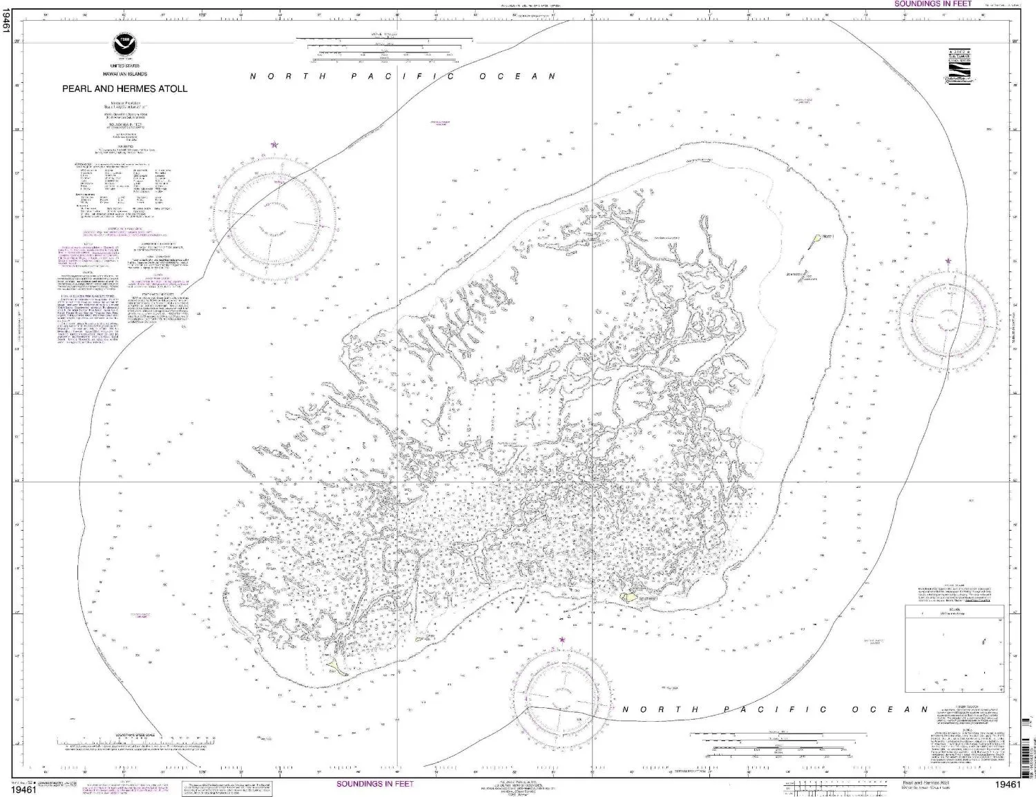
Pearl and Hermes Atoll NOAA Nautical Chart – Up-to-Date OceanGrafix Print for Mariners
Rated
0
out of 5
$
27.95
Buy product
Buy product
Charts & Maps
13229 South Coast of Cape Cod and Buzzards Bay NOAA Chart Folio for Small Craft – U.S. Coast Guard Approved
Rated
0
out of 5
$
32.95
Buy product
Buy product
Charts & Maps
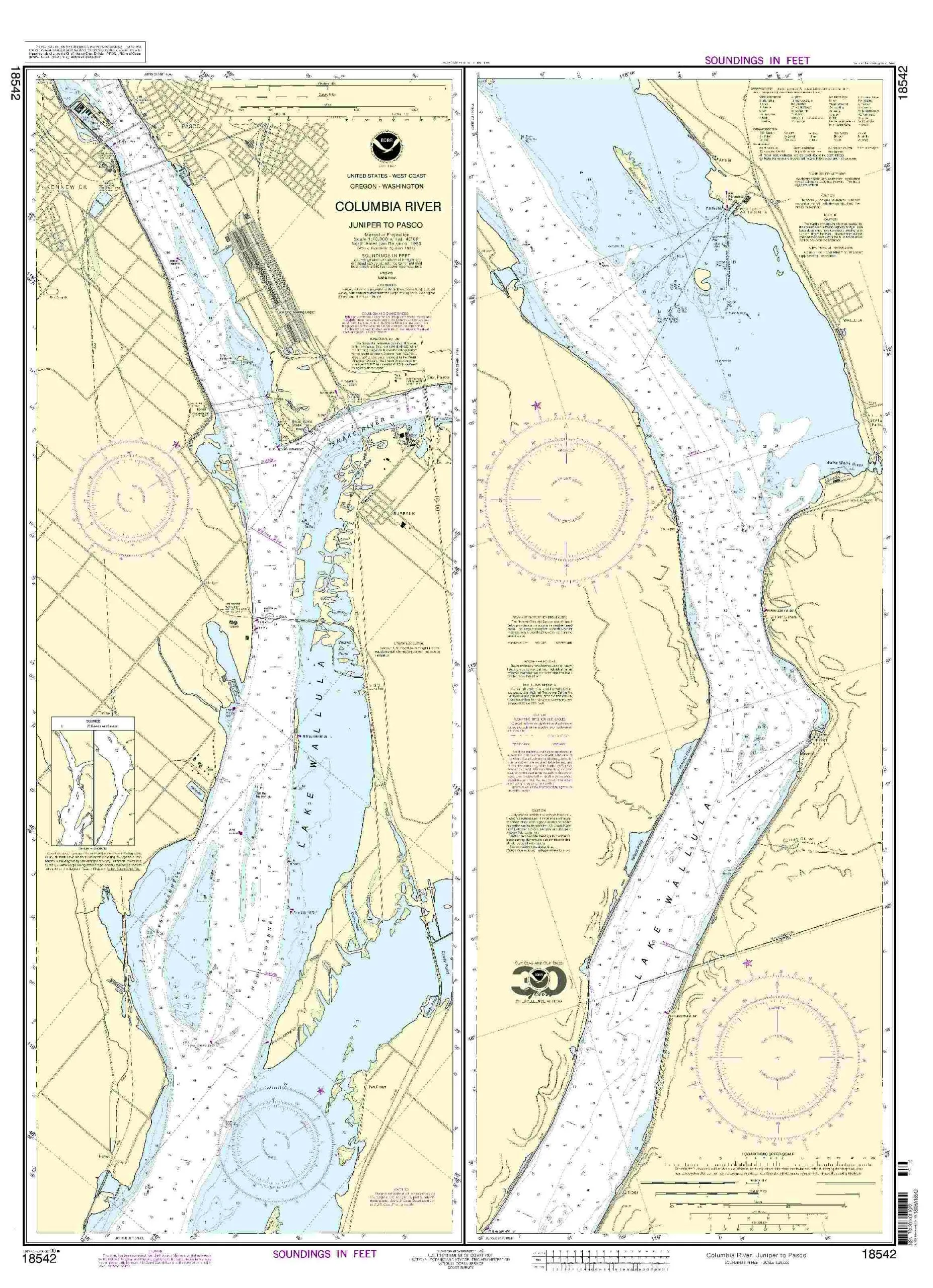
NOAA Nautical Chart – Columbia River Juniper to Pasco, 28.45’x39.19′, U.S. Coast Guard Approved
Rated
0
out of 5
$
28.00
Buy product
Buy product
Charts & Maps
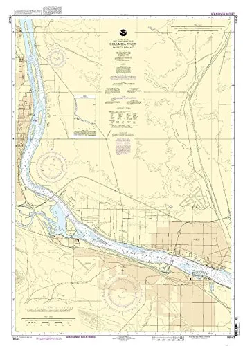
NOAA-Approved Nautical Chart – Columbia River Pasco to Richland – Latest Updates for Mariners
Rated
0
out of 5
$
27.95
Buy product
Buy product
Charts & Maps
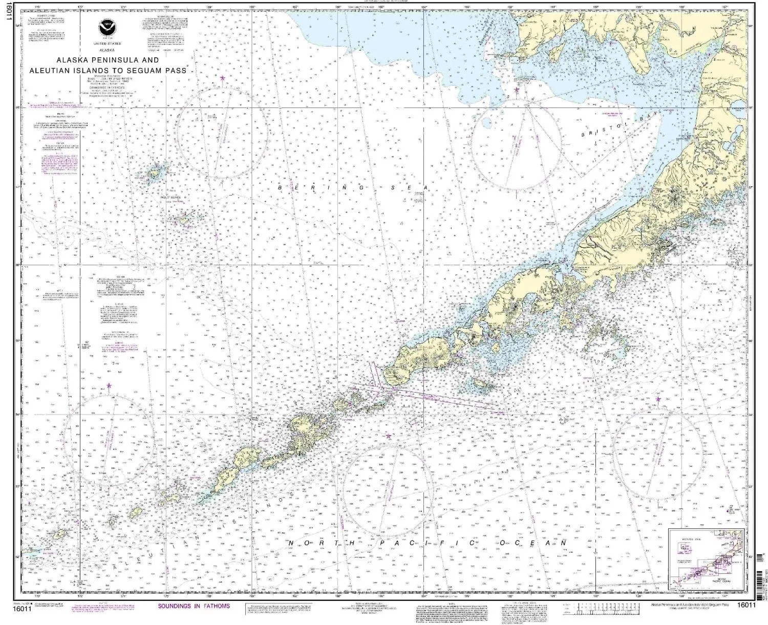
Alaska Peninsula & Aleutian Islands Nautical Chart – NOAA Approved, Printed on Demand
Rated
0
out of 5
$
34.95
Buy product
←
1
2
3
…
346
347
348
349
350
351
352
…
410
411
412
→
Scroll to Top