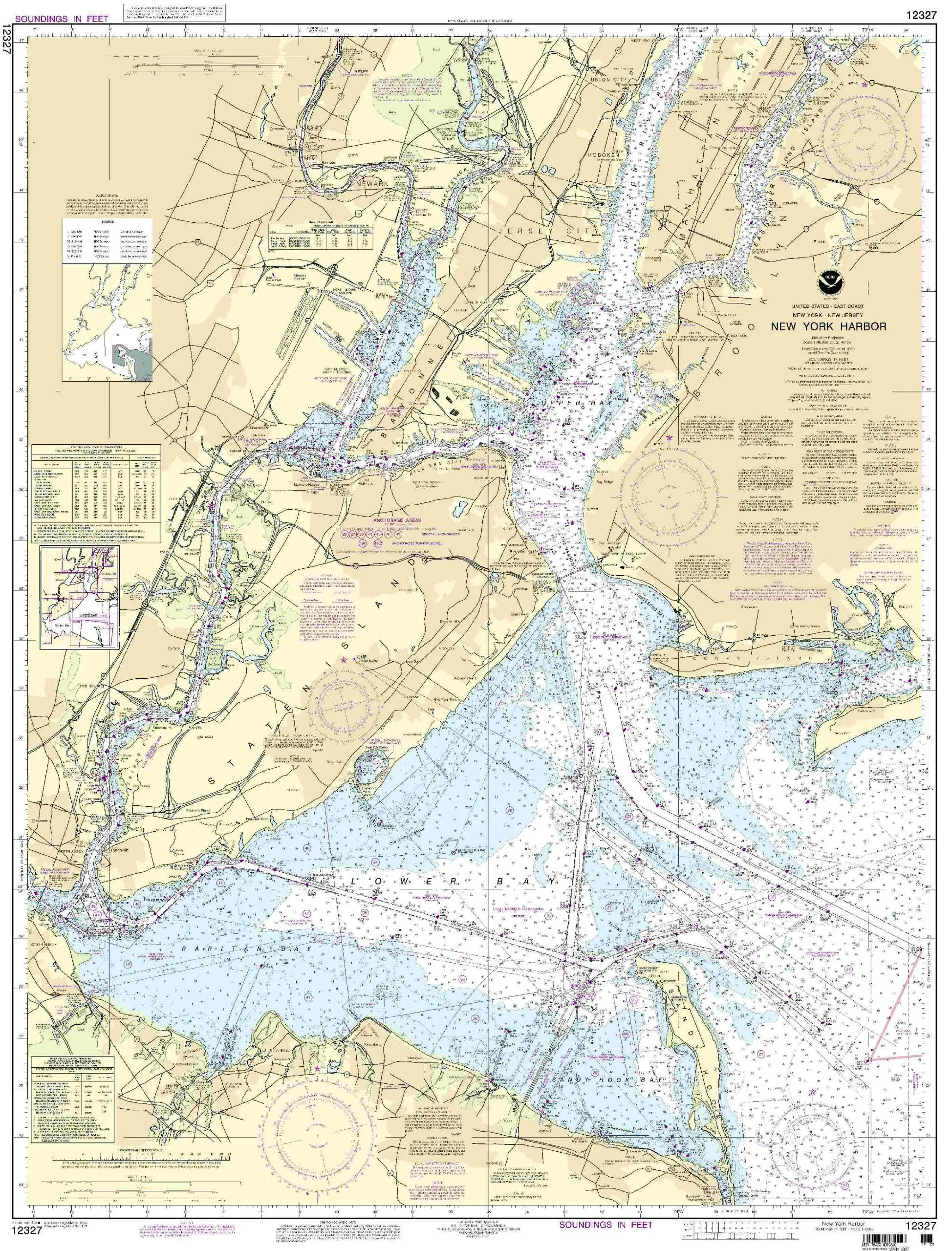
Discover the essential tool for every mariner, the 12327 New York Harbor Nautical Chart, designed specifically for navigational accuracy and safety.
| Brand | NOAA |
| Size | 46.2” H x 35.24” W |
| Scale | 1:40000 |
| Region | Eastern U.S./Canada |
| Approval | U.S. Coast Guard Approved |
| Features | NOAA-approved, All Notice to Mariners corrections applied, Meets U.S. and international carriage requirements |
The 12327 New York Harbor Nautical Chart is the ultimate reference for navigating the waters of New York Harbor and surrounding areas. Created by OceanGrafix, this chart is printed only after an order has been placed, ensuring that you receive the most current and accurate information available.
One of the standout features of this chart is its adherence to the latest updates from the Notice to Mariners. This means that any changes or corrections to the navigation data are promptly applied, ensuring mariners have the most reliable information at their fingertips.
Not only does this chart meet the U.S. Coast Guard’s rigorous standards, but it also satisfies international carriage requirements for commercial vessels. This makes it an essential tool for both recreational and professional mariners.
The chart is designed at a scale of 1:40000, providing an excellent level of detail that is crucial when navigating busy waterways. With dimensions of 46.2 inches high by 35.24 inches wide, it offers a comprehensive view of the harbor and its surroundings.
In summary, the 12327 New York Harbor Nautical Chart is more than just a piece of paper; it’s a vital resource that combines latest navigational data, compliance with regulatory standards, and high-quality printing. Whether you are a seasoned mariner or a novice exploring the waters for the first time, having this chart on board will enhance your experience and ensure safe navigation.


Reviews
There are no reviews yet.