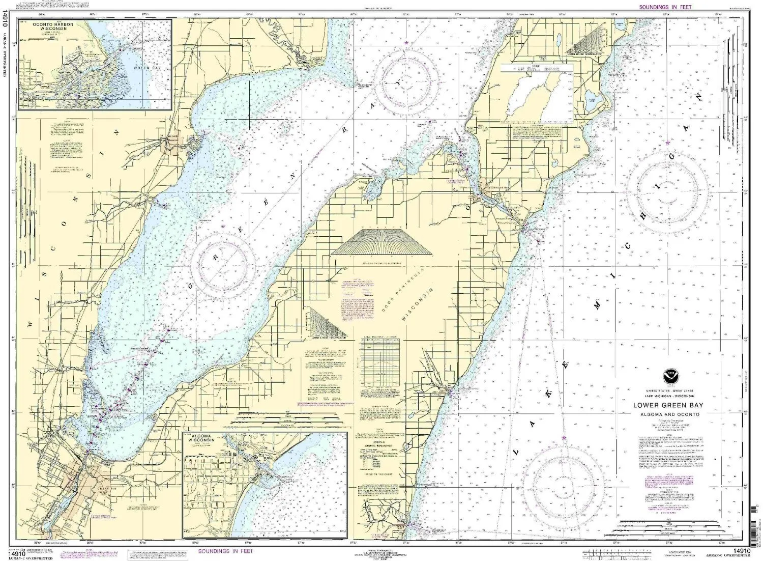
Welcome to the world of precise navigation with the 14910 Lower Green Bay NOAA Nautical Chart. This exceptional chart is designed to meet the needs of mariners, ensuring they have the most up-to-date information available. Crafted by OceanGrafix, this chart is not just a product; it is a reliable tool that enhances your maritime experience.
The 14910 Lower Green Bay chart is printed only after an order is received, guaranteeing that you always receive the latest updates. This feature is particularly important for those navigating the waters of the Eastern U.S. and Canada, where conditions can change rapidly. By applying all Notice to Mariners corrections, the chart ensures that you are equipped with the most accurate information for your journey.
Meeting both U.S. and international carriage requirements for commercial vessels, this chart is a trusted resource for all types of marine operations. The U.S. Coast Guard has approved this chart, providing an additional layer of assurance for mariners who depend on accurate navigational tools.
| Chart Scale: | 1:80000 |
| Dimensions: | 34.36′ H x 46.87′ W |
| Region: | Eastern U.S./Canada |
| Approval: | U.S. Coast Guard Approved |
Whether you are a seasoned mariner or just starting your journey on the water, the 14910 Lower Green Bay NOAA Nautical Chart is an indispensable asset. It brings together functionality and reliability, ensuring that you can navigate with confidence. The detailed scale of 1:80000 allows for precise plotting of your course, while the sizeable dimensions of 34.36′ H x 46.87′ W provide a comprehensive view of the area.
As you prepare for your next expedition, consider the significance of having an updated nautical chart at your fingertips. The 14910 Lower Green Bay chart not only meets your navigational needs but also serves as a testament to quality and accuracy. Make it a part of your navigational toolkit, and experience the difference it makes in your maritime ventures.


Reviews
There are no reviews yet.