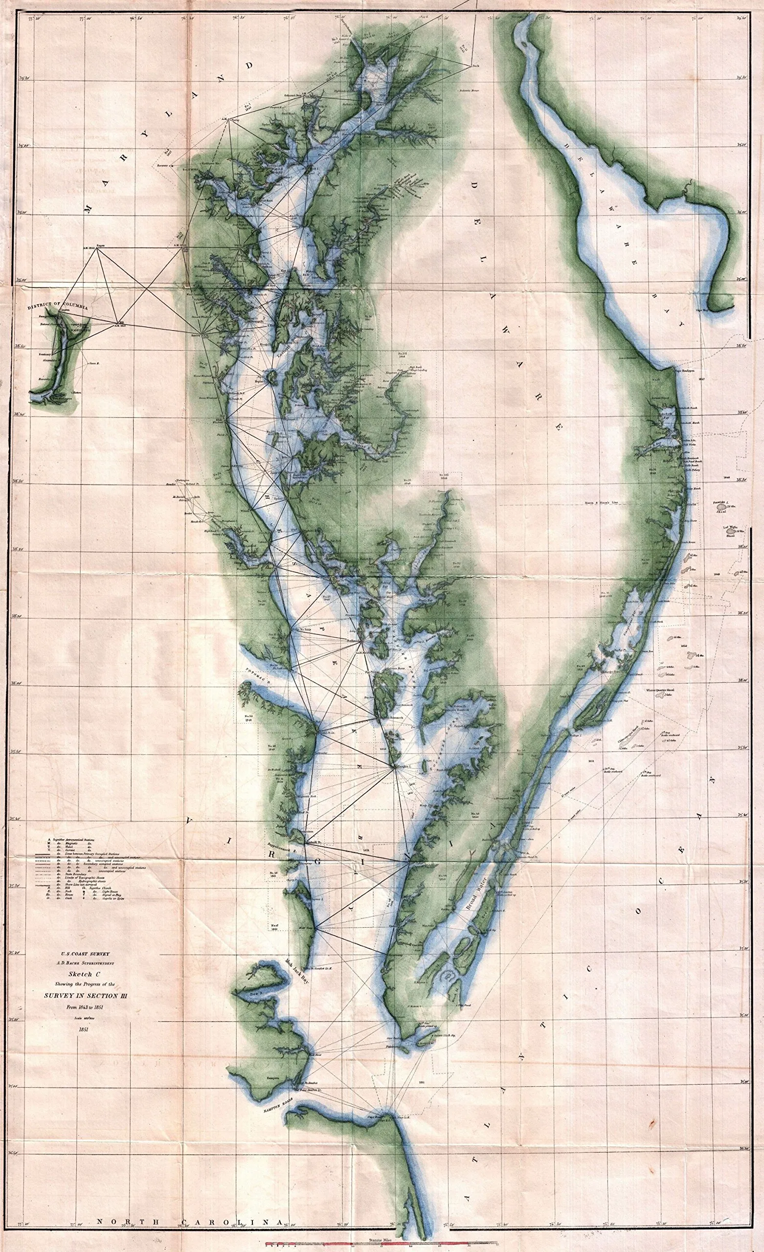
Introducing the exceptional 1851 U.S. Coast Survey Chart, a meticulously crafted reproduction that vividly captures the rich maritime history of the Chesapeake Bay and Delaware Bay regions. This chart is not just a map; it is a gateway to understanding the intricate waterways, historical landmarks, and geographical features of this vital area.
Spanning from the mouth of the Susquehanna River to Cape Henry, and extending westward to Washington D.C. and eastward to Cape May, this reproduction showcases the significant expanses of the Chesapeake and Delaware Bays. It provides an in-depth look at triangulation points throughout the Bay, offering a unique perspective on the coastal navigation methods of the past.
Prepared under the expert supervision of A.D. Bache, a pivotal figure in the development of the U.S. Coast Survey, this chart reflects the dedication to accuracy and detail that characterized the 1852 Superintendent’s Report. The chart thoughtfully includes notable features such as:
| Major Landmarks | Details |
| Lighthouses | Key navigational aids that have guided countless mariners. |
| Ports | Vital hubs for trade and transportation, bustling with activity. |
| Cities | Historical and modern settlements that have shaped the region. |
| Beaches | Beautiful coastal areas perfect for recreation and relaxation. |
| Industrial Sites | Locations significant to the economic development of the area. |
This reproduction is perfect for history enthusiasts, educators, and anyone with a passion for maritime exploration. Whether you’re looking to enhance your home decor, use it as an educational tool, or simply appreciate the beauty of historical cartography, this chart serves all purposes.
The quality of this reproduction ensures that every detail is clear and vibrant, allowing you to appreciate the artistry that went into creating the original chart. Hang it in your office, study, or living room to inspire conversations and ignite curiosity about the maritime history of the Chesapeake and Delaware Bays.
Don’t miss your chance to own a piece of history! This reproduction encapsulates the intersection of art and science in nautical exploration, making it an invaluable addition to any collection.


Reviews
There are no reviews yet.