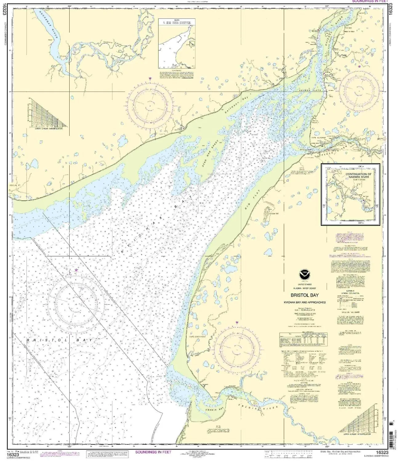
Introducing the Bristol Bay Kvichak Bay nautical chart, a must-have for mariners navigating the stunning Pacific Northwest and Alaska region. This chart, produced by OceanGrafix, is renowned for its accuracy and reliability. It is NOAA-approved, ensuring that you have access to the most up-to-date nautical information available.
One of the standout features of this chart is its meticulous attention to detail. It is printed only after an order has been received, which means that you will receive the latest information, including all Notice to Mariners corrections that have been applied. This ensures that your navigation is based on the most current data, enhancing safety and efficiency on the water.
The chart is designed to meet both U.S. and international carriage requirements for commercial vessels. This is particularly crucial for professional mariners who must adhere to strict regulations while navigating in various waters. The U.S. Coast Guard has approved this chart, further validating its reliability and quality.
Specifications of the Bristol Bay Kvichak Bay nautical chart are as follows:
| Scale | 1:100000 |
| Size | 42.13” H x 35.34” W |
| Region | Pacific Northwest/Alaska |
| Approval | NOAA Approved, U.S. Coast Guard Approved |
| Features | All Notice to Mariners corrections applied |
Whether you are a commercial fisherman, a recreational sailor, or involved in shipping, this nautical chart is an essential tool for ensuring safe passage through the intricate waterways of Bristol Bay and the Kvichak Bay area. With its precise scale and comprehensive details, it allows for effective planning and navigation.
In conclusion, the Bristol Bay Kvichak Bay nautical chart is more than just a map; it is a vital resource designed for those who depend on accurate navigational data. Invest in your safety and confidence on the water with this essential chart, and navigate the waters of the Pacific Northwest and Alaska with ease.


Reviews
There are no reviews yet.