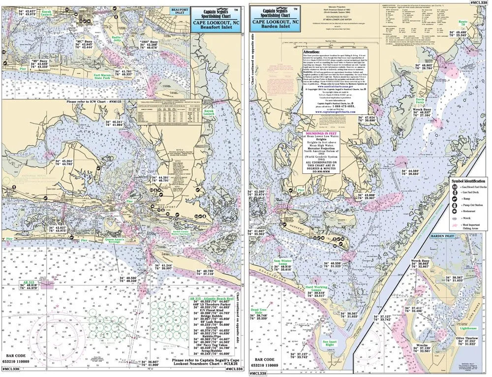
Introducing the Captain Segull Inshore Fishing Chart, a must-have for any fishing enthusiast navigating the vibrant waters from Morehead City to Cape Lookout, North Carolina. This meticulously designed chart is not only visually appealing but also highly functional, making it an essential companion for small boat and kayak fishing adventures.
Measuring 12 inches by 18 inches, the chart is crafted with the needs of anglers in mind. The double-sided laminated design ensures durability and water resistance, allowing you to take it on your fishing trips without worrying about wear and tear. Whether you’re a seasoned fisherman or a newcomer to the sport, this chart provides a wealth of information, enhancing your fishing experience.
| Features | Details |
| Size | 12 inches x 18 inches |
| Material | Laminated for durability |
| Coverage Area | Morehead City to Cape Lookout, NC |
| Details | Fishing areas, wrecks, reefs, local names, and amenities |
This chart features detailed information about various fishing areas, wrecks, and reefs that are crucial for a successful fishing trip. Additionally, it includes local names and amenities, making it easier for you to navigate and plan your fishing outings. The GPS coordinates are marked out to the thousandths of a minute, ensuring precision in locating your favorite spots.
Whether you’re targeting specific fish species or simply exploring the beautiful coastal waters, the Captain Segull Inshore Fishing Chart is designed to meet all your needs. Its practical layout allows for quick reference, so you can spend more time fishing and less time searching for information.
In summary, if you’re looking for a reliable, easy-to-read fishing chart that offers detailed insights into the inshore waters of North Carolina, look no further than the Captain Segull Inshore Fishing Chart. It’s perfect for both experienced anglers and those just starting out, ensuring a fruitful and enjoyable fishing experience.


Reviews
There are no reviews yet.