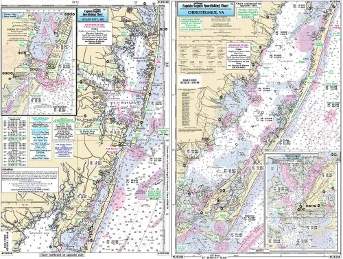
Introducing the Captain Segull Inshore Ocean City to Chincoteague Inlet MD Fishing Nautical Chart, a must-have for any serious angler or boating enthusiast. This high-quality laminated fishing chart is designed specifically for small boats and kayaks, making it perfect for inshore fishing adventures.
Measuring 12’x18′, this compact chart is easy to carry and store, while providing detailed information essential for navigating the waters of Ocean City, MD, and Assawoman Bay, as well as the Chincoteague Bay in Virginia. It features clearly marked fishing areas, wrecks, reefs, local names, and amenities, all plotted with precision up to the thousandths of a minute in GPS coordinates.
| Product Features | Details |
| Brand | Captain Segull’s Sportfishing Chart |
| Size | 12′ x 18′ |
| Material | Laminated for durability |
| Usage | Inshore fishing |
| Includes | Fishing areas, wrecks, reefs, local names, amenities |
| GPS Detail | Up to thousandths of a minute |
This fishing chart is not only practical but also enhances your fishing experience by providing vital information that can lead to a successful day on the water. Whether you’re planning a weekend getaway or a casual day of fishing, having the right chart is essential. This chart’s clarity and detail make it easy to read, ensuring that you can quickly locate the best spots to cast your line.
Moreover, the laminated finish offers added protection against water and wear, allowing you to use it season after season without worrying about damage. Its compact size makes it convenient to bring along on your fishing trips, fitting easily into your tackle box or backpack.
In summary, the Captain Segull Inshore Fishing Chart is an invaluable resource for anyone looking to explore the beautiful waters of Ocean City, MD, and Chincoteague Inlet, VA. With its user-friendly design and comprehensive details, this chart will guide you to the fishing hotspots while ensuring a safe and enjoyable boating experience.


Reviews
There are no reviews yet.