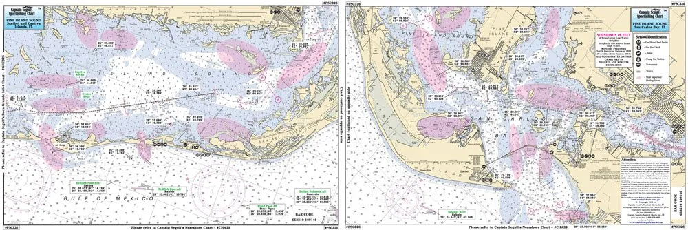
Discover the beauty and excitement of inshore fishing with the Captain Segull Inshore Fishing Chart, specifically designed for the stunning Sanibel and Captiva Islands in Florida. This detailed chart is an essential tool for anglers looking to navigate the waters of San Carlos Bay, showcasing critical information to enhance your fishing experience.
Measuring 12 inches by 18 inches, this double-sided laminated fishing chart is both durable and user-friendly. It provides clear graphics and comprehensive data at your fingertips, enabling you to locate prime fishing spots, wrecks, and reefs with precision. Whether you are in a small boat or kayak, this chart is tailored to meet your needs as you explore the inshore waters.
The chart includes not only fishing areas but also local names and amenities, making it easier for you to plan your fishing trip effectively. With the ability to access GPS coordinates out to the thousandths of a minute, you can navigate confidently and ensure you are always on the right track.
| Features | Benefits |
| Laminated for durability | Resistant to water and tears, ensuring longevity in outdoor conditions. |
| Double sided | Provides comprehensive coverage of fishing areas without flipping. |
| Detailed GPS coordinates | Improves navigation and helps locate the best fishing spots accurately. |
| Local names and amenities | Enhances your fishing experience by providing context and useful information. |
Whether you are a seasoned angler or a novice, the Captain Segull Fishing Chart is designed to elevate your inshore fishing adventures. With its detailed presentation and practical features, you’ll find it easier than ever to enjoy the beautiful waters surrounding Sanibel and Captiva Islands.
Don’t miss out on the chance to enhance your fishing trips with this indispensable chart. With its user-friendly layout and essential information, it’s the ideal companion for anyone looking to make the most of their time on the water.


Reviews
There are no reviews yet.