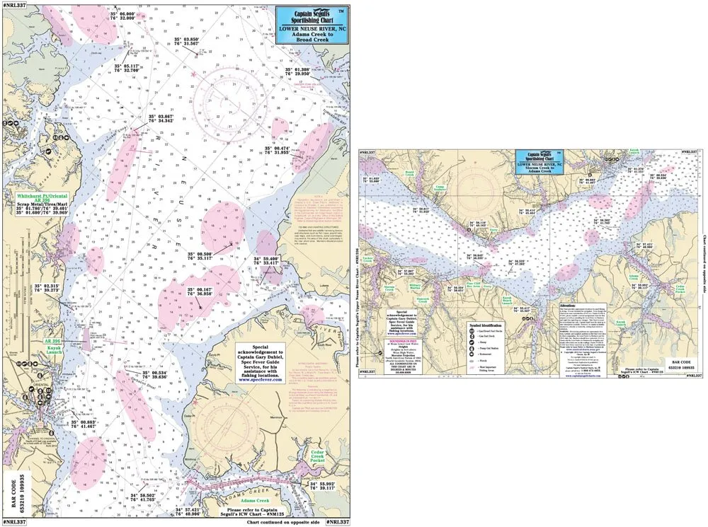
Explore the vibrant waters of the Lower Neuse River with the Captain Segull Inshore Fishing Chart. This specially designed chart is not just a piece of paper; it’s your ultimate guide for fishing adventures in one of North Carolina’s most beautiful inshore environments. Measuring 12′ x 18′, this chart is the ideal size for easy handling while out on the water, whether you’re in a small boat or a kayak.
This chart features detailed information about the fishing areas, wrecks, and reefs that are crucial for any angler looking to make the most of their time on the water. With local names and amenities clearly marked, you will navigate the waters with confidence. The chart extends out to the GPS coordinates with precision down to the thousandths of a minute, ensuring you have the most accurate data at your fingertips.
One of the standout features of this product is its double-sided design. This thoughtful addition allows you to have access to more information without needing to switch charts in the middle of your fishing trip. On one side, you’ll find detailed charts of the Lower Neuse River from Fairfield Harbor to River Dunes and from Oriental to the Intracoastal Waterway (ICW) entrance. The other side covers additional areas and provides insights that can help enhance your fishing experience.
The chart is laminated, which means it is not only durable but also water-resistant. This feature is particularly important for fishing charts, as they are often exposed to the elements. You won’t have to worry about accidental spills or wet hands damaging your chart. Simply wipe it clean after use, and it will remain in excellent condition for your next adventure.
| Product Features | Details |
| Brand | Captain Segull’s Sportfishing Chart |
| Size | 12′ x 18′ |
| Features | Laminated, Double-sided, Inshore fishing detail |
Whether you are an experienced angler or a novice looking to explore the local waters, the Captain Segull Inshore Fishing Chart is a valuable tool. Its clear and precise information helps in planning your fishing trips, making it easier to find the best spots to cast your line.
In conclusion, this fishing chart is more than just a navigational aid; it is an essential companion for anyone looking to enjoy the beauty and bounty of the Lower Neuse River. Don’t miss out on the chance to enhance your fishing experience with this meticulously crafted chart that combines functionality with ease of use. Get ready to embark on your next fishing adventure with the Captain Segull Inshore Fishing Chart!


Reviews
There are no reviews yet.