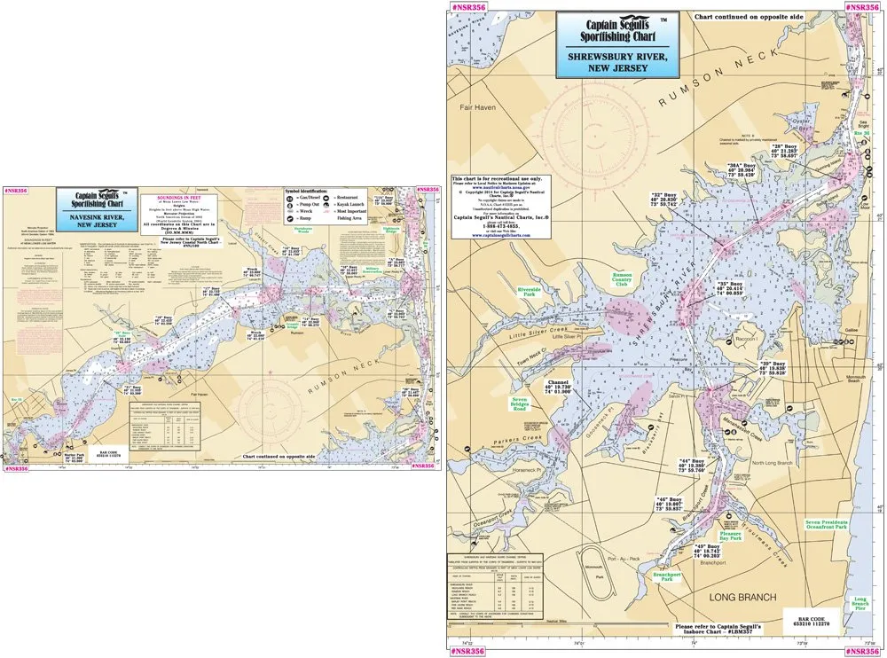
Introducing Captain Segull’s Inshore Fishing Chart, a meticulously crafted tool for both novice and experienced anglers. This detailed chart covers the inshore fishing spots of the Navesink and Shrewsbury Rivers in New Jersey, providing essential information for successful fishing trips. Measuring 12’x18′, it is perfectly sized to fit in your tackle box or glove compartment, enabling you to take it wherever your fishing adventures lead.
This chart is double-sided and laminated, which enhances its durability and usability. Whether you are casting a line from a boat or the shore, this chart will guide you to the best fishing locations. The clarity and accuracy of the waterway details ensure you won’t miss out on any prime fishing opportunities.
Here are some key features of Captain Segull’s Fishing Chart:
| Feature | Description |
| Size | 12′ x 18′ |
| Type | Double-sided laminated |
| Coverage Area | Navesink & Shrewsbury Rivers, NJ |
| Ideal For | Inshore fishing enthusiasts |
Whether you’re fishing for bass, flounder, or other local species, this chart provides valuable insights into the best practices and locations. The high-quality lamination protects against water damage, ensuring that it remains readable and intact, even in wet conditions.
Utilizing this chart, anglers can easily identify key fishing spots, depth contours, and navigational markers. It is an essential companion for anyone looking to improve their fishing experience in these beautiful New Jersey rivers. From seasoned veterans to those just starting, Captain Segull’s Fishing Chart is designed to enhance your fishing trips, making them more productive and enjoyable.
Invest in your fishing success with Captain Segull’s Inshore Fishing Chart and discover the hidden gems of the Navesink and Shrewsbury Rivers today!


Reviews
There are no reviews yet.