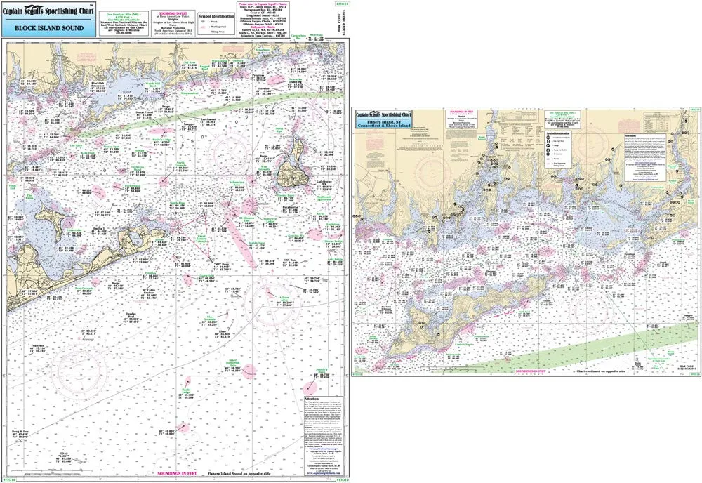
Discover the ultimate fishing companion with Captain Segull’s Nearshore Fishers Island and Block Island Sound Nautical Chart. Specifically designed for fishing enthusiasts, this laminated chart delivers invaluable insights into the best fishing spots, wrecks, and reefs in the area. With a size of 19.5′ x 26.5′, this chart is both durable and portable, making it perfect for any fishing trip.
The chart features two sides, each offering unique navigational information. Side A provides a comprehensive inshore view of Fishers Island Sound, extending from Westerly west to Groton-New London Airport, including the serene Little Narragansett Bay. This side is essential for anglers who prefer to fish in calmer waters, as it highlights the most productive areas for catching various species.
On the flip side, Side B reveals an offshore chart that spans from Niantic Cove in Connecticut to Gardiners Bay in New York, covering the eastern region up to Point Judith, Rhode Island, and southward to Jennie’s Horn fishing spot. This side is perfect for those who venture further into the sea, showcasing deeper waters where larger fish tend to thrive.
One of the remarkable features of this chart is its precision. The detailed layout includes fishing areas, wrecks, reefs, local names, and amenities, all presented with GPS accuracy to the thousandths of a minute. This level of detail ensures that you have all the information needed for a successful fishing expedition.
| Chart Features | Details |
| Type | Laminated Fishing Chart |
| Size | 19.5′ x 26.5′ |
| Inshore Area | Fishers Island Sound, Westerly to Groton-New London Airport |
| Offshore Area | Niantic Cove, Gardiners Bay, Point Judith, Jennie’s Horn |
Whether you’re a seasoned angler or a weekend fishing warrior, Captain Segull’s Nautical Chart is an essential addition to your gear. Its durable laminated design ensures it withstands the rigors of outdoor use, while the comprehensive information it provides helps you navigate the waters with confidence.
Enhance your fishing experience today with this expertly crafted chart, and make every trip to the water a successful and enjoyable one. The combination of detailed maps and practical features makes it a must-have for anyone serious about fishing in Fishers Island and Block Island Sound.


Reviews
There are no reviews yet.