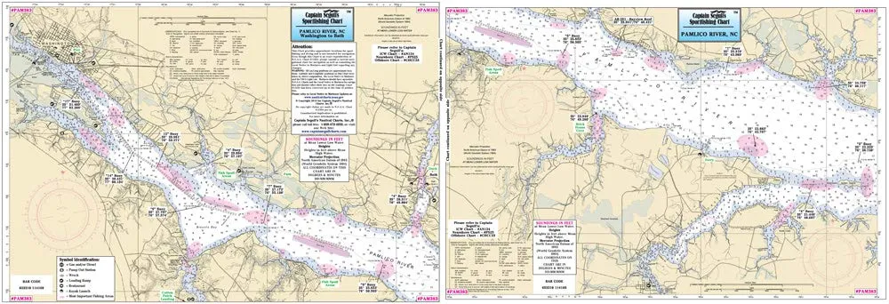
Discover the ultimate fishing companion with Captain Segull’s Inshore Pamlico River, NC Fishing Nautical Chart # PAM383. This expertly crafted fishing chart is designed specifically for small boats and kayaks, making it an essential tool for anglers who want to explore the beautiful waters of the Pamlico River, from Washington to South Creek, NC.
This high-quality chart measures 12 inches by 18 inches, providing ample space for detailed information while remaining compact enough to fit conveniently in your gear. One of the standout features of this chart is its double-sided laminated design, which ensures durability and water resistance. This means you can use it in various weather conditions without worrying about damage.
The chart is meticulously detailed, showcasing critical fishing areas, wrecks, reefs, and local names, making it easier for you to navigate and find the best spots to cast your line. Additionally, it includes GPS coordinates to the thousandths of a minute, allowing for precise location tracking. This feature is particularly important for serious anglers who want to maximize their fishing success.
Whether you’re a seasoned fisherman or just starting, this chart provides valuable insights into the waters of the Pamlico River. The clear visual representation and easy-to-read text make it user-friendly. You will appreciate the time and effort put into creating this chart, as it combines practicality with essential fishing information.
To enhance your fishing experience further, the chart also highlights local amenities, ensuring you have access to everything you need during your fishing trips. From launch points to nearby services, this chart serves as your guide to a successful day on the water.
In summary, Captain Segull’s Inshore Pamlico River Fishing Nautical Chart # PAM383 is an indispensable tool for any fishing enthusiast. Its thoughtful design, comprehensive details, and durable construction make it perfect for anyone looking to explore the Pamlico River. Don’t miss out on this essential fishing resource!
| Feature | Description |
| Chart Size | 12′ x 18′ |
| Design | Double-sided laminated |
| Content | Fishing areas, wrecks, reefs, local names, amenities |
| GPS Accuracy | Out to the thousandths of a minute |


Reviews
There are no reviews yet.