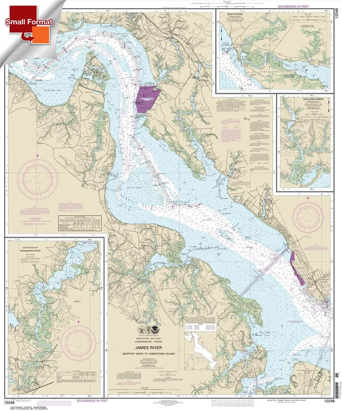
Introducing the Chart 12248, a meticulously crafted nautical map that covers the scenic route from Newport News to Jamestown Island, including the Back River and College Creek. Measuring 21 inches by 25.32 inches, this small format chart is designed for marine enthusiasts who appreciate the beauty of high-quality navigation tools.
Constructed from top-grade waterproof and tear-resistant material, this chart ensures durability and reliability, even in wet conditions. Its exceptional print quality makes it display-ready, allowing you to showcase your nautical passion. The chart arrives rolled, preserving its integrity and ensuring it’s ready for immediate use upon arrival.
It’s important to note that small format charts, such as this one, are proportionately scaled down. They do not meet the U.S. Coast Guard carriage requirements, so while they are great for planning your next adventure, they are not recommended for navigation purposes. The scale has been reduced accordingly, and the scale bars on the chart are proportionally smaller, allowing you to use them for reference.
Our small format charts are produced by Paradise Cay Publications, utilizing proprietary methods that ensure both accuracy and quality. Ruby & Rudy’s Books proudly serves as the exclusive seller of this particular brand of nautical charts. Be cautious of other sellers listing the same product, as they may not be authorized to sell this brand and could be offering inferior items.
As a NOAA-certified agent, Paradise Cay Publications has undergone a rigorous vetting process to ensure that their charts meet the highest standards set by NOAA. This process includes submitting samples for evaluation, where the chart’s scale and print quality are thoroughly assessed. Additionally, the materials used must withstand reasonable erasing for plotting purposes, and it is essential that the paper demonstrates adequate water resistance to comply with NOAA’s requirements.
Only charts printed by certified NOAA Chart Agents are authorized to bear the NOAA logo and meet the necessary carriage requirements. With this assurance, you can trust that your Chart 12248 is a genuine product crafted for quality and performance.
In addition to the Chart 12248, Ruby & Rudy’s offers a comprehensive selection of chart products, including PAPER CHARTS, WATERPROOF CHARTS, SMALL FORMAT CHARTS, BOOKLET CHARTS, and BOOK CHARTS. Explore our full line of nautical charts to find the perfect companion for your maritime adventures.
| Feature | Details |
| Size | 21.00 x 25.32 inches |
| Material | Waterproof, Tear-resistant |
| Print Quality | Display quality, on-demand |
| Usage | Planning, not for navigation |
| Authorized Seller | Ruby & Rudy’s Books |
Whether you’re an avid boater, a passionate fisherman, or simply someone who enjoys exploring waterways, the Chart 12248 is an essential tool that combines functionality with artistic detail. Whether you’re planning your next excursion or simply admiring the beauty of nautical maps, this chart will undoubtedly enhance your experience.


Reviews
There are no reviews yet.