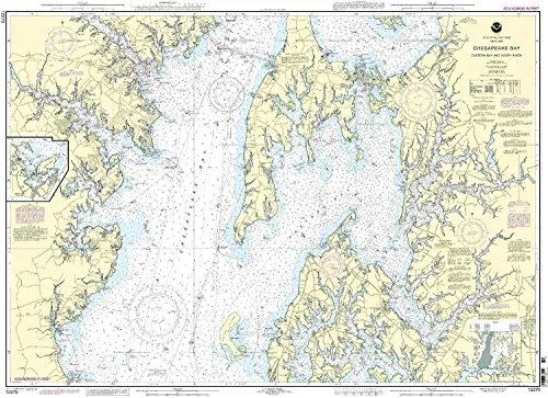
Introducing the Chesapeake Bay Nautical Chart, a vital resource for mariners navigating the beautiful waters of the Eastern Bay and South River. This chart, designated as 12270 by NOAA, combines accuracy and essential information to enhance your boating experience.
One of the standout features of this chart is that it is printed only after an order has been received. This guarantees that you receive the most up-to-date information available. With all Notice to Mariners corrections applied, you can confidently rely on its accuracy for your maritime navigation.
The Chesapeake Bay Nautical Chart meets U.S. and international carriage requirements for commercial vessels, making it an essential tool for both recreational and commercial mariners. Approved by the U.S. Coast Guard, this chart provides peace of mind as you explore the stunning waterways of the region.
| Attribute | Details |
| Chart Type | NOAA Nautical Chart |
| Scale | 1:40000 |
| Dimensions | 35.28” H x 48.74” W |
| Approval | U.S. Coast Guard Approved |
| Updates | All Notice to Mariners corrections applied |
Whether you are planning a leisurely day on the water or undertaking serious navigation for commercial purposes, the Chesapeake Bay Nautical Chart provides the necessary details to ensure your safety and confidence on the water. With its precise scale and comprehensive updates, this chart is not just a map, but an essential tool for every mariner.
Don’t leave your navigation to chance. Equip yourself with the Chesapeake Bay Nautical Chart and sail with assurance, knowing that you have the best resources at your fingertips.


Reviews
There are no reviews yet.