Discover the ultimate fishing companion with our Coastal Fishing Chart, specifically designed for enthusiasts navigating the beautiful waters of Buzzards Bay and Nantucket Sound. This chart provides comprehensive coverage, ensuring that you have the best tools at your disposal for a successful fishing trip.
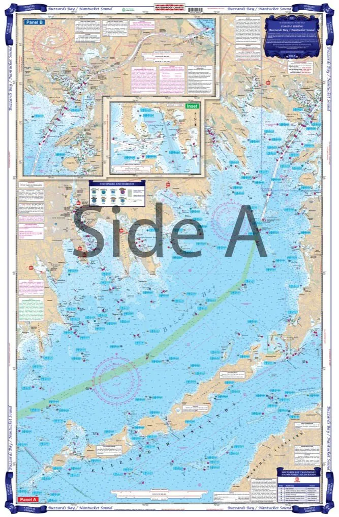
On side A, you will find detailed mapping from the eastern entrance of Cape Cod Canal down to Smith Neck, seamlessly extending over to Sow and Pigs Reef. This section also includes the Elizabeth Islands chain, traversing across Wood’s Hole, and leading back to West Falmouth and Pocasset Harbor. The meticulous detail in this area makes it a must-have for any fisherman aiming to explore these rich waters.
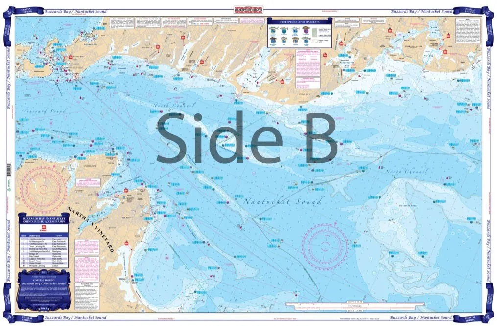
Side B of the chart focuses on Martha’s Vineyard, capturing essential spots from Norton Point around to Hatsett Rock, including Vineyard Haven, and extending eastward to Osterville Point. This section is particularly beneficial for those who frequent Waquoit Bay and Wood’s Hole, which are renowned for their fishing opportunities. The chart’s clarity and precision come from data gathered directly from local tackle stores and expert fishing guides.
What truly sets this chart apart are the dozens of preplotted GPS coordinates that we have included. These coordinates make it easy for anglers to locate prime fishing spots, as well as significant underwater features such as rocks and wrecks. The chart also highlights species-specific locations, allowing you to target your fishing efforts more effectively.
For anglers interested in various species, this chart will guide you to the best spots for Striped Bass, Bluefish, Sea Bass, Flounder, Scup, and various bottom fish. It’s designed to enhance your fishing experience, ensuring that you spend less time searching and more time reeling in your catch.
Like all of our coastal series charts, this one is crafted with durability in mind. It comes folded and is inserted into its own protective cover, ensuring it withstands the rigors of outdoor use. The high-quality synthetic paper (Hop-Syn) is both tear-resistant and waterproof, making it a reliable choice for any fishing trip, rain or shine.
Measuring 25 inches by 38 inches, the chart is easy to handle and read while you’re out on the water. It adheres to the WGS84 – World Mercator Datum, guaranteeing that you have the most current and accurate information at your fingertips.
The Coastal Fishing Chart is not just an essential tool for navigation; it’s an investment in your fishing success. By utilizing the insights and information provided, you can elevate your fishing game and discover the hidden gems in the waters of Buzzards Bay and Nantucket Sound.
| Features | Details |
| Material | Tear Resistant Synthetic Paper (Hop-Syn), Waterproof |
| Size | 25′ X 38′ |
| Coverage | Buzzards Bay, Nantucket Sound, Martha’s Vineyard, and surrounding areas |
| GPS Coordinates | Dozens of preplotted coordinates for optimal fishing |
| Fish Species | Striped Bass, Bluefish, Sea Bass, Flounder, Scup, and more |
| Chart Type | Two-Sided, Foldable |
Don’t miss out on adding this essential fishing chart to your tackle box. With its detailed information and user-friendly design, it’s the perfect resource for both novice and experienced anglers alike. Get ready to reel in your next big catch with confidence!

Reviews
There are no reviews yet.