Welcome to the ultimate fishing experience with our Coastal Fishing Chart designed specifically for Raritan Bay and Jamaica Bay. This detailed chart, measuring 25′ x 38′, is not just any ordinary map; it’s a robust fishing guide crafted to enhance your fishing adventures.
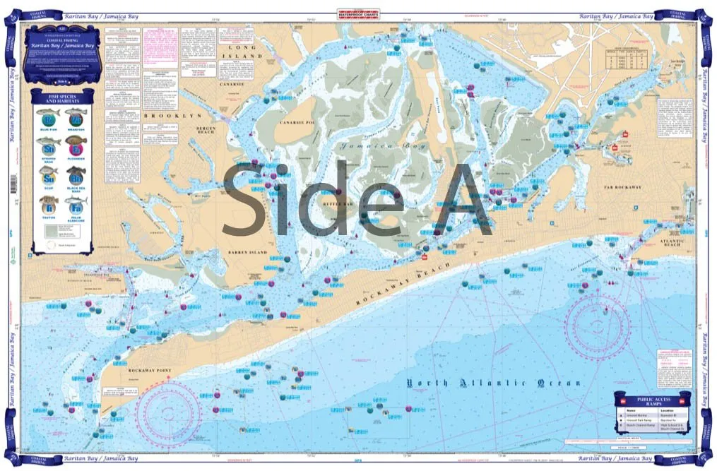
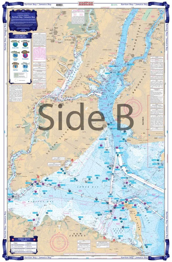
On Side A of the chart, you will find comprehensive coverage of Raritan Bay. This coverage is built from trusted NOAA Charts #12327 and #12334. The area spans from Union City on the Hudson River, down to Sandy Hook, and loops back up to Newark. Each section of the bay has been meticulously charted to provide you with the most accurate fishing locations.
Side B of the chart is equally impressive, compiled from NOAA Chart #13250, showcasing coverage from Rockaway Point and Manhattan Beach out to Atlantic Beach. This side extends back up to North Channel and Great Bay, ensuring you have all the vital information at your fingertips for a successful fishing trip.
Our team has collaborated with local guides, including the renowned Al Ristori, and local tackle stores to identify the most promising areas for fishing. You will find symbols on the chart indicating where you are likely to catch popular species such as Striped Bass, Bluefish, and Sea Bass. This visual representation is crucial for both novice and experienced anglers aiming to increase their haul.
Furthermore, we understand the importance of efficiency when fishing. That’s why we have pre-plotted dozens of GPS waypoints directly on the chart. Imagine sitting at the dock, entering these coordinates into your GPS, and setting off to your next fishing hotspot with ease. The convenience of having these waypoints eliminates the guesswork and allows you to focus more on the thrill of fishing.
This Coastal Fishing Chart is part of our New Coastal Series and comes folded for easy storage and transportation. Moreover, it lists all the popular boat ramps, marinas, and bait stores in the area, providing you with all the necessary resources for a successful fishing outing. Whether you are a seasoned fisherman or just starting, this chart is an invaluable tool for enhancing your fishing experience.
Crafted from tear-resistant synthetic paper (Hop-Syn), this chart is designed to withstand the elements. It is waterproof, ensuring that even in wet conditions, your chart remains intact and usable. You can rely on its durability, making it the perfect companion for any fishing adventure.
In summary, the Coastal Fishing Chart for Raritan Bay and Jamaica Bay is not just a map; it’s a gateway to an exceptional fishing experience. With detailed coverage, essential fishing hotspots, and practical GPS waypoints, you’re set for successful fishing trips. Don’t miss out on this opportunity to elevate your fishing game with our expertly crafted chart!
| Feature | Description |
| Size | 25′ x 38′ |
| Material | Tear-resistant synthetic paper (Hop-Syn) |
| Waterproof | Yes |
| Coverage | Raritan Bay & Jamaica Bay with GPS waypoints |
| Side A | NOAA Charts #12327 and #12334 |
| Side B | NOAA Chart #13250 |
| Includes | Boat ramps, marinas, bait stores |


Reviews
There are no reviews yet.