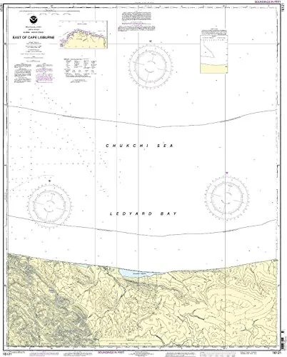
Introducing the East of Cape Lisburne Nautical Chart 16121, a vital resource for both commercial and recreational mariners. This chart is produced by OceanGrafix in partnership with the National Oceanic and Atmospheric Administration (NOAA). It is designed to provide the most accurate and up-to-date information available, ensuring safe navigation across waters.
Key Features:
| Type | NOAA Standard Nautical Chart |
| Printing Method | On Demand |
| Updates | All Notice to Mariners (NTM) corrections applied |
| Compliance | Meets U.S. and international carriage requirements |
| Approval | U.S. Coast Guard Approved |
This nautical chart is printed on demand, meaning that you receive a product that includes the latest notice to mariners updates at the time of printing. OceanGrafix ensures that all the pertinent corrections are applied, providing you with a reliable tool for navigation.
The NOAA-approved chart adheres to the standards set forth in the International Convention for the Safety of Life at Sea (SOLAS). Specifically, it meets the definitions and requirements outlined in SOLAS Chapter V Regulation 2.2, ensuring that it is suitable for all navigational purposes.
For those operating commercial vessels, this chart complies with SOLAS Chapter V Regulation 19.2.1.4, which defines the necessary standards for safe maritime navigation. Mariners can rely on this chart for up-to-date information, crucial for avoiding hazards and ensuring a safe journey.
Whether you are navigating coastal waters or exploring remote areas, the East of Cape Lisburne Nautical Chart 16121 is an essential tool for your maritime adventures. Its accuracy and reliability make it a must-have for any serious mariner.
Choose the East of Cape Lisburne Nautical Chart 16121 for your next voyage and experience peace of mind knowing that you are equipped with the best available data for navigation. Stay safe and informed on the water with this indispensable resource.


Reviews
There are no reviews yet.