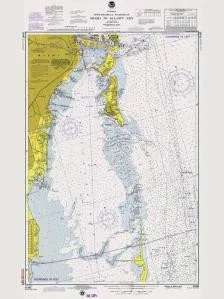
Welcome to the fascinating world of historical navigation with the Historical Nautical Chart 11465-3-1975. This unique chart, produced by OceanGrafix, provides a glimpse into the maritime history of the region from Miami to Elliot Key as it was depicted in the year 1975. Perfect for collectors and enthusiasts alike, this chart serves as a stunning decorative piece that connects you to the rich nautical past of Florida.
This chart is not just a mere representation of geographical features; it is a testament to the evolution of maritime navigation. While it is important to note that this chart is not intended for navigational purposes due to its historical nature, it offers a wealth of information for educational and decorative use.
| Chart Title | Historical Nautical Chart 11465-3-1975 |
| Region | Miami to Elliot Key |
| Year | 1975 |
| Produced By | OceanGrafix |
As you explore this chart, you will notice the detailed illustrations that reflect the maritime landscape of the time. The historical significance of nautical charts cannot be overstated; they have been essential tools for sailors, researchers, and historians alike. This particular chart captures a snapshot of the coastal waters and navigational routes as they were known over four decades ago.
Collectors of nautical memorabilia will find this chart to be an invaluable addition to their collection. Whether displayed in a home, office, or nautical-themed decor, it speaks volumes about the history of exploration and navigation in the Florida waters. This chart is ideal for those who appreciate the beauty of historical documents and the stories they tell.
In summary, the Historical Nautical Chart 11465-3-1975 serves multiple purposes: it is a decorative item, an educational tool, and a collector’s dream. Embrace the rich maritime heritage of the Miami area with this exquisite piece of history. Make it a focal point in your space, and let it inspire conversations about the adventures that have taken place on these waters.


Reviews
There are no reviews yet.