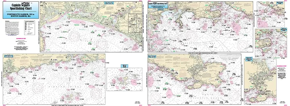
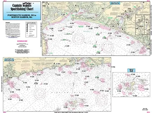
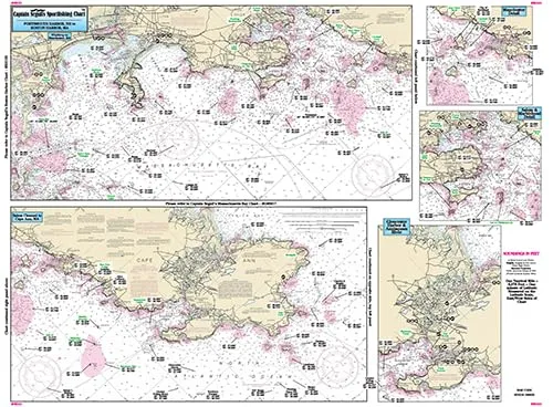
Discover the ultimate fishing companion with the Inshore Portsmouth, NH to Boston Harbor, MA Laminated Nautical Navigation & Fishing Chart by Captain Segull’s Sportfishing Charts. This meticulously crafted chart, designated as Chart # NS101, is designed for both novice and experienced anglers alike. With dimensions of 19.5 inches by 26.5 inches, it makes an ideal addition to your fishing gear, ensuring you have the most accurate navigation available while you embark on your fishing adventures.
This inshore fishing chart offers an in-depth look at the coastal waters just 1-2 miles off the shore, providing essential information about the bays and local fishing areas. From Portsmouth Harbor in New Hampshire to Boston Harbor in Massachusetts, this chart is your guide to some of the best fishing locations along this scenic stretch of coastline.
One of the standout features of this chart is its detailed representation of the Isle of Shoals, highlighting numerous local fishing spots with familiar names. Additionally, it includes GPS coordinates, allowing you to navigate directly to your next big catch with ease.
| Chart Features | Description |
| Laminated | Durable and waterproof for long-lasting use in all fishing conditions. |
| Local Names | Identifies various fishing areas with easy-to-remember names. |
| GPS Coordinates | Provides precise locations for the best fishing spots. |
| NOAA Chart 13274 | Utilizes official NOAA data for the most reliable navigation. |
With its emphasis on user-friendliness, this chart is perfect for anglers who appreciate a clear and straightforward layout. The laminated surface ensures that it can withstand the elements, making it suitable for use in both fresh and saltwater fishing environments. Whether you’re planning a day trip or a weekend getaway, this chart will help you maximize your fishing experience.
In conclusion, the Inshore Portsmouth to Boston Harbor Fishing Chart by Captain Segull’s Sportfishing Charts is an essential tool for any fishing enthusiast. Its combination of detailed local knowledge, durable design, and user-friendly navigation makes it a must-have for those who want to explore the rich fishing opportunities along the New England coast. Don’t head out on the water without it!


Reviews
There are no reviews yet.