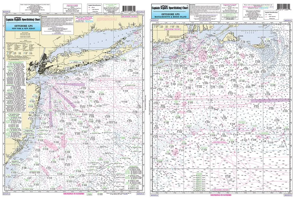
Explore the vast and exciting world of offshore fishing with our expertly crafted Laminated Nautical Navigation & Fishing Chart by Captain Segull’s Nautical Sportfishing Charts. This essential chart (# OFGPS18) is designed specifically for avid fishermen and navigators operating in the waters of Massachusetts (MA), Rhode Island (RI), Connecticut (CT), New York (NY), and New Jersey (NJ). With its impressive size of 19.5 inches by 26.5 inches, this chart provides a comprehensive view of the offshore canyons and prime fishing locations.
The chart features two distinct sides, each packed with valuable information. Side A covers the area from Nantucket Shoals to the tip of Montauk, NY, stretching south to encompass all the canyons, starting with the renowned Veatch Canyon. This region is known for its rich fishing grounds, and this chart highlights the best spots for anglers seeking to reel in a big catch.
Transitioning to Side B, you’ll find detailed coverage extending from Montauk to the Five Fathom Bank off Cape May, NJ. This side concludes in the west with the Lindenkohl Canyon, another hotspot for fishing enthusiasts. Moreover, this chart includes a detailed inset of the Ambrose Channel leading into New York, showcasing hundreds of local fishing locations complete with local names and GPS coordinates. This feature allows you to easily navigate to your favorite fishing spots with precision.
Whether you’re a seasoned angler or just starting your offshore fishing journey, having a reliable and informative chart is crucial. Captain Segull’s Nautical Fishing Chart is laminated for durability, ensuring it withstands the rigors of outdoor use and remains legible in various weather conditions. The high-quality lamination protects the chart from moisture, tearing, and fading, making it a long-lasting companion on your fishing adventures.
The clear and vibrant design of the chart enhances readability, allowing you to quickly identify crucial navigation points and fishing areas. It’s not just a chart; it’s a gateway to discovering new fishing opportunities and exploring the beautiful waters of the Northeast. With this chart in hand, you’ll be well-equipped to navigate the offshore canyons and maximize your fishing potential.
In summary, Captain Segull’s Laminated Nautical Navigation & Fishing Chart is a must-have for anyone serious about offshore fishing in the MA, RI, CT, NY, and NJ regions. Its detailed coverage, local names, and GPS coordinates make it an indispensable tool for successful fishing trips. Invest in this chart today and elevate your fishing experience to new heights!
| Product Features | Details |
| Brand | Captain Segull’s Sportfishing Chart |
| Size | 19.5′ x 26.5′ |
| Material | Laminated for durability |
| Coverage | MA, RI, CT, NY, NJ offshore canyons |
| Features | Local fishing locations, GPS coordinates |


Reviews
There are no reviews yet.