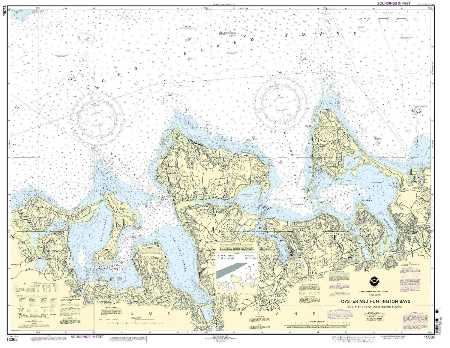
Explore the vast waters of the Long Island Sound with the expertly crafted Nautical Chart 12365, which covers the Oyster and Huntington Bays. This chart is an essential tool for any mariner, providing the most accurate and up-to-date navigation information available. Produced by OceanGrafix, this chart is approved by NOAA (National Oceanic and Atmospheric Administration) and is designed to meet both U.S. and international carriage requirements for commercial vessels.
One of the standout features of this chart is its meticulous printing process. Each chart is printed only after an order has been placed, ensuring that you receive the most current version available. This attention to detail means that all Notice to Mariners corrections are applied, giving you the confidence you need while navigating the waters.
The dimensions of the chart are impressive, measuring 34.11 inches in height and 43.91 inches in width. With a scale of 1:20000, this chart provides a detailed view of the Eastern U.S. and Canada region, making it an invaluable resource for both recreational and commercial mariners alike.
| Chart Name: Long Island Sound Nautical Chart 12365 | Brand: NOAA |
| Features: NOAA-approved, up-to-date information, Notice to Mariners corrections applied | Size: 34.11′ H x 43.91′ W |
| Scale: 1:20000 | Applications: Commercial and recreational use |
This chart not only meets the rigorous standards set by the U.S. Coast Guard but also serves as a reliable guide for safe navigation through the complex waterways of the Long Island Sound. Whether you are a seasoned sailor or new to maritime navigation, this chart will enhance your understanding of the region’s geography and help ensure a safe journey.
In conclusion, the Long Island Sound Nautical Chart 12365 is more than just a map; it is a comprehensive tool that combines accuracy, reliability, and ease of use. Equip yourself with this essential nautical chart and navigate with confidence!


Reviews
There are no reviews yet.