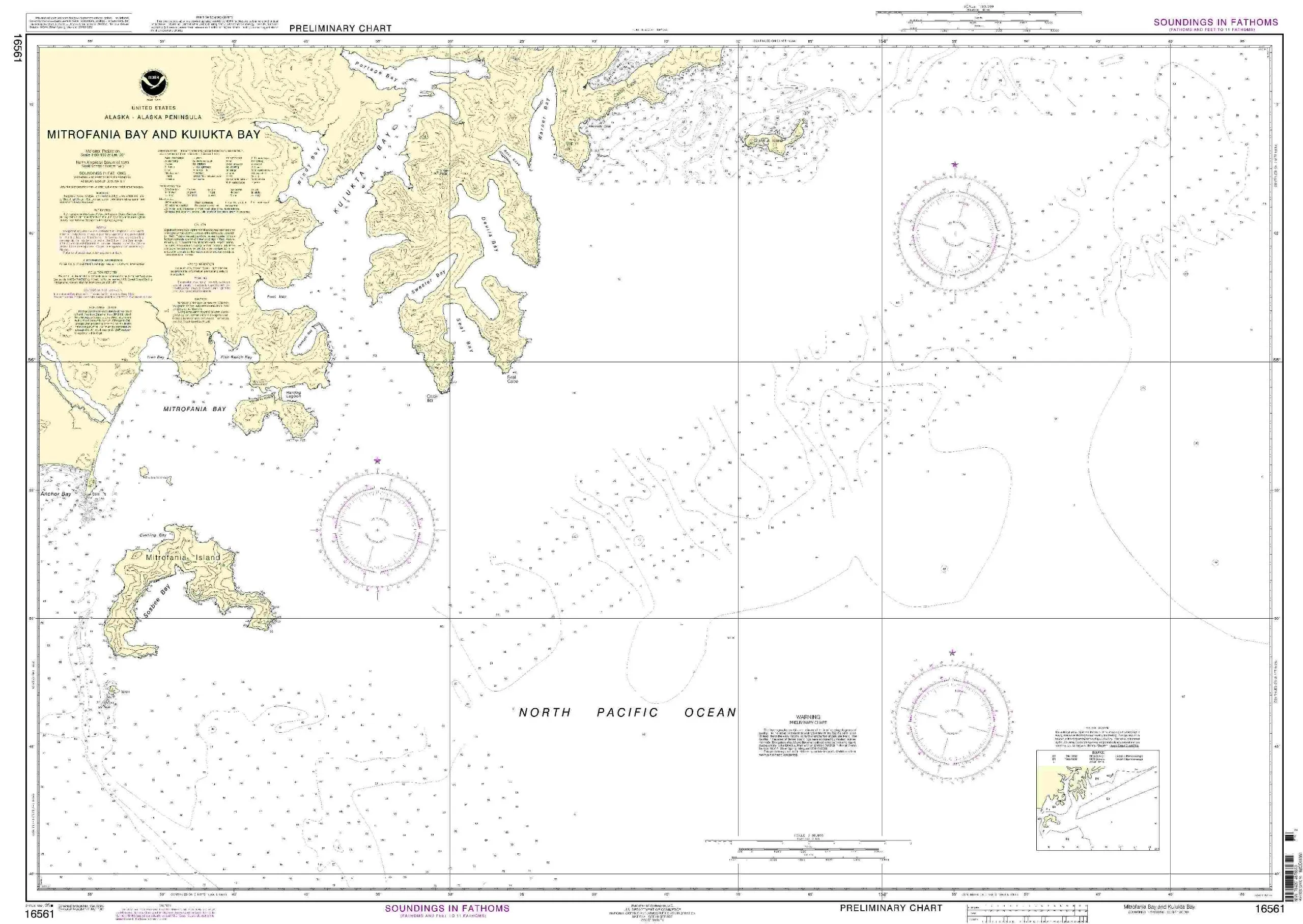
Welcome to the detailed presentation of the Mitrofania Bay and Kuiukta Bay NOAA Nautical Chart. This chart is designed specifically for both commercial and recreational mariners who demand accuracy and reliability in their navigation tools. By utilizing the most up-to-date information, this chart ensures that you have the best resources at your disposal while navigating these waters.
The Mitrofania Bay and Kuiukta Bay chart is printed on demand, meaning that every copy produced incorporates the latest Notice to Mariners (NTM) updates at the time of printing. This feature is crucial for ensuring that mariners have access to the most current navigational information available. The National Oceanic and Atmospheric Administration (NOAA) has collaborated with OceanGrafix to provide these high-quality nautical charts, ensuring that they meet rigorous standards.
| Features | Details |
| Approval | NOAA and U.S. Coast Guard approved |
| Printing Method | Printed on demand |
| NTM Updates | Latest updates applied at printing |
| Carriage Requirements | Meets SOLAS Chapter V Regulation 19.2.1.130 |
This chart not only provides the latest navigational data but also adheres to the guidelines set forth by the International Maritime Organization (IMO) and the relevant SOLAS regulations. Specifically, it meets the definition of a nautical chart as outlined in SOLAS Chapter V Regulation 2.2, ensuring that it is suitable for both commercial vessels and recreational boaters alike. Thus, you can trust that this chart fulfills all international carriage requirements established for safe navigation.
By choosing the Mitrofania Bay and Kuiukta Bay NOAA Nautical Chart, you are investing in a product that prioritizes safety and accuracy. The U.S. Coast Guard approval further enhances its credibility, providing peace of mind as you navigate through these waters. Whether you are planning a leisurely trip or a commercial venture, having the most reliable chart is essential for ensuring a smooth journey.
In conclusion, the Mitrofania Bay and Kuiukta Bay NOAA Nautical Chart offers mariners an essential navigation tool backed by the authority of NOAA and the U.S. Coast Guard. With its up-to-date information, compliance with international regulations, and printed on demand feature, this chart stands out as a premium choice for maritime navigation. Equip yourself with the best to navigate confidently.


Reviews
There are no reviews yet.