
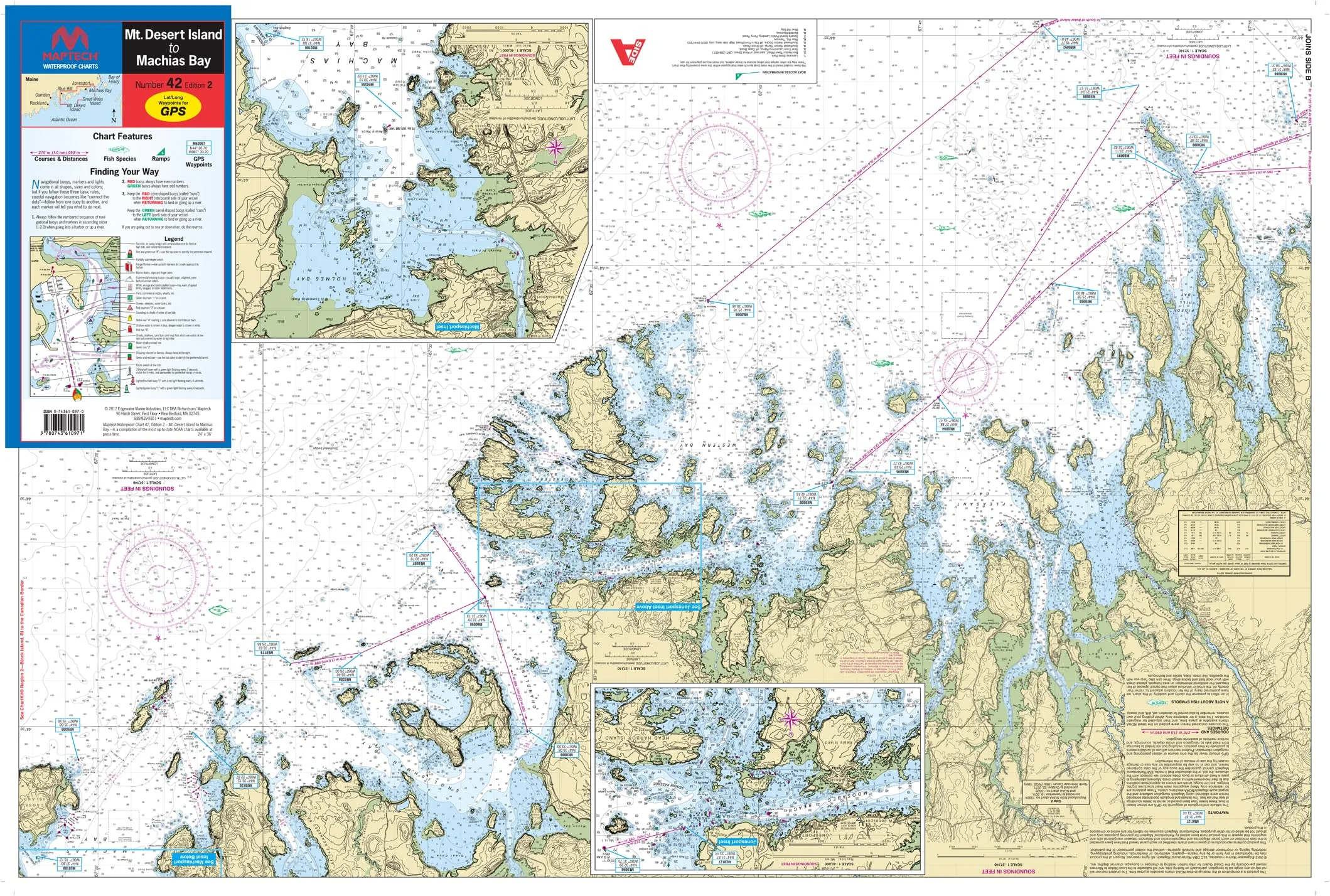
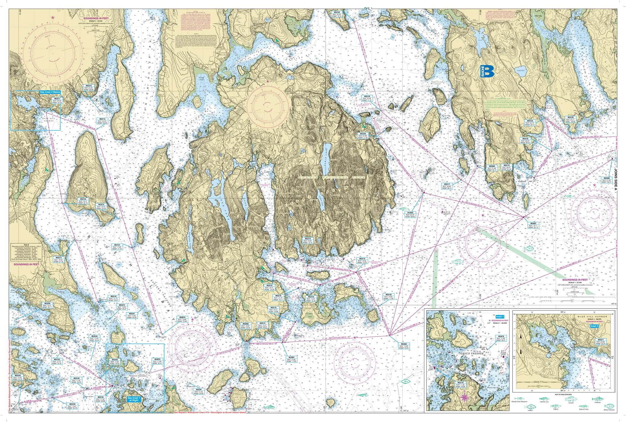
Introducing the MAPTECH® Waterproof Chart #42, 2nd Edition, featuring detailed coverage from Mt. Desert Island to Machias Bay. This chart is essential for anyone looking to navigate the stunning waterways of the Mt. Desert Island Region in Maine. With dimensions of 24′ x 36′, and a convenient folded size of 12” x 6”, it is designed for easy handling and storage.
The chart is printed on waterproof material, ensuring durability and longevity even in wet conditions, making it ideal for marine environments. It offers critical information for both seasoned navigators and those new to the area. The scale of 1:57,140 allows for an accurate representation of the region, giving users confidence while at sea.
Included in this comprehensive chart are various features that enhance its usability:
| Feature | Details |
| Waypoints for Major Buoys | Clearly marked waypoints to assist in safe navigation. |
| Courses and Distances | Essential information for plotting routes effectively. |
| Ramp Locations | Find suitable launch points with ease. |
| Fishing Spots | Identified locations with information on fish species. |
| Insets | Detailed insets for Blue Hill Harbor, Casco Passage, Jonesport, and Machiasport. |
This chart is not just a tool; it is an invitation to explore the beautiful coastal regions of Maine. Whether you are fishing, sailing, or simply enjoying the scenic views, the MAPTECH Waterproof Chart #42 enriches your experience with reliable navigational data.
Don’t miss out on the opportunity to enhance your maritime adventures. Equip yourself with the best navigational tools available and make your journey safe and enjoyable. The Mt. Desert Island to Machias Bay Waterproof Chart is your gateway to exploring one of Maine’s most picturesque regions.


Reviews
There are no reviews yet.