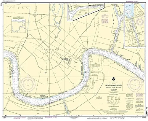
Welcome to our detailed presentation of the New Orleans Harbor Nautical Chart, specifically covering the route from Chalmette Slip to Southport. This chart is not just any ordinary nautical chart; it is NOAA-approved and represents the most accurate information available for mariners navigating these waters.
OceanGrafix, a trusted partner of the National Oceanic and Atmospheric Administration (NOAA), brings you the latest in nautical chart technology. This chart is printed on demand, ensuring that you receive the most current information at the time of your order. With all Notice to Mariners (NTM) corrections applied, you can be confident that you have the most reliable navigation tool for your adventures on the water.
| Feature | Description |
| NOAA Approved | All charts are verified and approved by the National Oceanic and Atmospheric Administration. |
| Printed on Demand | You receive a fresh print with the latest updates, ensuring up-to-date navigation information. |
| Notice to Mariners Corrections | Each chart is printed with all current NTM corrections applied, enhancing its accuracy. |
| Compliance | Meets U.S. and international carriage requirements for commercial vessels as per SOLAS regulations. |
| U.S. Coast Guard Approved | This chart meets all necessary standards set forth by the U.S. Coast Guard. |
This nautical chart is designed for both commercial and recreational mariners. It complies with the regulations set forth in SOLAS Chapter V Regulation 19.2.1.73, which governs the carriage of nautical charts for vessels. The chart meets the definition outlined in SOLAS Chapter V Regulation 2.2, ensuring that it is a legitimate and necessary tool for navigation.
Whether you are a seasoned mariner or a recreational boater, having accurate nautical charts is essential for safe navigation. This New Orleans Harbor chart provides essential information about the waterways, depths, and potential hazards that mariners may encounter. With this chart in hand, you can navigate confidently, knowing that you have the latest information at your disposal.
In conclusion, the New Orleans Harbor Nautical Chart from Chalmette Slip to Southport is an indispensable tool for anyone navigating these waters. With its NOAA approval, on-demand printing, and application of the latest NTM corrections, you can trust that you are making a wise choice for your nautical navigation needs. Don’t leave your safety to chance—equip yourself with the best nautical chart available today.


Reviews
There are no reviews yet.