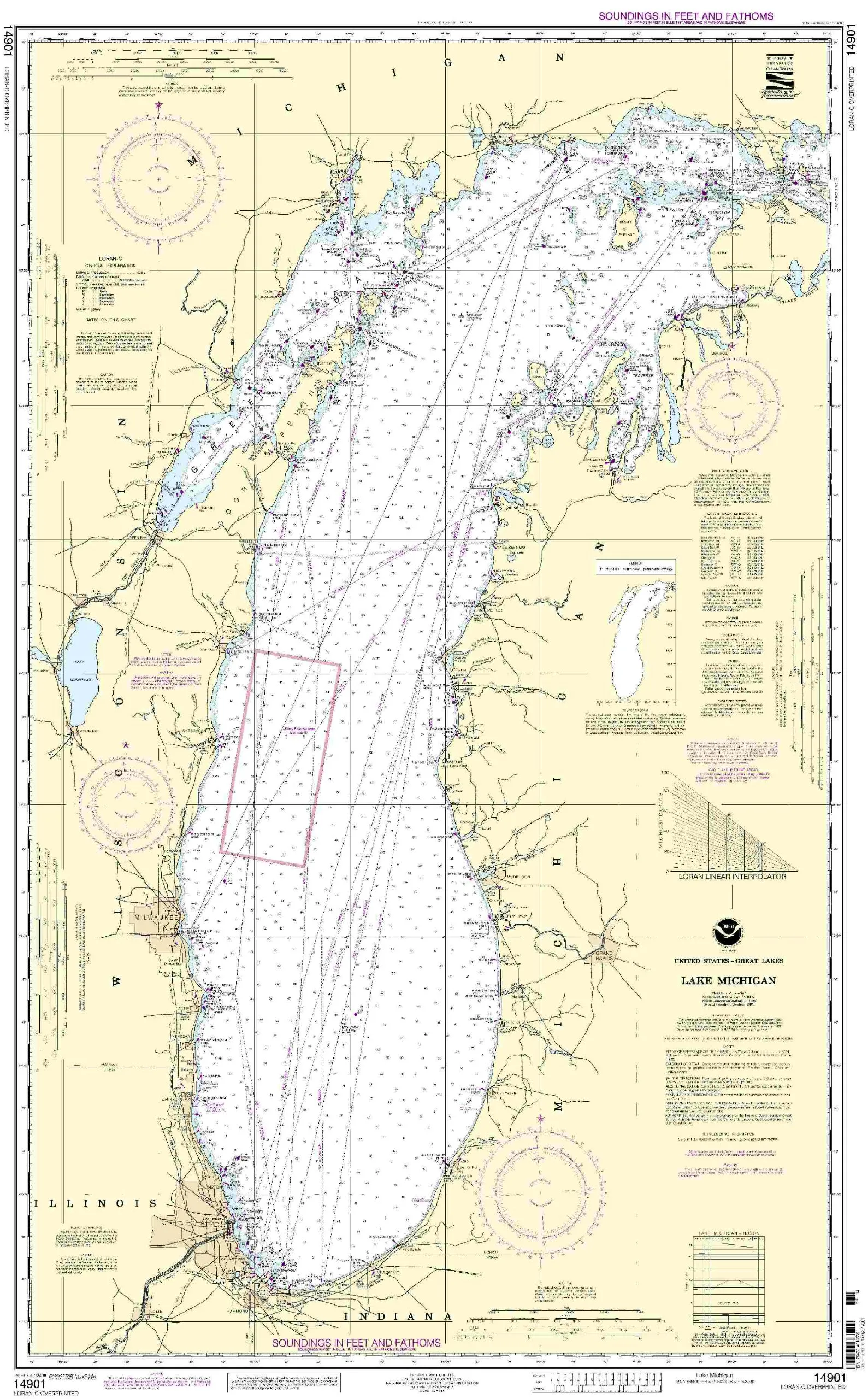
Discover the essence of safe navigation with the NOAA 14901 Lake Michigan nautical chart, an essential tool for both commercial and recreational mariners. This chart is not just a piece of paper; it represents the culmination of years of research and data collection by the National Oceanic and Atmospheric Administration (NOAA). As the world of maritime navigation evolves, so do the methodologies employed to ensure that sailors have access to the most accurate and up-to-date information.
With OceanGrafix at the helm, this chart is printed on demand, ensuring that every mariner receives the latest Notice to Mariners (NTM) updates right at the time of purchase. This unique feature guarantees that your navigation tools are as current as possible, offering peace of mind whether you’re sailing through the bustling waters of Lake Michigan or venturing into more serene locales.
Table 1: Key Features of NOAA 14901 Lake Michigan Nautical Chart
| Feature | Description |
|---|---|
| Approval | NOAA-approved for accuracy and reliability |
| Printing Method | Printed on demand with real-time NTM updates |
| Compliance | Meets U.S. and international SOLAS requirements for commercial vessels |
| Use Cases | Suitable for both commercial and recreational navigation |
| Certification | U.S. Coast Guard approved |
Understanding the importance of nautical charts is crucial for any mariner. They serve as a map of the waterways, providing vital information such as depths, hazards, and navigational aids. The NOAA 14901 Lake Michigan chart adheres to the standards set forth in SOLAS Chapter V Regulation 2.2, which not only defines what constitutes a nautical chart but also outlines the requirements for its use in maritime operations. This ensures that every mariner can rely on the information provided to make informed decisions while navigating the waters.
Furthermore, the chart meets the carriage requirements as defined in SOLAS Chapter V Regulation 19.2.1.4, which mandates that commercial vessels carry up-to-date nautical charts for safe navigation. This is particularly important in a region like Lake Michigan, where water conditions can change rapidly, and accurate information is paramount for safe passage.
In conclusion, the NOAA 14901 Lake Michigan nautical chart is more than just a navigational aid; it is a commitment to safety and accuracy in maritime navigation. Whether you are a seasoned sailor or a novice exploring the waters for the first time, having this chart on board will enhance your confidence and preparedness. Invest in your maritime journey with the NOAA 14901 Lake Michigan chart and sail with peace of mind knowing you have the most reliable navigation tool at your disposal.


Reviews
There are no reviews yet.