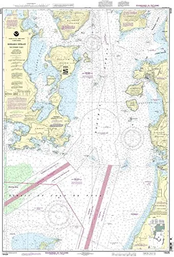
Introducing the NOAA 18429-Rosario Strait Nautical Chart – Southern Part, a vital resource for mariners navigating the intricate waterways of the Rosario Strait. This chart is not only NOAA-approved but also printed on demand, ensuring that you receive the most up-to-date version available. With all Notice to Mariners corrections applied at the time of printing, this chart guarantees accuracy and reliability, essential for safe navigation.
The National Oceanic and Atmospheric Administration (NOAA) has collaborated with OceanGrafix to produce charts that are meticulously updated for both commercial and recreational use. Mariners can trust that the NOAA 18429-Rosario Strait chart adheres to the strict standards set forth in the SOLAS (Safety of Life at Sea) Chapter V regulation 2.2, which defines the necessary specifications for nautical charts.
Essentially, this chart meets the carriage requirements laid out in SOLAS Chapter V Regulation 19.2.1.4, making it an indispensable tool for anyone operating in these waters. Whether you are a seasoned sailor or a newcomer to navigation, having the latest information is crucial for planning your journeys and ensuring safety at sea.
| Feature | Details |
|---|---|
| Brand | NOAA |
| Chart Type | Nautical Chart |
| Size | Standard Nautical Chart Size |
| Updates | All Notice to Mariners corrections applied |
| Approval | U.S. Coast Guard Approved |
In summary, the NOAA 18429-Rosario Strait Nautical Chart – Southern Part is a must-have for anyone serious about maritime navigation. With its up-to-date information, compliance with international regulations, and commitment to safety, this chart stands out as a premier choice for both commercial and recreational mariners. Equip yourself with the right tools, and navigate the waters with confidence!


Reviews
There are no reviews yet.