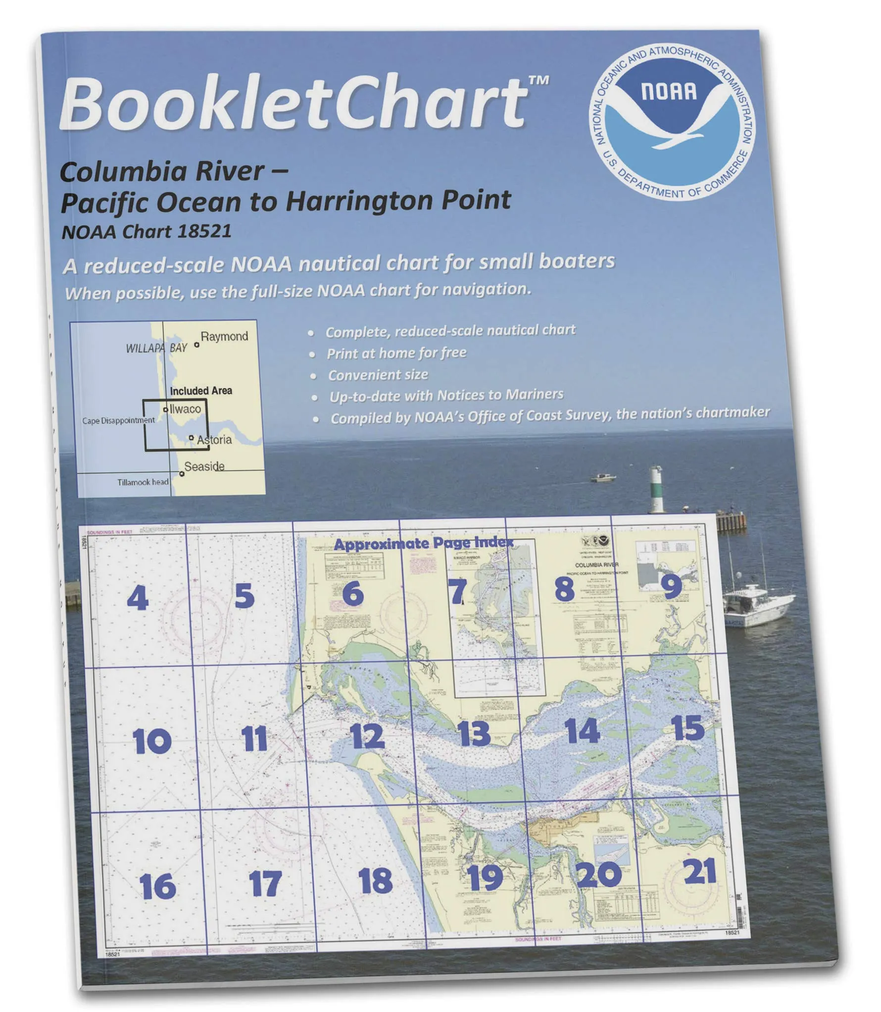
The NOAA BookletChart 18521 offers an essential tool for recreational boaters navigating the Columbia River from the Pacific Ocean to Harrington Point, including Ilwaco Harbor. This booklet-style chart, measuring 8.5 inches by 11 inches, is designed specifically for use aboard small craft. It provides a convenient alternative to larger, full-scale nautical charts that can be cumbersome to manage while at sea.
What sets the BookletChart apart is its exact replication of the full-scale NOAA Chart 18521, printed in a more manageable size without sacrificing any important navigational information. This allows boaters to easily locate themselves on the water while enjoying a more compact navigation aid. The chart features reduced bar scales that maintain accuracy, ensuring that distances measured on the booklet remain reliable.
When you order your BookletChart, it will be printed on demand, incorporating all updates available at the time of printing. Each chart is printed on high-quality, durable paper and is bound with a sturdy saddle-stitched method, ensuring longevity and ease of use. The page count varies depending on the chart, but the compact size makes it a perfect fit for onboard storage.
It is important to note that while the BookletChart is a handy navigation tool for recreational boaters, it does not fulfill the chart carriage requirements for regulated commercial vessels as outlined in Titles 33 and 44 of the Code of Federal Regulations. However, the chart has been meticulously updated to reflect corrections published by the U.S. Coast Guard Local Notice to Mariners, the National Geospatial Intelligence Agency Weekly Notice to Mariners, and, when applicable, the Canadian Coast Guard Notice to Mariners.
Since their inception as an experimental product by the Coast Survey, BookletCharts have gained popularity among navigators and have moved into official production due to their success. Nearly 1,000 updated BookletCharts are now available, covering approximately 95,000 miles of U.S. coastline and the Great Lakes.
These smaller-scale charts still contain most of the vital information found on full-scale nautical charts, making them a valuable resource for both new and experienced boaters. NOAA’s nautical charts play a crucial role in ensuring safety at sea, as they help protect lives and property. Many boaters, however, rely solely on local knowledge or their memories, which can be a risky practice. The ocean is constantly changing; seafloors shift, shorelines erode, and new navigation hazards are discovered regularly.
With the BookletChart, boaters are well-informed about these developments, which significantly contributes to safer voyages, whether navigating around the bay or along the coast. By utilizing the NOAA BookletChart 18521, you are investing in a reliable and user-friendly navigation aid that enhances your boating experience and promotes safe practices on the water.


Reviews
There are no reviews yet.