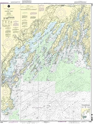
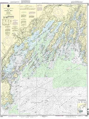
The Casco Bay Nautical Chart, meticulously produced by OceanGrafix, represents a significant advancement in nautical navigation. This chart is designed specifically for mariners who require the most current information for safe navigation on the waters of the Eastern U.S. and Canada. It is printed only after an order has been placed, ensuring that you receive the latest and most accurate data available.
One of the key features of this chart is its adherence to the highest standards set by the National Oceanic and Atmospheric Administration (NOAA). It meets both U.S. and international carriage requirements, making it suitable for commercial vessels. Additionally, the chart has been approved by the U.S. Coast Guard, which adds an extra layer of reliability for those navigating these important waterways.
With a scale of 1:40000, the Casco Bay Nautical Chart provides detailed information that is vital for both recreational and commercial mariners. The dimensions of the chart are 46.4 inches in height and 35.97 inches in width, allowing for easy handling and visibility on board.
OceanGrafix ensures that all Notice to Mariners corrections are applied to the chart, which is critical for maintaining navigational safety. This means that you can trust the information on this chart to be up-to-date, reflecting the latest changes in the marine environment.
| Feature | Detail |
| Brand | NOAA |
| Scale | 1:40000 |
| Dimensions | 46.4” H x 35.97” W |
| Approval | U.S. Coast Guard Approved |
| Corrections | All Notice to Mariners corrections applied |
| Usage | Meets U.S. and international carriage requirements |
In summary, the Casco Bay Nautical Chart is an essential tool for any mariner navigating the Eastern U.S. and Canada. Its up-to-date information, quality, and compliance with safety standards make it an invaluable addition to your navigational resources.


Reviews
There are no reviews yet.