


Introducing the NOAA Chart 11376 for Mobile Bay
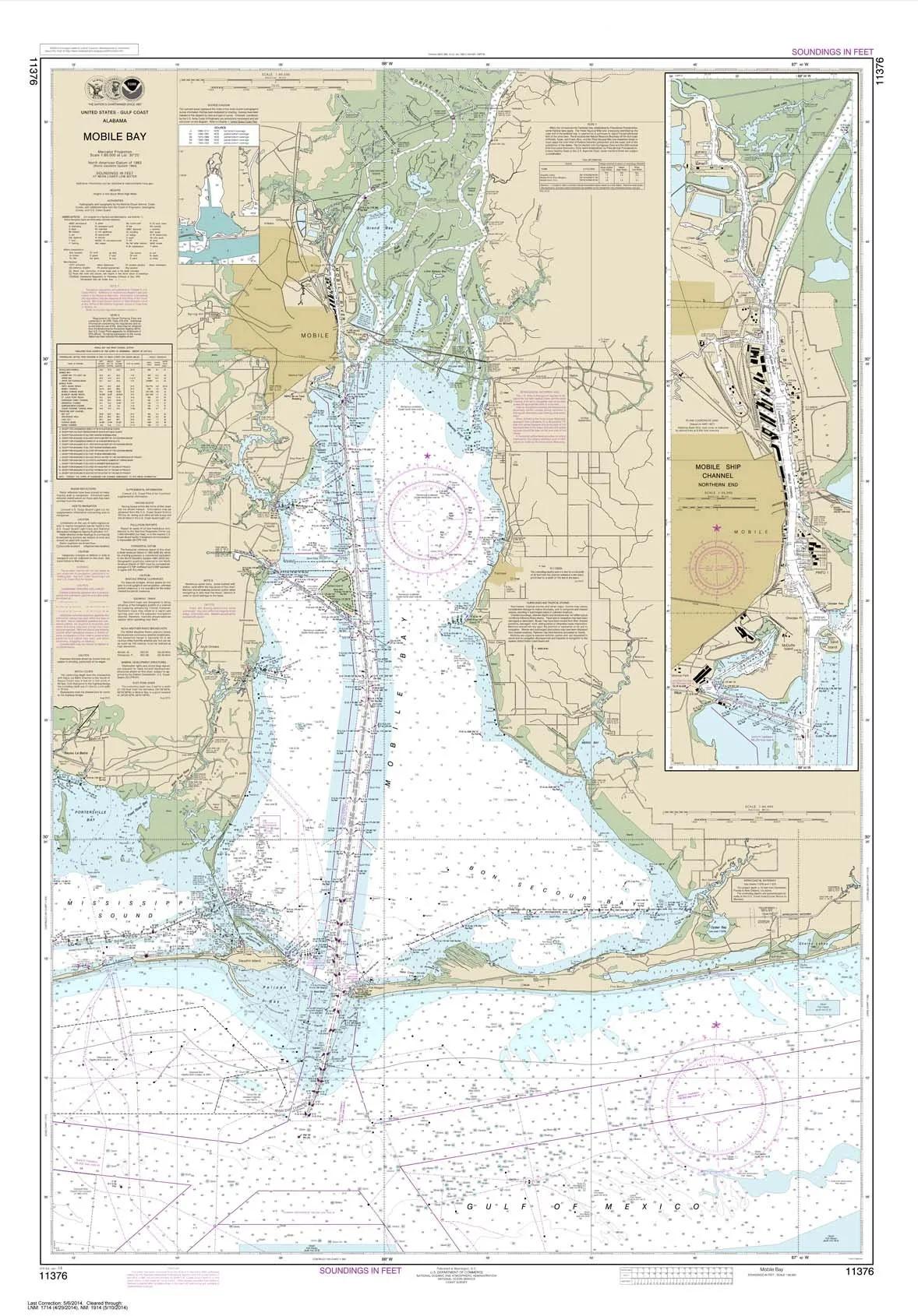
The NOAA Chart 11376 is a meticulously crafted nautical chart depicting the Mobile Ship Channel’s northern end. With dimensions of 34.9 by 50.1 inches, this chart is printed on high-quality, water-resistant paper, ensuring durability and longevity for all your navigation needs.
This chart is not just a regular map; it is a certified product by NOAA (National Oceanic and Atmospheric Administration) and the U.S. Coast Guard, making it an essential tool for commercial vessels. The chart is prepared using the most recent data from NOAA, ensuring that you have access to the latest and most accurate maritime information.
Quality and Presentation
Each chart is printed on demand, guaranteeing that you receive a fresh product that has never been previously handled. The chart arrives rolled, not folded, which preserves its quality and makes it easy to display. This attention to detail ensures that the chart is ready for you to use right out of the packaging.
| Key Features | Details |
| Size | 34.9 X 50.1 inches |
| Material | High-quality, water-resistant paper |
| Certification | NOAA and U.S. Coast Guard certified |
| Seller | Exclusive to Ruby & Rudy’s Books |
Why Choose NOAA Chart 11376?
When it comes to nautical charts, quality matters. The NOAA Chart 11376 has been printed using proprietary methods that ensure it meets strict standards for scale and print quality. Only NOAA-certified chart agents can offer charts that carry the NOAA logo, and Ruby & Rudy’s Books is proud to provide this service through Paradise Cay Publications.
The rigorous vetting process that NOAA requires for its certified agents means that you can trust the accuracy and reliability of the chart. This includes testing the charts for their ability to withstand erasing, which is essential for navigation. The water-resistant paper used for this chart meets NOAA’s standards, making it suitable for use in various maritime conditions.
Explore More
In addition to the NOAA Chart 11376, Paradise Cay Publications offers a complete line of nautical charts that cater to different preferences and needs. Whether you need PAPER CHARTS, WATERPROOF CHARTS, SMALL FORMAT CHARTS, BOOKLET CHARTS, or BOOK CHARTS, you can find the right chart that fits your requirements.
Ensure your navigation is safe and precise with the NOAA Chart 11376 for Mobile Bay. It’s not just a chart; it’s a reliable companion for your maritime adventures!


Reviews
There are no reviews yet.