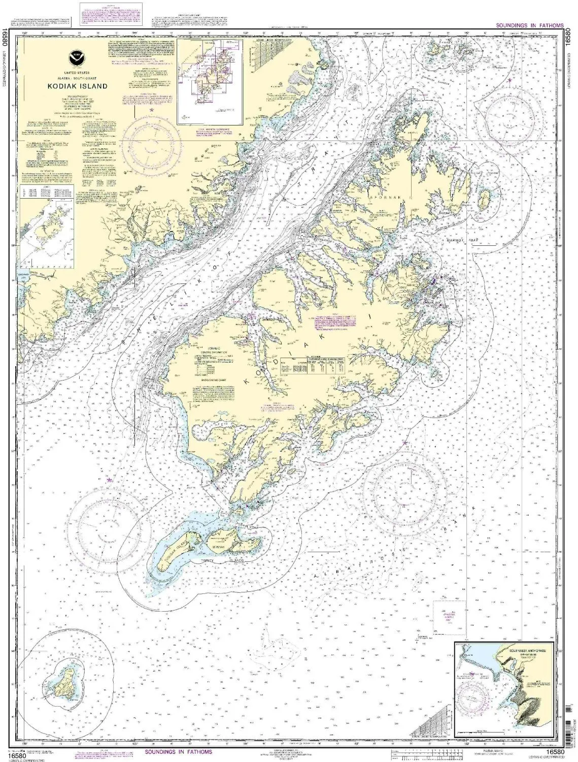
Introducing the NOAA-approved nautical chart for Kodiak Island, designated as 16580. This chart represents the Southwest Anchorage and Chirikof Island areas, providing mariners with essential information for navigation in the Pacific Northwest and Alaska region. It is designed to meet both U.S. and international carriage requirements, making it an indispensable tool for commercial vessels.
One of the standout features of this nautical chart is its scale of 1:350000, which ensures that users receive an accurate representation of the waterways. With dimensions measuring 46.73 inches in height and 35.21 inches in width, the chart is large enough to provide detailed insights into the navigational routes and landmarks of the region.
OceanGrafix, the provider of this nautical chart, ensures that each chart is printed only after an order is received. This commitment guarantees that mariners have access to the most up-to-date information available. All Notice to Mariners corrections are meticulously applied, ensuring that navigators can rely on the chart for accurate and current data.
Furthermore, the NOAA Kodiak Island nautical chart meets the approval of the U.S. Coast Guard, ensuring that it adheres to the highest standards of safety and compliance. This approval is crucial for commercial vessels operating in these waters, as it provides peace of mind for captains and crew members who depend on accurate navigational aids.
To enhance visual appeal and user experience, we have organized the key features of the NOAA Kodiak Island nautical chart in the table below:
| Feature | Description |
| Scale | 1:350000 |
| Dimensions | 46.73” H x 35.21” W |
| Approval | U.S. Coast Guard Approved |
| Updates | All Notice to Mariners corrections applied |
| Provider | OceanGrafix |
This chart is not just a map; it is a vital resource for ensuring safe and efficient navigation through the waters surrounding Kodiak Island and beyond. Mariners can confidently rely on this NOAA chart for their journeys, knowing that it reflects the latest navigational information and complies with all necessary regulations.
In conclusion, the NOAA Kodiak Island Nautical Chart is an essential tool for anyone navigating the Pacific Northwest and Alaska regions. With its detailed scale, large dimensions, and up-to-date information, it stands as a testament to safety and precision in maritime navigation.


Reviews
There are no reviews yet.