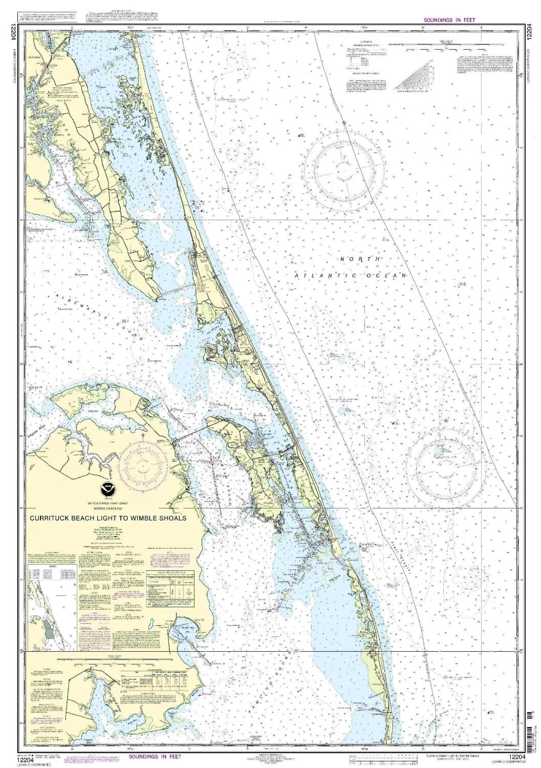
The NOAA Nautical Chart 12204, covering the route from Currituck Beach Light to Wimble Shoals, is an essential resource for both commercial and recreational mariners. Produced by OceanGrafix, this chart is printed on demand, ensuring that you receive the most up-to-date information available. Each chart incorporates all Notice to Mariners (NTM) corrections at the time of printing, guaranteeing accuracy and reliability.
As mandated by the National Oceanic and Atmospheric Administration (NOAA), these nautical charts comply with SOLAS Chapter V Regulation 2.2, which defines what constitutes a nautical chart. Furthermore, they fulfill the carriage requirements outlined in SOLAS Chapter V Regulation 19.2.1.4 for commercial vessels, thereby ensuring that mariners are equipped with the necessary navigational aids while at sea.
| Feature | Detail |
| Chart Type | NOAA Standard Nautical Chart |
| Printing Method | On-Demand |
| Updates | All NTM corrections applied |
| Compliance | Meets U.S. and international carriage requirements |
| Approval | U.S. Coast Guard Approved |
In today’s fast-paced world, having access to accurate and timely nautical information is crucial for safe navigation. The NOAA Nautical Chart 12204 plays an integral role in ensuring that mariners can make informed decisions while navigating coastal waters. With OceanGrafix’s commitment to quality and accuracy, you can trust that this chart will serve you well on your maritime adventures.
Whether you’re a seasoned professional or a casual boater, this chart provides a detailed representation of the waters between Currituck Beach Light and Wimble Shoals, highlighting important features such as navigational aids and hazards. It is designed for ease of use, allowing you to quickly reference critical information while on the water.
Investing in the NOAA Nautical Chart 12204 is not just about having a piece of paper; it’s about ensuring your safety and the safety of others while at sea. Always rely on quality charts that meet the highest standards of navigation. Choose NOAA and OceanGrafix for your nautical chart needs.
In conclusion, the NOAA Nautical Chart 12204 from Currituck Beach Light to Wimble Shoals represents the pinnacle of nautical charting. By staying current with the latest updates and adhering to strict regulatory standards, this chart is an invaluable tool for anyone navigating these waters.


Reviews
There are no reviews yet.