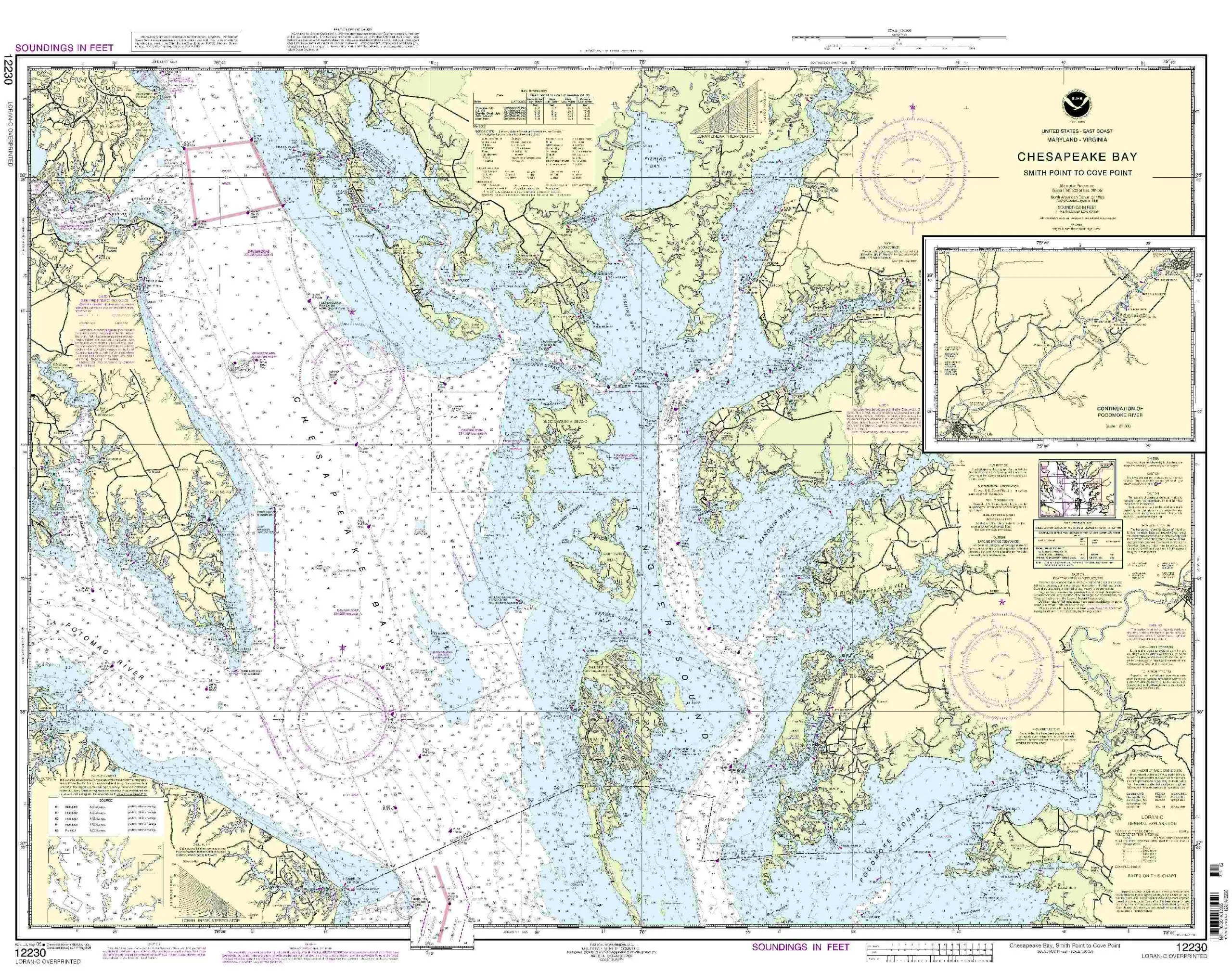
Introducing the NOAA Nautical Chart 12230, covering the area from Smith Point to Cove Point. This chart is an essential tool for mariners navigating the Eastern U.S. and Canada region. With a scale of 1:80000, it provides detailed and accurate information crucial for safe navigation.
OceanGrafix is dedicated to providing the most up-to-date nautical charts available. Unlike traditional charts that may become outdated, our charts are printed only after an order has been received. This ensures that you receive the latest information available, which is vital for safe maritime operations.
Each chart includes all relevant Notice to Mariners corrections, so you can trust that the information is current and reliable. This commitment to accuracy means that you can focus on your journey, knowing that you have the best navigational tools at your disposal.
Our NOAA Nautical Chart 12230 meets both U.S. and international carriage requirements for commercial vessels. It is also approved by the U.S. Coast Guard, providing an additional layer of assurance that you are using a compliant and reliable chart for your maritime activities.
Specifications of the NOAA Nautical Chart 12230 are as follows:
| Chart Name: | 12230-Smith Point to Cove Point |
| Scale: | 1:80000 |
| Size: | 32.76” H x 42.26” W |
| Region: | Eastern U.S./Canada |
| Approval: | U.S. Coast Guard Approved |
| Corrections: | All Notice to Mariners applied |
This chart not only provides necessary details for navigation but also enhances your overall maritime experience. Whether you’re a seasoned mariner or just starting out, having the right chart can make all the difference in ensuring a safe and enjoyable journey.
In summary, the NOAA Nautical Chart 12230 from OceanGrafix is an invaluable resource for anyone navigating the waters between Smith Point and Cove Point. With its meticulous attention to detail, up-to-date information, and compliance with maritime regulations, you can navigate confidently and efficiently.


Reviews
There are no reviews yet.