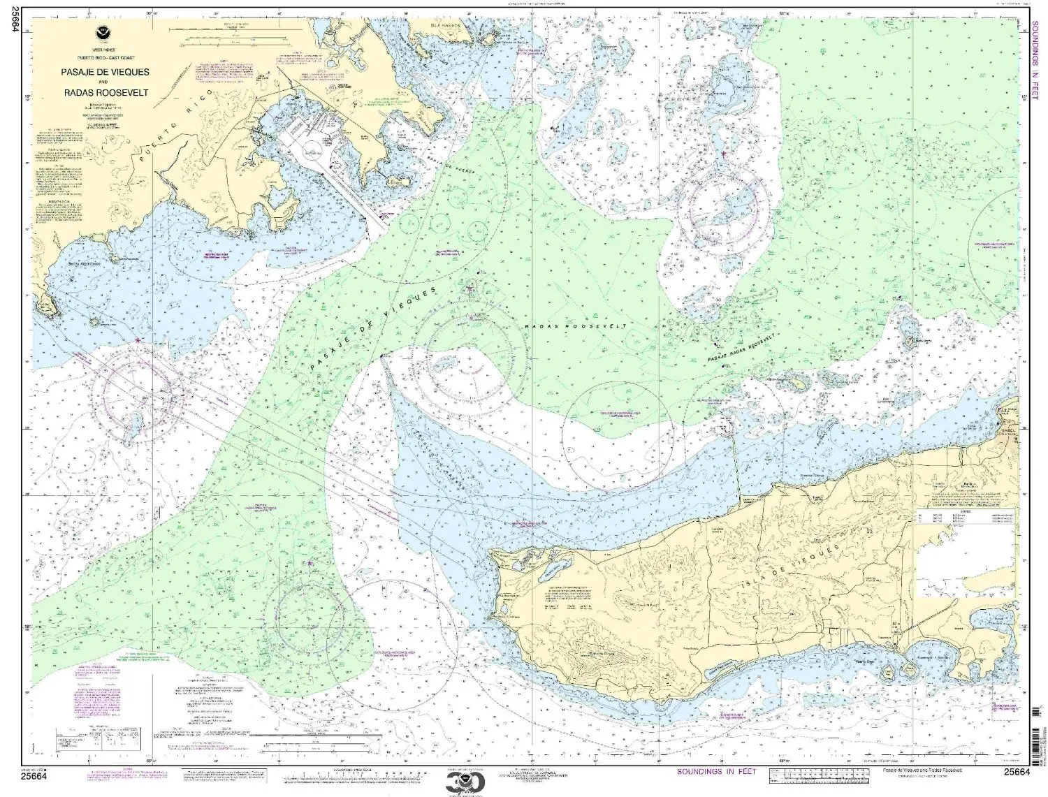
Introducing the 25664 nautical chart of Pasaje de Vieques and Radas Roosevelt, brought to you by NOAA. This chart is specifically designed for mariners seeking the most accurate and reliable navigational tools. With a scale of 1:25000, it provides detailed information crucial for safe navigation in the Caribbean region.
OceanGrafix, a trusted provider of nautical charts, ensures that all charts are printed only after an order is received. This guarantees that you receive the most up-to-date information available. Each chart incorporates all necessary corrections from the Notice to Mariners, which means you can navigate confidently without worrying about outdated data.
Not only does this chart meet U.S. and international carriage requirements for commercial vessels, but it is also U.S. Coast Guard approved. This approval indicates that the chart has been thoroughly evaluated and is recognized as a reliable source for maritime navigation.
| Feature | Details |
| Brand | NOAA |
| Scale | 1:25000 |
| Size | 36.15′ H x 46.13′ W |
| Approval | U.S. Coast Guard Approved |
The dimensions of the chart, 36.15 inches in height and 46.13 inches in width, make it a perfect fit for various navigation needs. Whether you are a seasoned sailor or a recreational boater, this chart will enhance your navigational accuracy and safety.
In conclusion, the NOAA nautical chart 25664 is an invaluable resource for anyone navigating the waters around Pasaje de Vieques and Radas Roosevelt. With its current updates, comprehensive details, and compliance with maritime regulations, it is essential for effective navigation in this stunning Caribbean region. Invest in your safety and peace of mind on the water with this top-of-the-line nautical chart.


Reviews
There are no reviews yet.