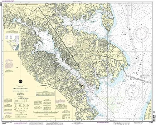
Welcome to the detailed presentation of the NOAA nautical chart for the Severn and Magothy Rivers. This chart is essential for mariners navigating the beautiful waterways of the Eastern U.S. and Canada.
OceanGrafix is proud to provide the most accurate and up-to-date nautical charts, ensuring you have the best resources at your fingertips. Each chart is printed only after an order has been received, which means that you are guaranteed the latest information. Additionally, all Notice to Mariners corrections are meticulously applied, ensuring that your navigation is both safe and reliable.
This particular chart features a scale of 1:25000, which allows for detailed navigation and understanding of the waterways. The dimensions of the chart are 32.95 inches in height and 40.61 inches in width, making it a substantial and informative tool for any mariner.
| Chart Features | Description |
| Scale | 1:25000 |
| Region | Eastern U.S./Canada |
| Dimensions | 32.95′ H x 40.61′ W |
| Approval | NOAA-approved |
| Corrections | All Notice to Mariners corrections applied |
| Compliance | Meets U.S. and international carriage requirements |
| Coast Guard Approval | U.S. Coast Guard approved |
Mariners are urged to utilize this chart as it meets the stringent requirements for commercial vessels, making it an essential addition to any navigation toolkit. Whether you’re planning a leisure trip or operating a commercial vessel, having the right nautical chart is crucial.
In conclusion, the NOAA nautical chart for the Severn and Magothy Rivers is not just a chart; it’s a commitment to safe and informed navigation. Make this chart a part of your maritime journey, and ensure you are always a step ahead when navigating these beautiful waters.



Reviews
There are no reviews yet.