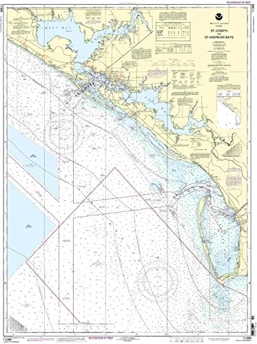
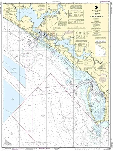
Welcome to the detailed presentation of the NOAA Nautical Charts for the St Joseph & St Andrew Bays. Our charts are specifically designed for mariners who value precision and accuracy while navigating the waters of the Eastern U.S. and Canada. These charts stand out due to their unique features and compliance with both U.S. and international navigation standards.
At OceanGrafix, we pride ourselves on providing the most current and reliable nautical charts available. Each chart is printed only after an order has been received, which ensures that you receive the most up-to-date information. This process guarantees that all Notice to Mariners corrections are applied, allowing you to navigate with confidence.
The NOAA Nautical Chart for St Joseph & St Andrew Bays features a 1:80000 scale, making it ideal for mariners who require detailed representations of these significant waterways. The dimensions of the chart are 45.21 inches in height and 33.85 inches in width, providing ample information on a scale that is easy to read and use.
| Chart Title | St Joseph & St Andrew Bays |
| Brand | NOAA |
| Scale | 1:80000 |
| Region | Eastern U.S./Canada |
| Dimensions | 45.21” H x 33.85” W |
Moreover, our charts meet all U.S. Coast Guard-approved standards and are compliant with international carriage requirements for commercial vessels. This makes them an essential resource for both recreational and commercial mariners alike.
In summary, if you are looking for a reliable and accurate nautical chart, the NOAA Nautical Charts for St Joseph & St Andrew Bays is your best choice. With the assurance of up-to-date information and compliance with navigation regulations, you can navigate with peace of mind.


Reviews
There are no reviews yet.