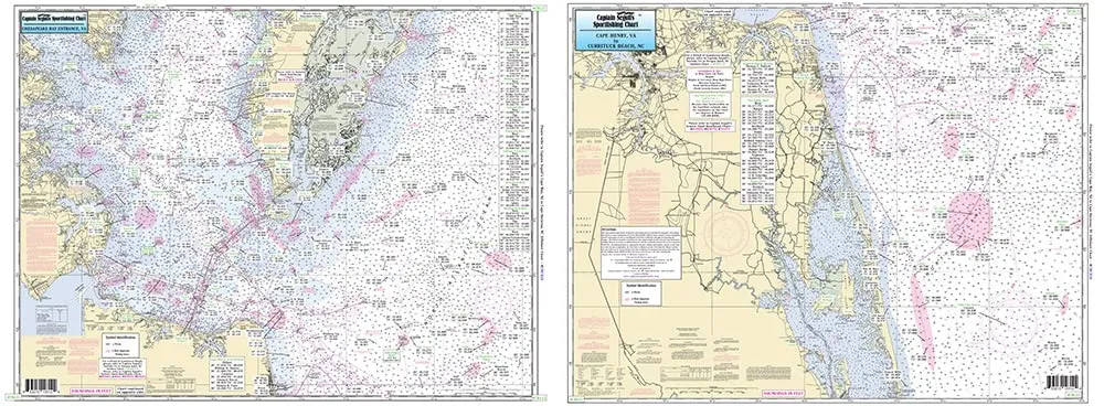
Discover the beauty and excitement of fishing in the Off Coastal Lower Chesapeake Bay with our high-quality laminated nautical navigation and fishing chart, designed by Captain Segull’s Nautical Sportfishing Charts. This chart, designated as Chart # CBL22, is an essential tool for both seasoned anglers and newcomers alike. Measuring a generous 19.5 inches by 26.5 inches, it offers a comprehensive view of the coastal waters, ensuring that you are well-equipped for your fishing adventures.
The chart features detailed information about the nearshore and offshore fishing areas, extending 20 to 30 miles off the coast. On Side A, you will find a clear depiction of the entrance to the Chesapeake Bay, while Side B covers the area from Cape Henry all the way to Currituck Beach Light, NC. This dual-sided layout provides a wealth of information at your fingertips, making it easier for you to navigate and plan your fishing trips.
One of the standout features of this chart is its thorough representation of fishing areas, wrecks, reefs, and local names. Anglers will appreciate the precise GPS coordinates that extend to the thousandths of a minute, allowing for accurate navigation. Whether you are looking for the best spots to catch fish or want to explore the underwater landscape, this chart has you covered.
Additionally, the laminated surface of the chart ensures durability and water resistance, which is crucial for use in marine environments. You can easily wipe it clean, ensuring that it remains in perfect condition even after multiple trips on the water. This makes it a practical choice for all types of fishing, whether you’re casting from a boat, kayak, or the shore.
| Chart Size: | 19.5′ x 26.5′ |
| Chart Features: | Laminated, dual-sided, detailed fishing areas, wrecks, reefs, GPS coordinates |
| Coverage Area: | 20 to 30 miles offshore, from Cape Henry to Currituck Beach Light, NC |
In summary, the Off Coastal Lower Chesapeake Bay laminated fishing chart is an indispensable resource for anyone interested in fishing in this rich and diverse area. With its detailed information, durable design, and practical layout, it will enhance your fishing experience, making every trip more enjoyable and successful. Don’t miss out on the opportunity to navigate these waters with confidence and ease!


Reviews
There are no reviews yet.