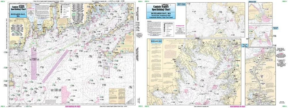
Welcome to your ultimate guide for navigating the beautiful waters of Buzzards Bay. The Offshore Buzzards Bay Laminated Nautical Navigation & Fishing Chart by Captain Segull’s Sportfishing Charts is designed for both novice and experienced anglers who seek adventure in their fishing expeditions.
This high-quality laminated chart measures 19.5′ x 26.5′, making it a convenient size for easy handling and transport. It boasts a comprehensive layout that covers the inshore and nearshore fishing areas. On Side A, you’ll find an extensive view of the western portion of Martha’s Vineyard, extending up to 30 miles west to Block Island, Rhode Island. This side includes the picturesque Elizabeth Islands and the Sakonnet River, giving you a thorough understanding of the rich fishing landscape.
Turning to Side B, this chart presents a detailed view of Buzzards Bay, reaching all the way north to the Cape Cod Canal. Here, you’ll discover insets of essential locations such as Woods Hole and Great Harbor, along with Robinsons Hole, Naushon Island, and Cuttyhunk Harbor. Not only does this side provide detailed navigation, but it also highlights the Cape Cod Canal itself, a vital waterway for fishermen.
What makes this chart truly indispensable for fishing enthusiasts is the wealth of information it provides. It shows fishing areas, wrecks, reefs, local names, and amenities. With GPS coordinates detailed to the thousandths of a minute, you will have precise guidance for your fishing trips, allowing you to maximize your success on the water.
Whether you are planning a weekend fishing trip with friends or a solo adventure to explore new waters, this laminated chart is your perfect companion. The durable laminate ensures that your chart remains protected from water and wear, allowing for long-term use in various conditions.
In summary, the Offshore Buzzards Bay Laminated Nautical Navigation & Fishing Chart is not just a map; it’s an essential tool for anyone passionate about fishing in this stunning region. With its detailed navigation and user-friendly design, it will enhance your fishing experience and help you discover new fishing spots. Equip yourself with this valuable resource and make your next fishing trip unforgettable!
| Feature | Description |
| Size | 19.5′ x 26.5′ |
| Material | Laminated for durability |
| Coverage | Buzzards Bay and surrounding areas |
| Detail Level | GPS coordinates out to the thousandths of a minute |
| Usage | Ideal for fishing enthusiasts |


Reviews
There are no reviews yet.