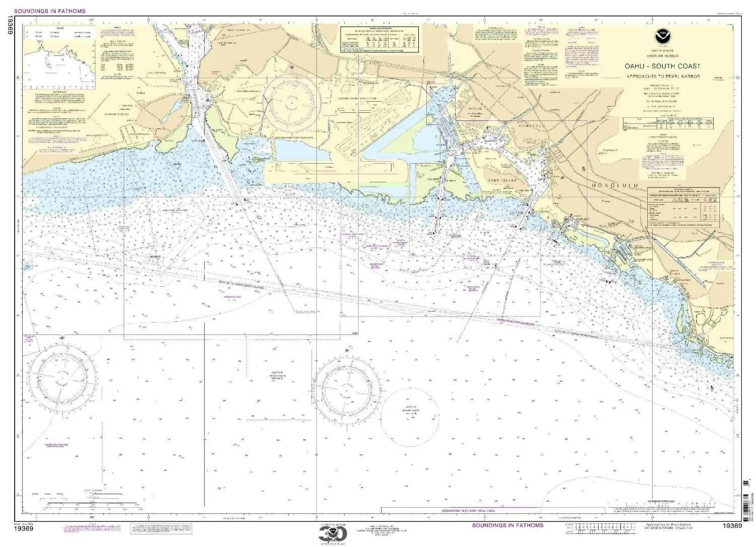
Introducing the Paradise Cay Publications NOAA Chart 19369, a meticulously crafted navigation tool designed for those who seek to explore the stunning South Coast of O’ahu, specifically the Approaches to Pearl Harbor. This high-quality chart is not just a map; it’s a gateway to adventure and discovery in one of the most beautiful regions of the South Pacific.
What sets this chart apart is its commitment to quality and accuracy. Printed on high-quality, water-resistant paper, it is designed to withstand the elements, ensuring that it remains intact and reliable during your maritime ventures. Whether you’re a seasoned sailor, a marine enthusiast, or simply a curious traveler, this chart offers a durable solution for your navigation needs.
The NOAA Chart 19369 is printed on demand, utilizing the most recent data provided by the National Oceanic and Atmospheric Administration (NOAA). This guarantees that you are receiving the most accurate and up-to-date information available, which is crucial when navigating coastal waters. The detailed scale of 1:20000 allows for precision in navigation, providing you with confidence as you embark on your journey.
In addition to its practical features, this chart is prepared to be display quality. It arrives rolled, not folded, which means you can easily frame it or store it without worrying about unsightly creases or folds. This attention to detail makes it not only a functional tool but also a beautiful piece of art that captures the essence of the South Pacific region.
| Chart Features | Description |
| Material | High-quality water-resistant paper |
| Data Source | Latest data from NOAA |
| Scale | 1:20000 |
| Delivery | Arrives rolled, not folded |
This chart is not just for navigation; it is also a perfect gift for anyone who loves the ocean, sailing, or exploring new territories. Its combination of functionality and aesthetic appeal makes it a valuable addition to any nautical enthusiast’s collection. Whether you display it in your home or take it with you on your voyages, the NOAA Chart 19369 will inspire you to explore the waters around O’ahu.
As you prepare for your adventures, consider the importance of having reliable navigation tools. The Paradise Cay Publications NOAA Chart 19369 is designed to meet the needs of modern navigators while providing a glimpse into the natural beauty that the South Coast of O’ahu has to offer. Dive into your next adventure with confidence and clarity, armed with the best navigation resources available.


Reviews
There are no reviews yet.