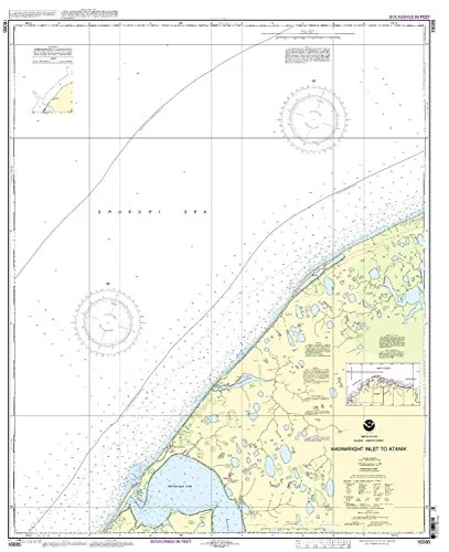
The Print-On-Demand Nautical Chart for Wainwright Inlet to Atainik, 6th Edition, is an essential tool for mariners navigating the Pacific Northwest and Alaska region. This detailed chart, produced by OceanGrafix, adheres to the highest standards, ensuring that sailors have access to the most accurate and up-to-date information while at sea.
One of the standout features of this chart is its production process. Unlike traditional charts, which may become outdated, OceanGrafix prints these charts only after an order has been received. This means that you are guaranteed to receive the latest information, reflecting all Notice to Mariners corrections. By prioritizing real-time updates, OceanGrafix ensures that mariners can make informed decisions based on the most current navigational data.
With a scale of 1:50000, this chart provides an incredibly detailed view of the waterways, allowing for precise navigation in intricate coastal areas. The dimensions of the chart are 43.85 inches in height and 35.67 inches in width, making it a substantial and informative resource to have on board your vessel.
The chart not only meets U.S. carriage requirements for commercial vessels but is also U.S. Coast Guard approved. This approval signals to mariners that the chart complies with international standards, providing peace of mind while navigating challenging waters.
| Product Details | Specifications |
| Model: 16085 | Scale: 1:50000 |
| Brand: NOAA | Region: Pacific Northwest/Alaska |
| Printed on Demand | Dimensions: 43.85′ H x 35.67′ W |
| Notice to Mariners Corrections Applied | U.S. Coast Guard Approved |
In conclusion, the Print-On-Demand Nautical Chart for Wainwright Inlet to Atainik is a vital resource for anyone navigating these waters. With its commitment to accuracy, real-time updates, and compliance with maritime standards, it stands as one of the best choices for mariners seeking reliable navigational tools.


Reviews
There are no reviews yet.