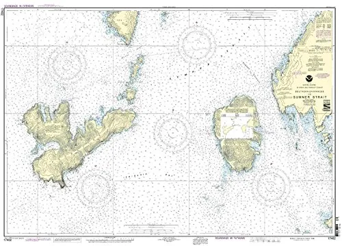
The Southern Entrances to Sumner Strait nautical chart, designated as Chart 17402, is an essential tool for both commercial and recreational mariners. This chart, created by NOAA in collaboration with OceanGrafix, offers the most current information available, ensuring safe navigation through these waters.
When you purchase this chart, you receive a product that is printed on demand, meaning it is produced specifically for each order. This allows for the incorporation of the latest Notice to Mariners (NTM) updates at the time of printing. These updates are critical for ensuring that mariners have the most accurate and up-to-date navigational information.
The chart is not only detailed but also adheres to strict international standards. It meets the definitions and requirements laid out in the Safety of Life at Sea (SOLAS) Chapter V Regulation 2.2. Furthermore, it fulfills the carriage requirements defined in SOLAS Chapter V Regulation 19.2.1.4, making it an essential asset for any vessel operating in these crucial waterways.
| Feature | Details |
| Brand | NOAA |
| Print Type | On Demand |
| Approval | U.S. Coast Guard Approved |
| Corrections | All NTM corrections applied |
| Compliance | Meets SOLAS Requirements |
Mariners can trust that this chart is not just a piece of paper; it is a reliable source of navigational information. The collaboration between NOAA and OceanGrafix ensures that the charts are thoroughly vetted and compliant with U.S. and international standards, providing peace of mind when navigating the waters of Sumner Strait.
In conclusion, if you are looking for a nautical chart that is both accurate and compliant with maritime regulations, the Southern Entrances to Sumner Strait Chart 17402 is an excellent choice. It is designed to meet the needs of all mariners, from the recreational sailor to the commercial shipping operator, ensuring safe and informed navigation through these important waters.


Reviews
There are no reviews yet.