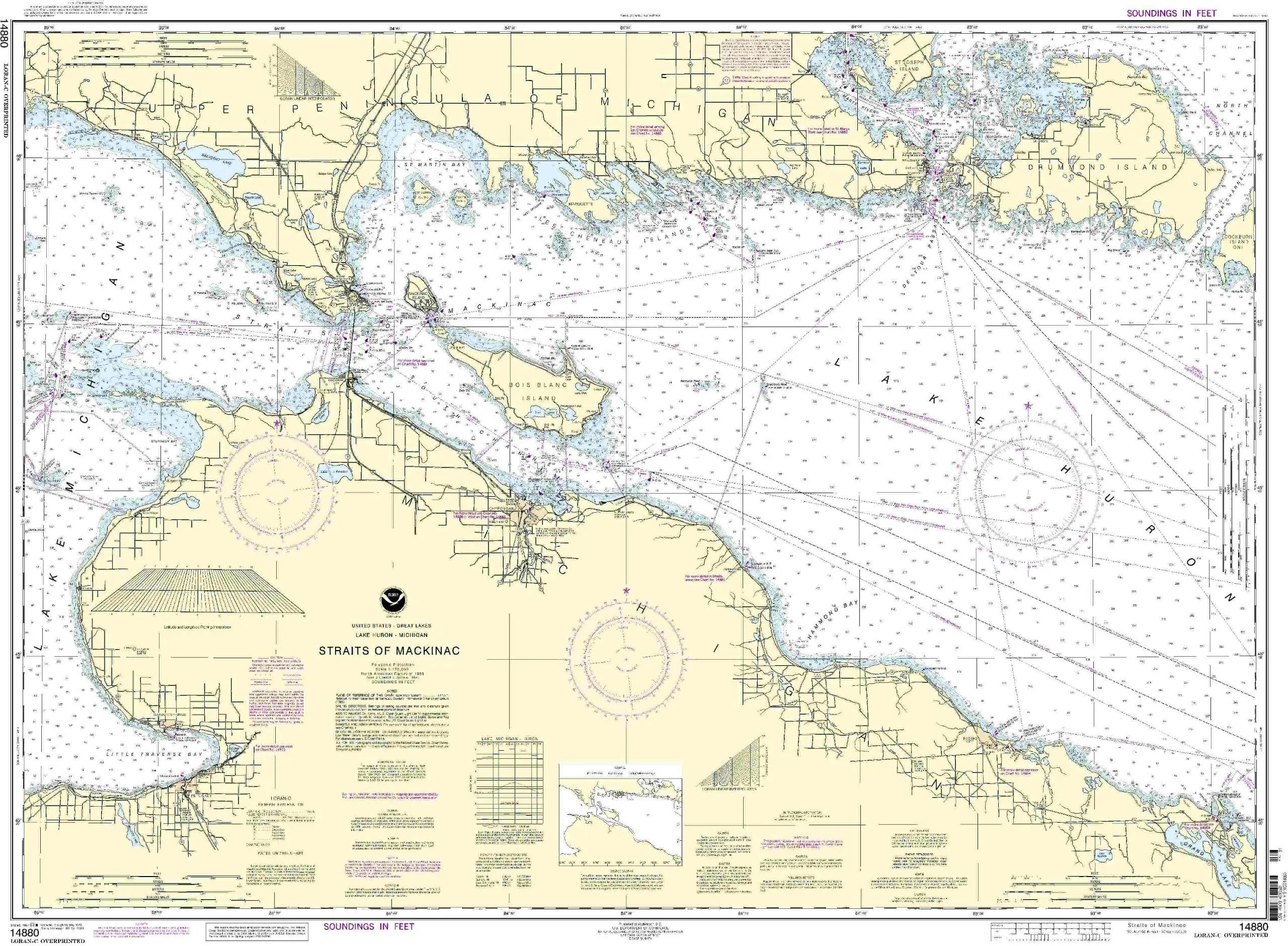
The Straits of Mackinac NOAA Nautical Chart 14880 is designed to meet the navigation needs of both commercial and recreational mariners. This chart stands out as a reliable resource for accurate marine navigation, having been printed on demand to ensure the most current information is available to users. It incorporates all the latest Notice to Mariners (NTM) updates at the time of printing, providing mariners with peace of mind as they navigate through these waters.
OceanGrafix, in partnership with the National Oceanic and Atmospheric Administration (NOAA), specializes in producing high-quality nautical charts. This collaboration guarantees that the charts meet stringent standards set forth by maritime regulations, including the International Convention for the Safety of Life at Sea (SOLAS). Specifically, the Straits of Mackinac chart adheres to SOLAS Chapter V Regulation 2.2, which defines nautical chart characteristics, and meets the carriage requirements outlined in SOLAS Chapter V Regulation 19.2.1.4.
| Key Features | Description |
| Latest Updates | All Notice to Mariners corrections applied at the time of printing. |
| U.S. Coast Guard Approved | Meets requirements for commercial vessels defined in maritime regulations. |
| Printed on Demand | Ensures that mariners receive the most up-to-date information for their navigation needs. |
This chart is not only a tool for navigation but also a vital component of safety at sea. Mariners relying on the Straits of Mackinac nautical chart can navigate with confidence, knowing that they are equipped with accurate and reliable information. Whether you are planning a commercial journey or a recreational outing, this chart will be an essential asset in your navigation toolkit.
Furthermore, the Straits of Mackinac chart is printed with the utmost attention to detail, ensuring clarity and readability, even in challenging conditions. The precision of the chart allows for easier plotting of courses and understanding of the surrounding maritime environment. By choosing the NOAA Nautical Chart 14880, mariners are investing in their safety and enhancing their navigation experience.
In summary, the Straits of Mackinac NOAA Nautical Chart 14880 is your go-to resource for safe navigation in this vital waterway. With its up-to-date corrections, U.S. Coast Guard approval, and commitment to quality, it serves as a trusted guide for all who venture into the waters of the Straits of Mackinac.


Reviews
There are no reviews yet.