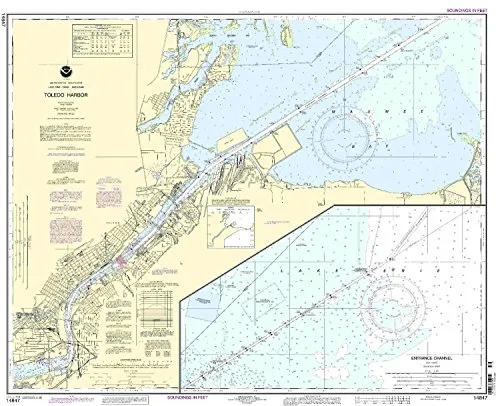
The Toledo Harbor Nautical Chart 14847 is an essential tool for both commercial and recreational mariners. This chart is produced by NOAA, the National Oceanic and Atmospheric Administration, in collaboration with OceanGrafix. It offers the most current and accurate navigation information available on the market.
One of the standout features of this chart is its ‘on-demand’ printing capability. This means that when you order the chart, it is printed fresh, incorporating all the latest Notice to Mariners (NTM) updates. As a result, you can trust that the information is the most relevant and precise for your navigation needs.
Moreover, the Toledo Harbor Nautical Chart 14847 adheres to the stringent standards set forth in SOLAS (Safety of Life at Sea) Chapter V. This includes Regulation 19.2.1.4, ensuring that it meets all U.S. and international carriage requirements for commercial vessels. The chart is also U.S. Coast Guard approved, making it a reliable choice for safe navigation.
| Attribute | Details |
|---|---|
| Brand | NOAA |
| Size | Standard Nautical Chart |
| Features | NOAA-approved, on-demand printing, all NTM corrections applied |
| Compliance | Meets SOLAS Chapter V Regulation 19.2.1.4 |
This chart is not just a piece of paper; it’s a crucial element in your navigation toolkit. Whether you are a seasoned mariner or just starting on your nautical journey, having the Toledo Harbor Nautical Chart 14847 on board can greatly enhance your safety and confidence while navigating the waters.
In conclusion, the Toledo Harbor Nautical Chart 14847 is a must-have for anyone who values precision and safety in maritime navigation. With its NOAA approval, on-demand printing, and compliance with international standards, this chart is your reliable partner in exploring the Toledo Harbor area.


Reviews
There are no reviews yet.